June 16, 2025 Supercell
Scott and Carver Counties, Minnesota
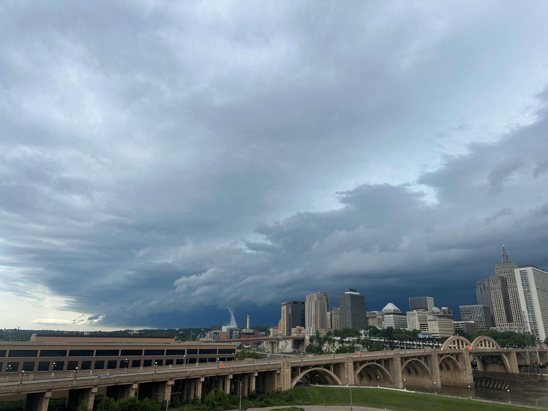
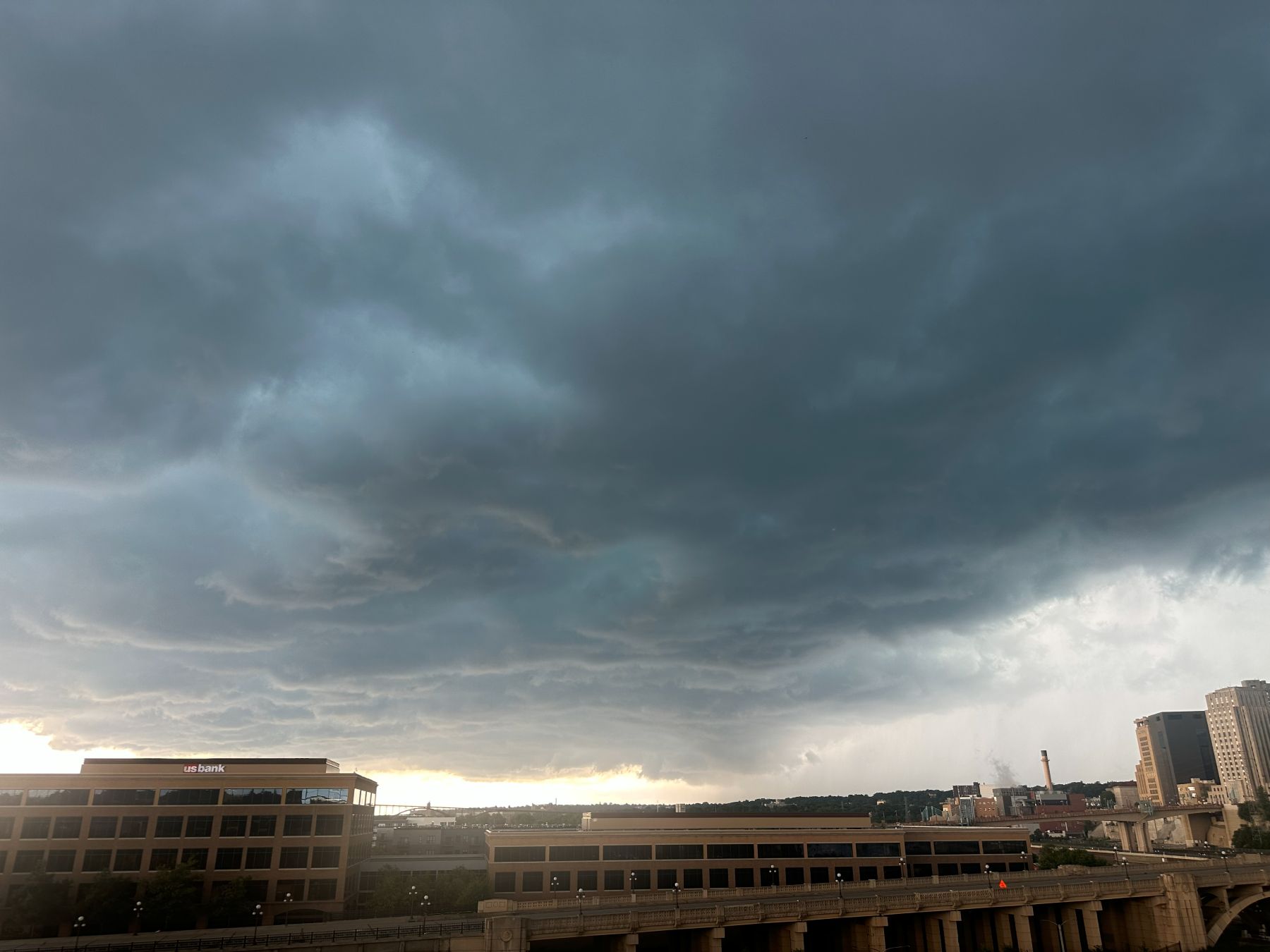
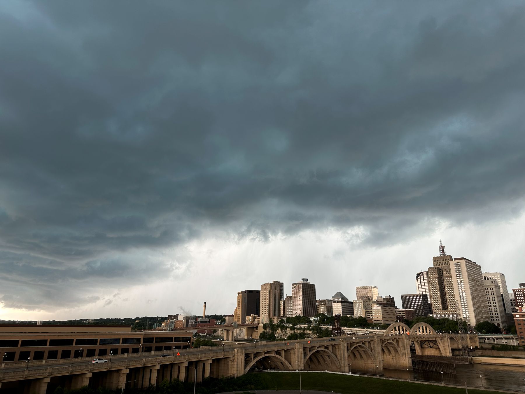
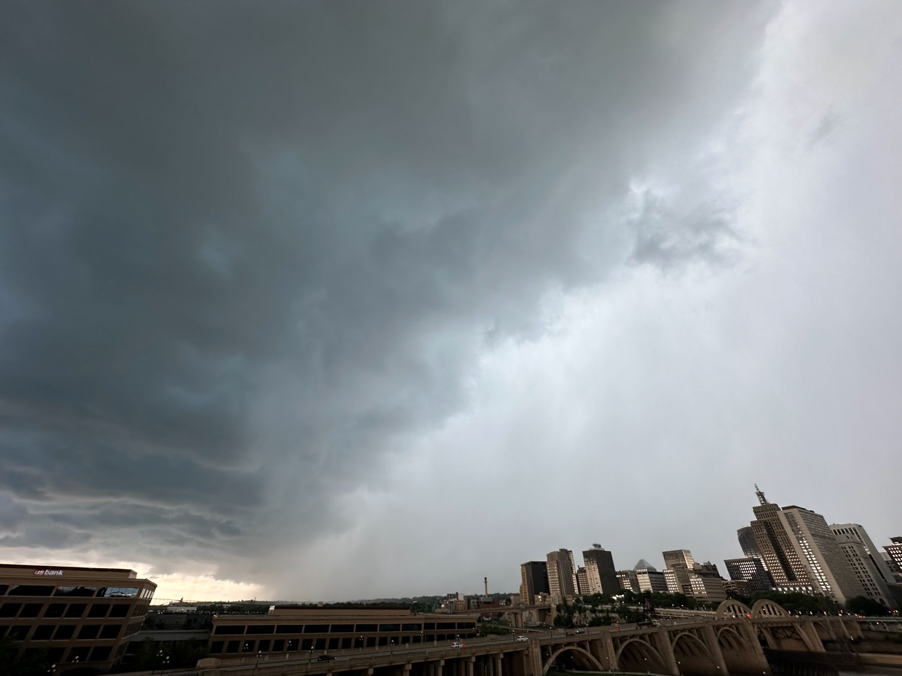
Today was somewhat of a dual storm chase day, but the first part wasn't really a chase. I was at work in the St. Paul office when some afternoon storms came by. This line of storms had a nice shelf cloud, and I stepped outside to the company's balcony to take pictures of its approach. The heavy rain hit us right at 3 PM. It was a nice way to see a storm without doing more than taking a break from work
There was an enhanced risk of severe storms and a 5% tornado area over about the southern 2/3 of Minnesota. I brought my cameras to work with me thinking I might have an opportunity to chase after work. Indeed, this is what happened.
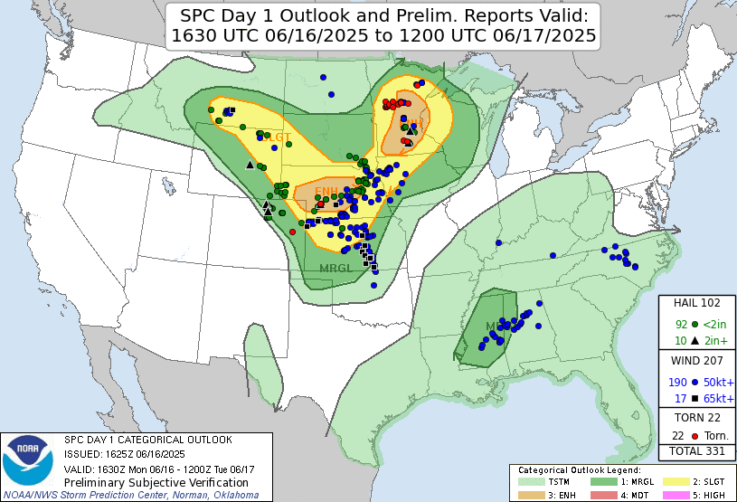 |
| Storm Prediction Center 1630 UTC Day 1 convective outlook with verification. |
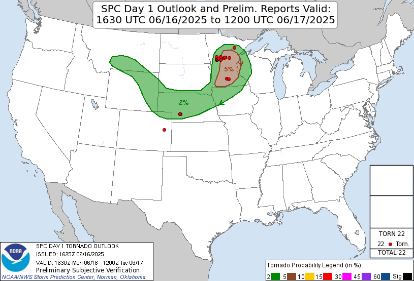 |
| Storm Prediction Center 1630 UTC Day 1 tornado outlook with verification. |
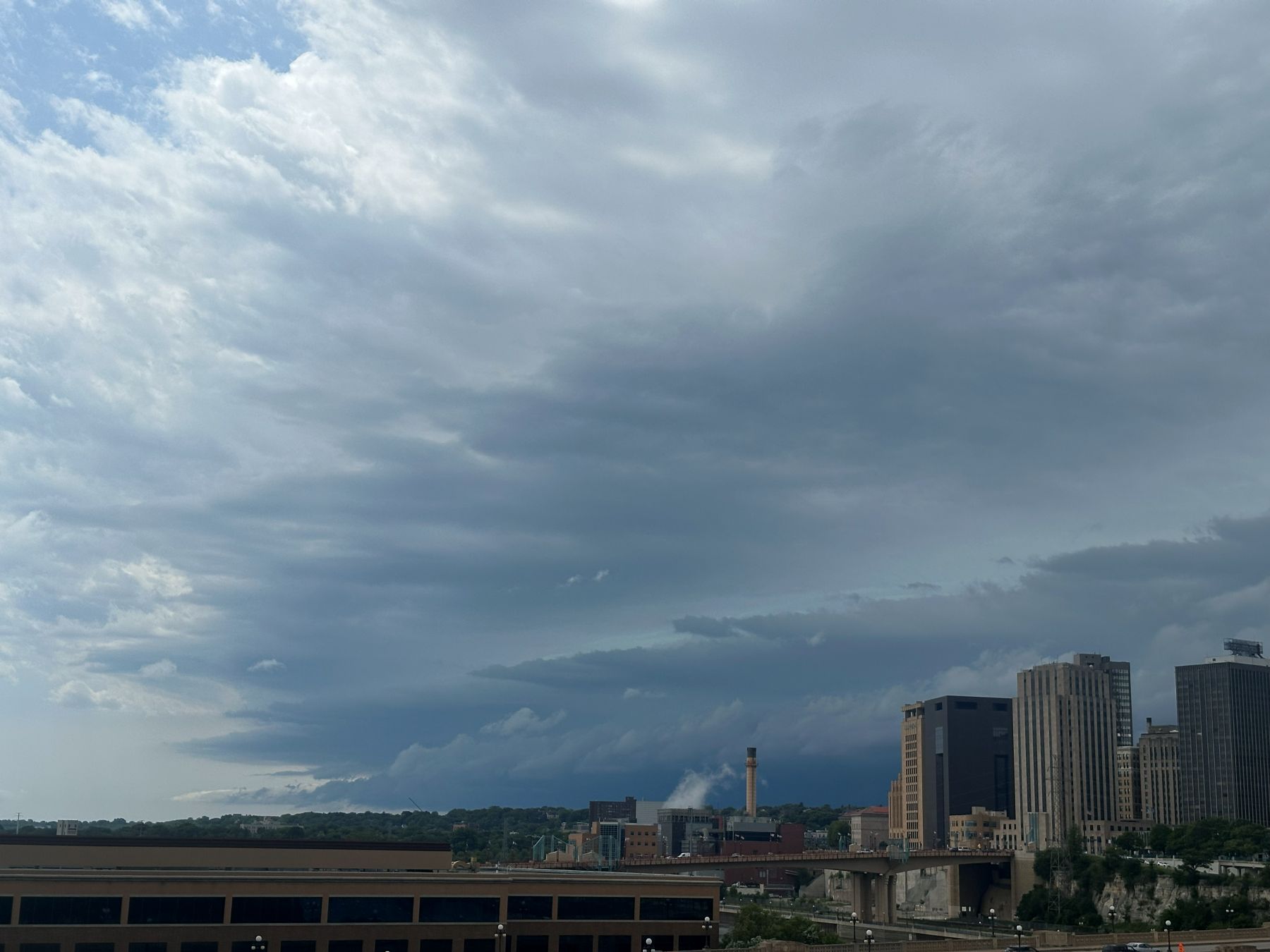 |
| A shelf cloud approaches downtown St. Paul. |
 |
| A shelf cloud over downtown St. Paul. |
 |
| A shelf cloud over downtown St. Paul.. |
 |
| The shelf cloud moves overhead. |
 |
| St. Paul reflects the light ahead of the shelf cloud. |
 |
| The heavy rain approaches. |
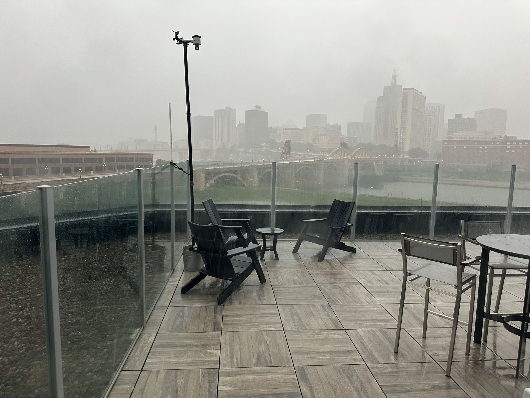 |
| The heavy rain arrives at the office. |
After the initial squall line passed St. Paul, a broken line of supercellular storms developed to the west of the Twin Cities. Additional storms developed north of Alexandria in west-central Minnesota. These were probably the most prolific tornado producers of the day. Had I been home, I definitely would have chased these as tornado warnings were issued for home from a couple of these storms, but most of the tornadoes were farther south. Whatever the case would have been for me up north, the atmosphere was destabilizing closer to where I was, and I would be able to chase.
There were multiple storms to choose from. There was one storm in northern Wright county near Annandale, and another coming into southwestern Wright county at Cokato. Additional, newer storms were developing south of that. I started by targeting the Annandale storm because it would most likely involve the shortest chase distance, and it was already tornado-warned. I headed toward I-94 in the northwestern metro area, but as I approached, this storm weakened, so I hesitated near I-94 and I-494 in case I wanted to change my mind and go south. I gave a glance or two at my initial target storm, and it had an anemic updraft base, so I turned south on 494 and targeted the more southern storm.
One of the newer cells became more dominant and appeared to be headed toward Waconia, so I decided to head that way. I turned west on Minnesota Highway 7 and began my zig-zag toward Waconia. The storm grew fast and soon became tornado-warned. It looked great on radar. I was hoping to get there fast, but I had a bit of navigation to do. It was clear the storm would reach Waconia before I would, so I had to reroute a little farther south to avoid the core, and this took a bit longer.
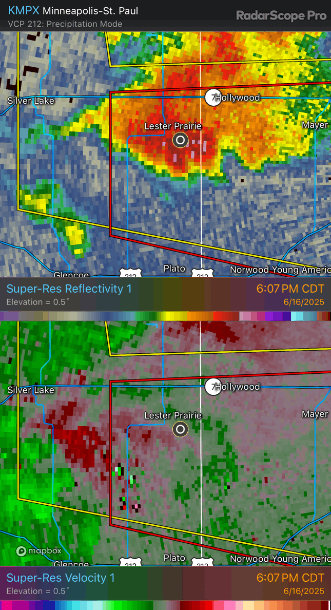 |
| Radar loop of my target storm as it approaches the western Twin Cities area. |
I arrived at the storm near Cologne. The wall cloud was a bit closer to me than I had expected since radar showed the rear flank to be farther west of me. Looking at the radar loop above, it could have been due to the storm merger than had just taken place. I might have been viewing a residual wall cloud from the storm that had come in from the south. There wasn't much rotation to speak of, however. This storm collision might have diminished the tornado prospects. The original action area to the west appeared to be weakening on radar.
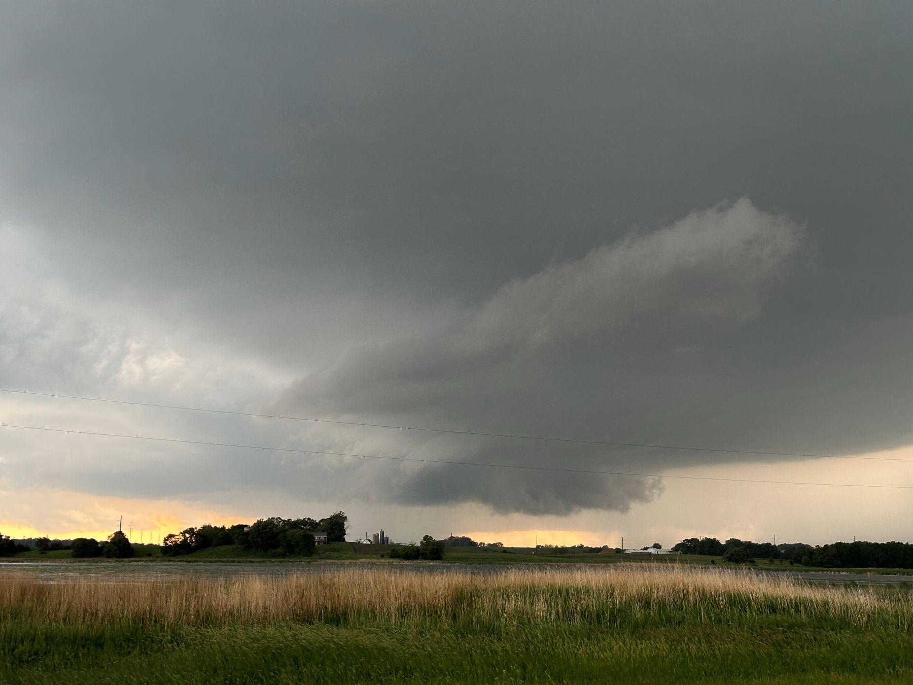 |
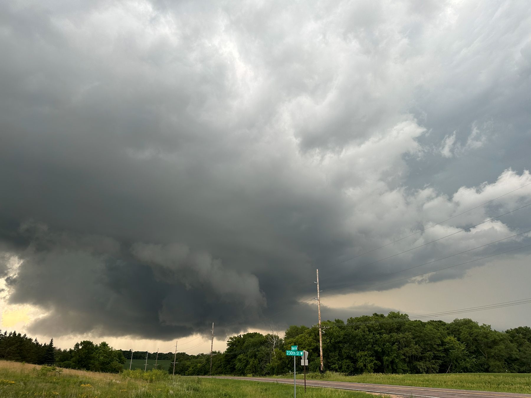
| A wall cloud northwest of Cologne. |
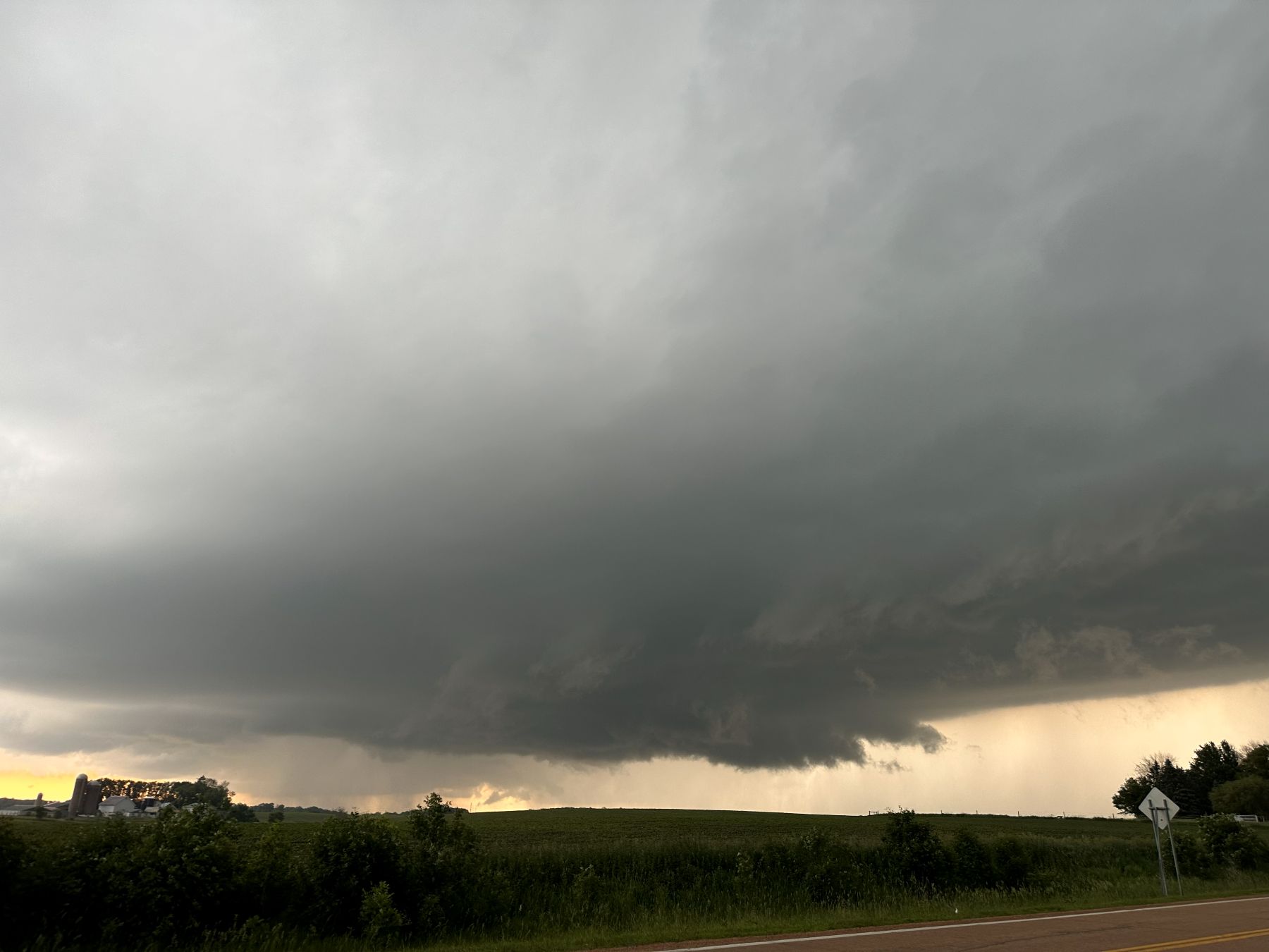 |
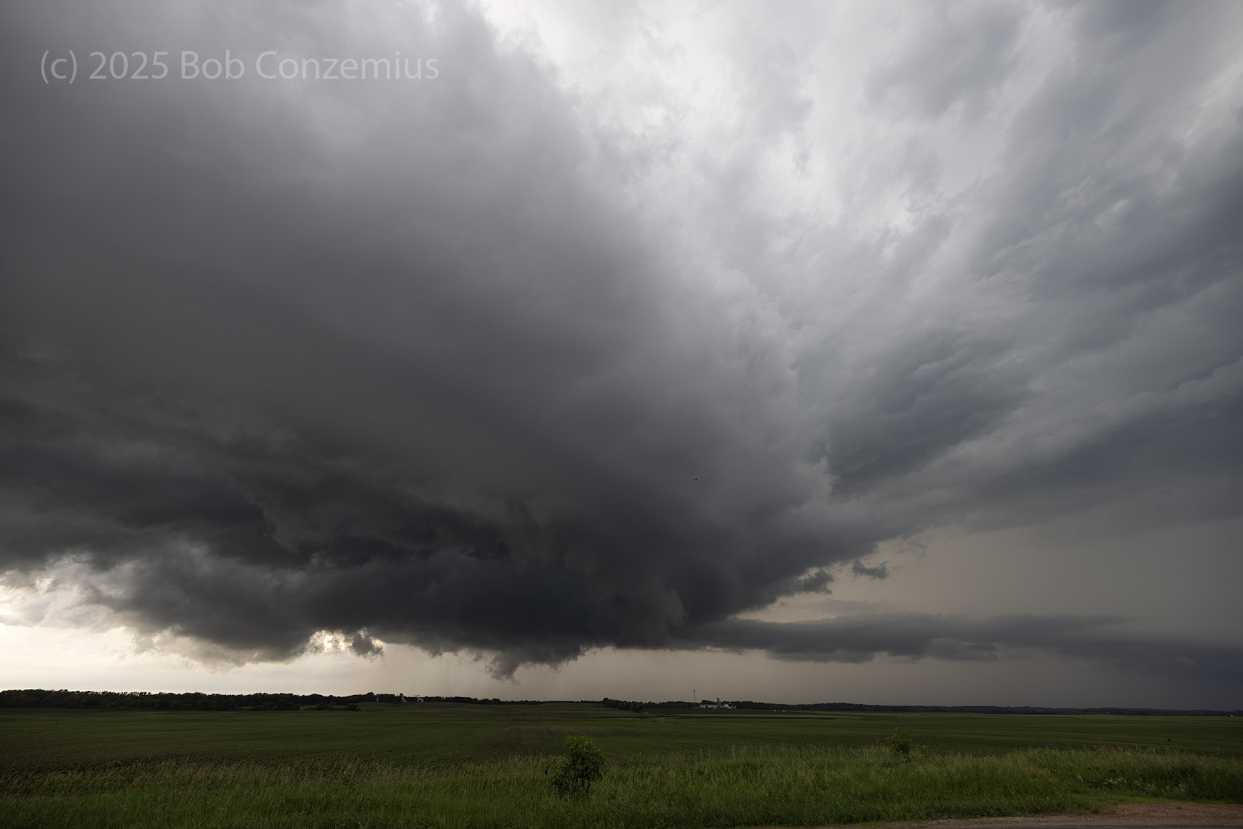
| Between Cologne and Young America. |
I navigated to stay up with the storm as it dropped southeast. However, I also noticed something that would spell more trouble for the storm. A rather large left-moving supercell was approaching from the south. I'd only have a small amount of time before the collision with this left-mover would weaken my storm. I watched as its core passed just to my east. I was hoping that this would be far enough away that the collision would not adversely affect the right-mover.
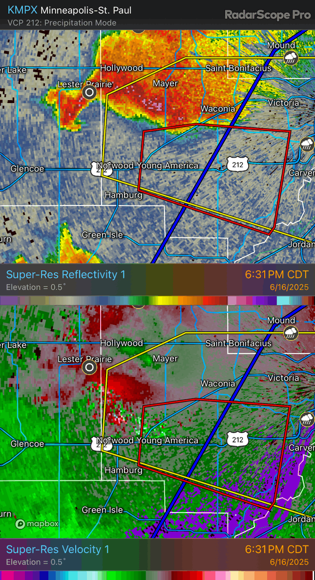 |
| Radar loop showing the collision with the left split storm. |
At first, the collision appeared to wipe out any discernable features with the storm (such as a wall cloud). However, the storm appeared to reintensify and regained some of its supercell structures. It had a broad wall cloud and a decent inflow tail. It also had quite a bit of lightning for a time. I thought the storm had a future. During this part of the chase, I ran into Scott Woelm, and we stayed together for the rest of the chase. Unfortunately, I did not have my 2-meter radio in the car, so it was difficult to communicate. I'll put it in the car from now on!
 |
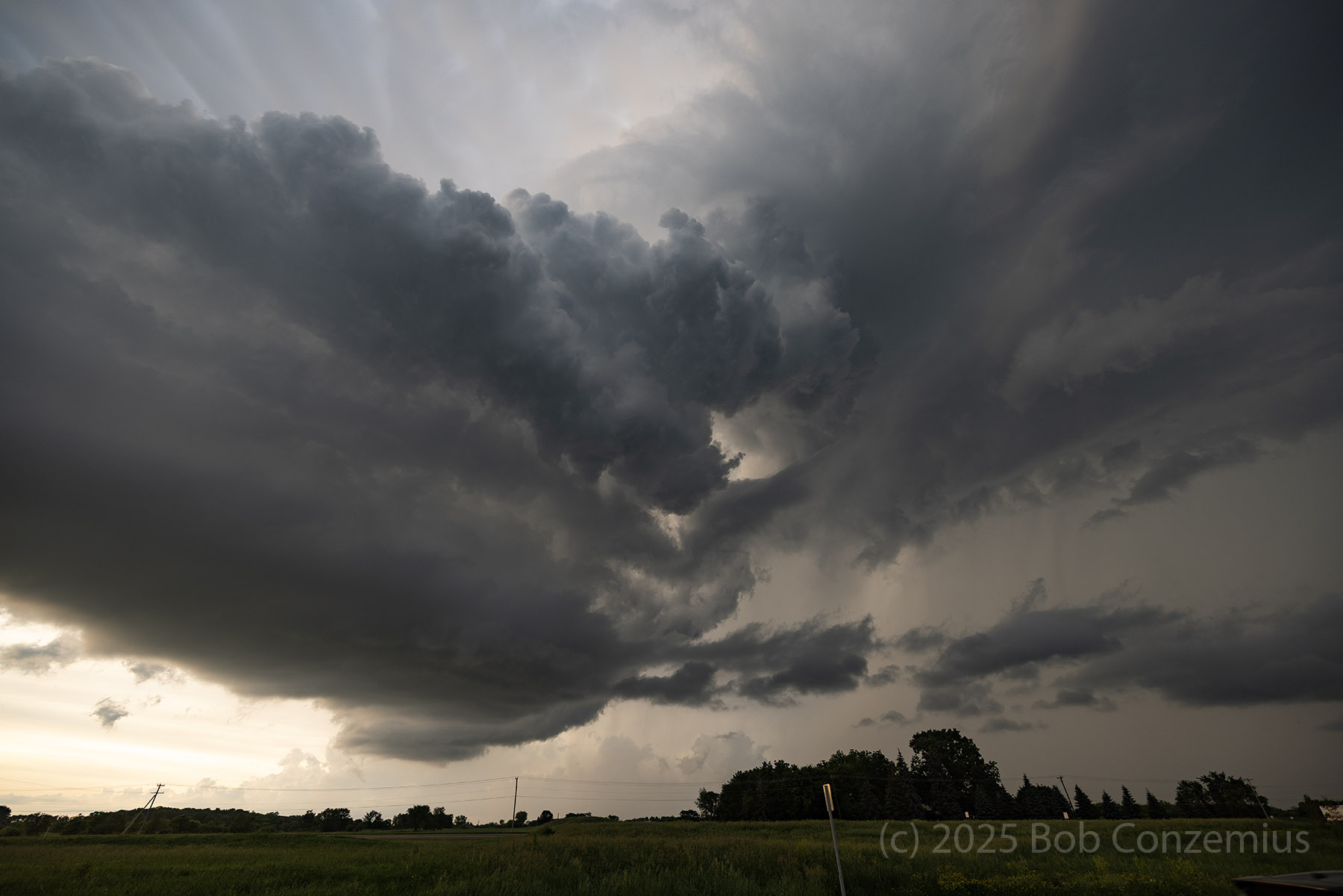
| The storm looked like this just north of New Prague. I thought it might recover. |
However, as we continued east with the storm, it began to shrink, and by the time we reached New Market, it really wasn't doing that well. It was in an LP phase. As we continued east of I-35, it shriveled into a thin rope. I took some photographs of this process, and the rope-out process of this supercell was really somewhat visually dramatic. Once this process finished, Scott and I headed back home.
 |
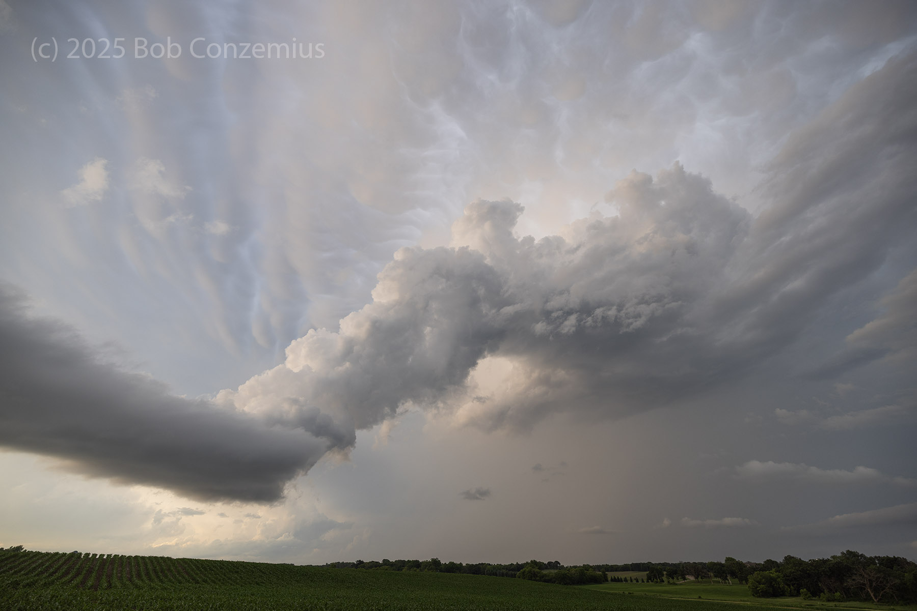
| Some decent structure with an inflow band, but the inflow band isn't very large. |
 |
| Storm viewed from the town of New Market. It is definitely shrinking |
 |
| The visually dramatic rope-out of our supercell. |
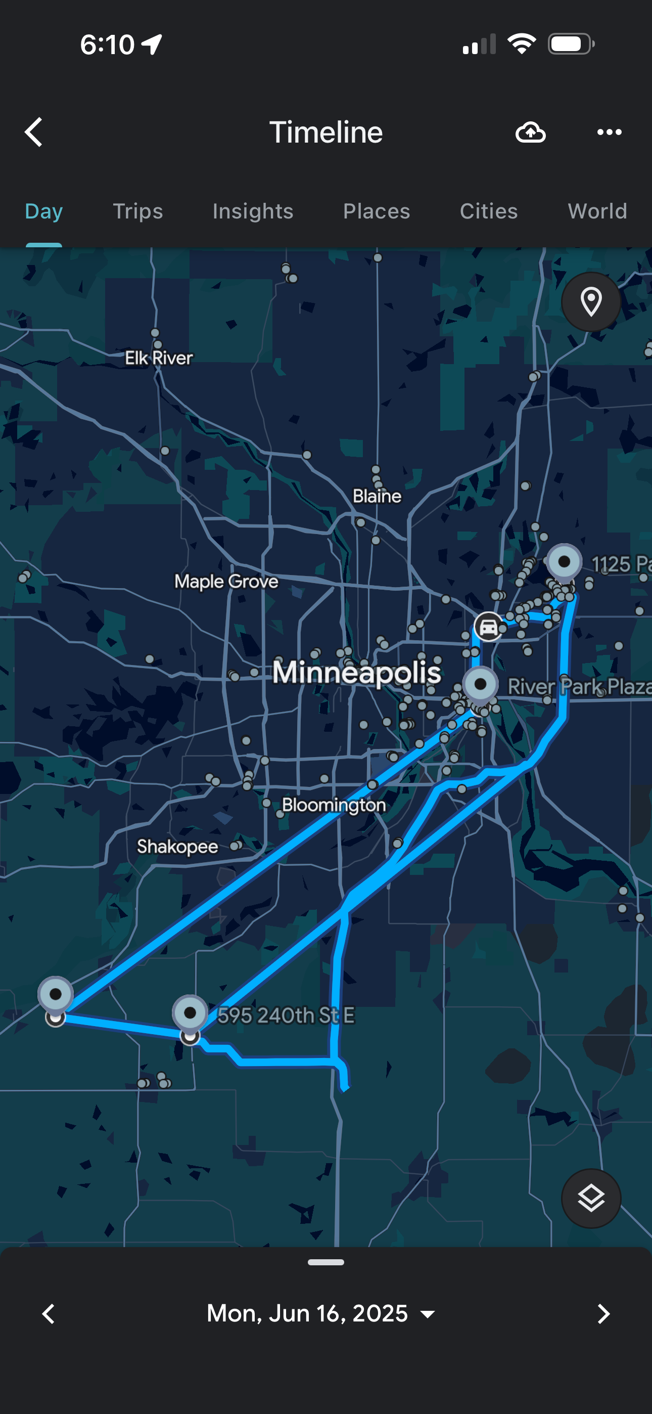 |
| This is the route I took (Google Maps missed my foray into the northwestern metro). |
Back to Storm Chases | Home