May 19, 2025 Severe Storms
Kansas
The large trough that had caused yesterday's tornado outbreak had moved a little farther east over night, and now there was another moderate risk for eastern Oklahoma, southeastern Kansas, northwestern Arkansas, and southwestern Missouri. This risk area was larger than yesterday's risk area, and the tornado risk was just as great as it had been yesterday. We targeted storms along the dryline, just like yesterday, but we needed more time to get into position for the target area. We were hoping for some storms in a part of southeastern Kansas that had decent visibility. To our south, eastern Oklahoma was rather frustrating chase territory, and we wanted the opportunity to see the storms we were chasing.
As far as tornadoes were concerned, the atmosphere produced mostly rain-wrapped circulations that were detected primarily by radar-- not by chasers. We drove into northeastern Oklahoma to wait for initiation, but we turned around and drove north back into Kansas as there were no storms developing in that part of Oklahoma. We had more cumulus to the north in Kansas, so we drove to Winfield. Things were still awfully slow to develop, so we waited at a park there to let things evolve. Some storms were developing well to the south in Oklahoma and north Texas, but we did not want to chase those, and they were out of range, anyway.
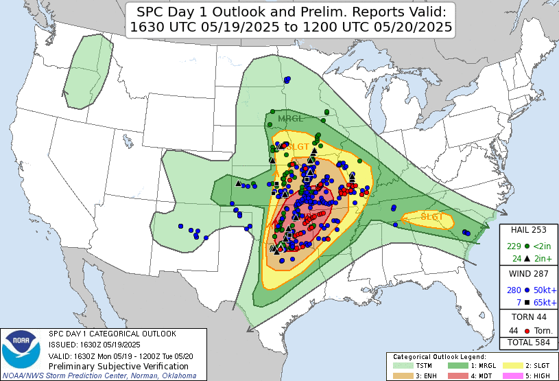 |
| Storm Prediction Center 1630 Day 1 outlook and verification. |
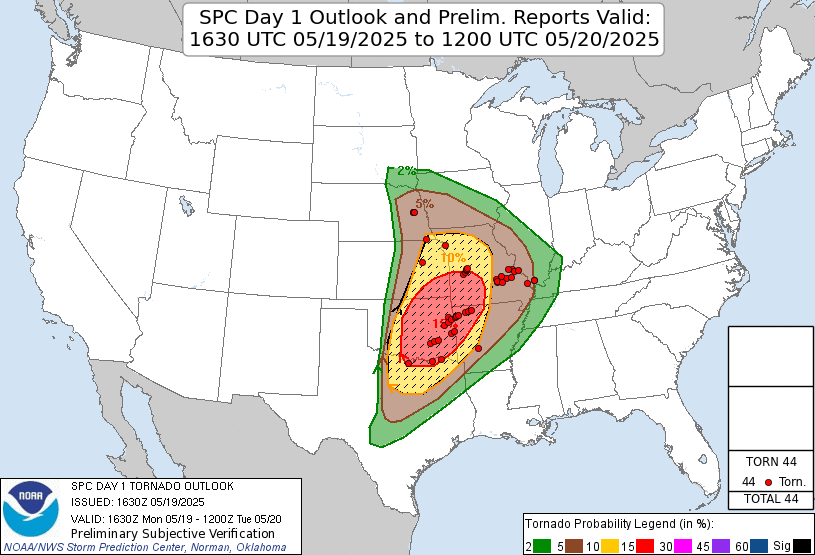 |
| Storm Prediction Center 1630 Day 1 tornado risk and verification. |
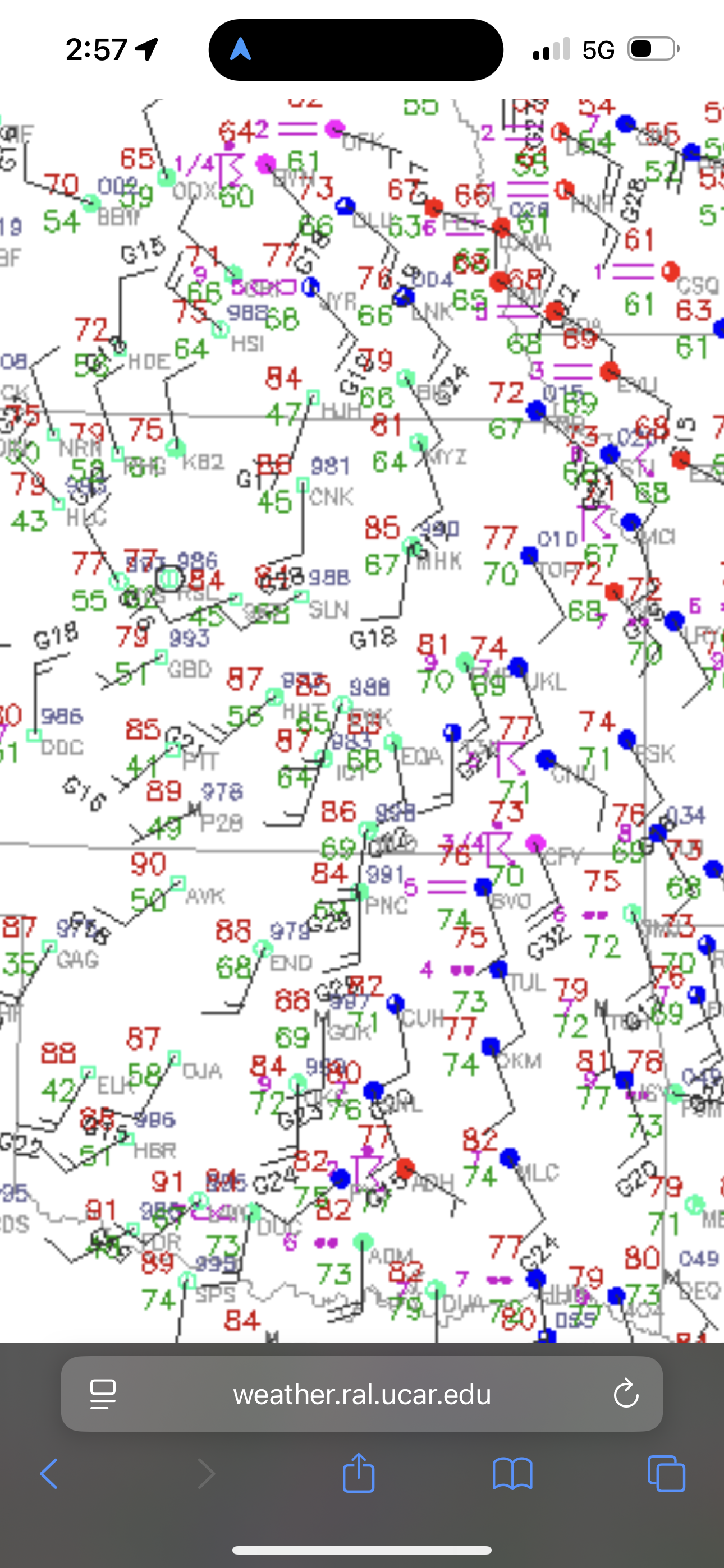 |
| Surface map in the afternoon. Dewpoints to the east were in the mid 70s, but we had slightly drier air. |
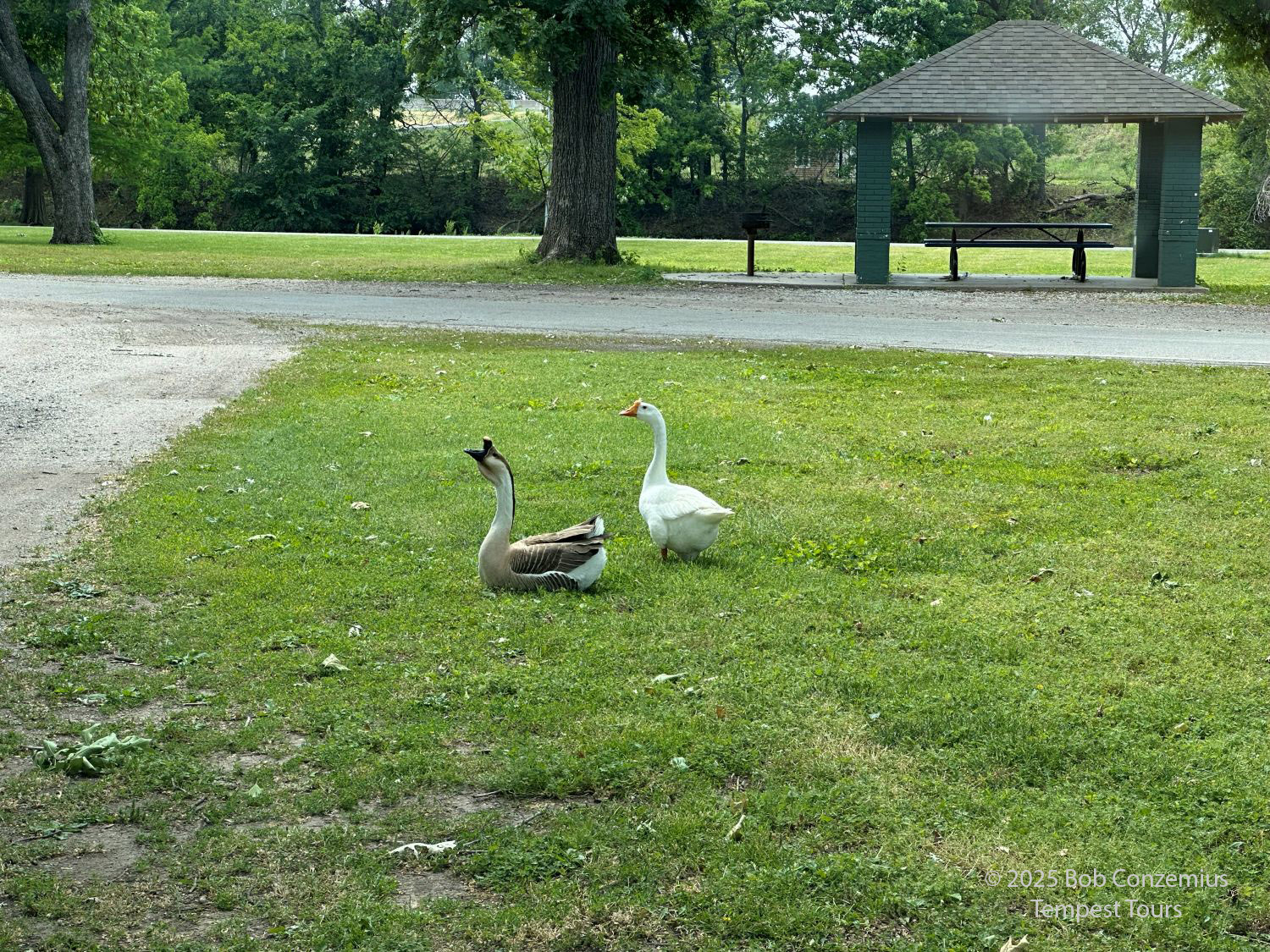 |
| Some geese at Island Park in Winfield, Kansas. |
Eventually, it became clear that tornadoes in southeastern Kansas would not likely occur. There were no storms in our area, so we needed to find another target. A line of storms was developing west of the Kansas Turnpike between Wichita and Topeka. These looked like they would be outflow-dominant, but seeing linear storms would be better than seeing nothing, so we got on the Kansas Turnpike and headed toward Emporia. There, we exited and drove west on U.S. Highway 50. We quickly ran into the line and set up to take pictures. We were greeted by a nice shelf cloud and were able to spend about 15 minutes or so taking pictures as it approached. We stayed to get the whale's mouth view of the underside of the shelf cloud, and then we drove back east.
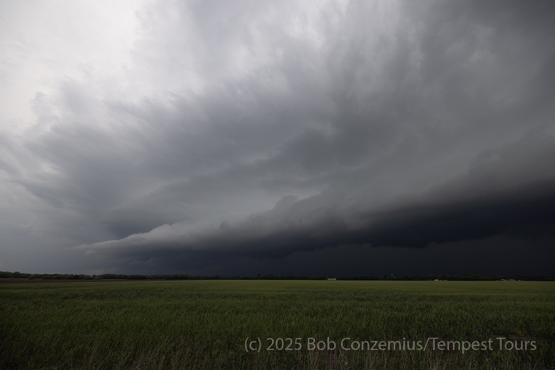 |
| A large shelf cloud approaches us. |
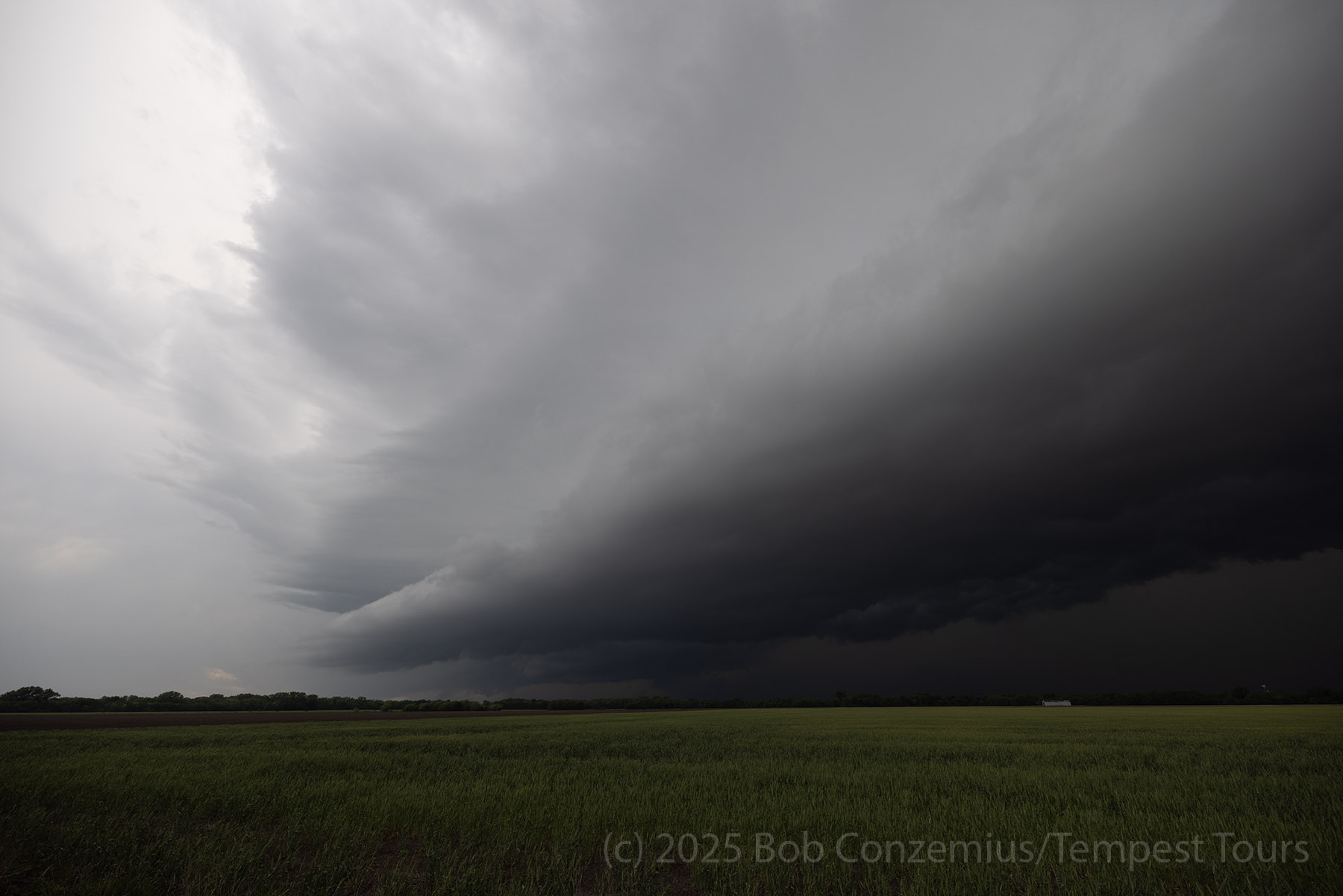 |
| The shelf cloud is nearly overhead now. |
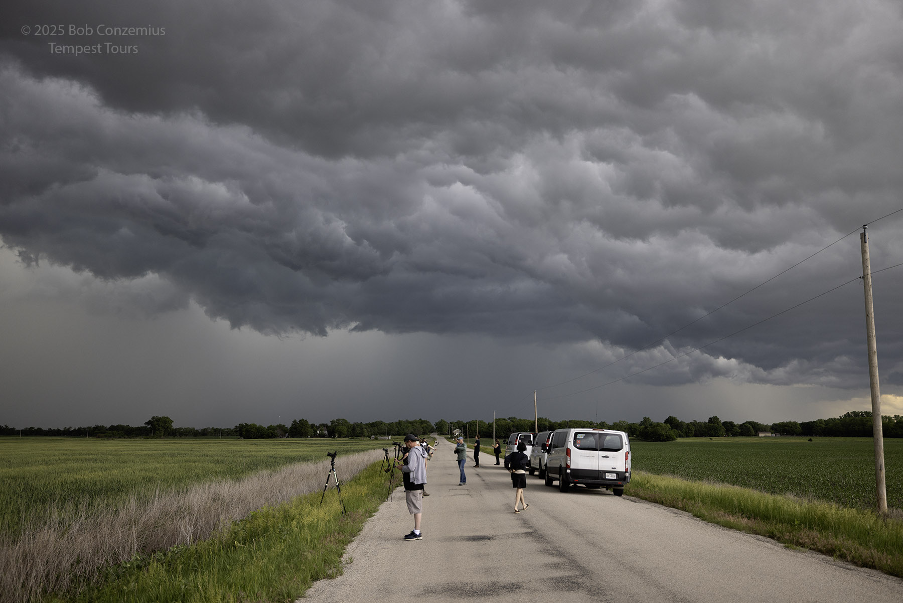 |
| This is the whale's mouth view of the underside of the shelf cloud. |
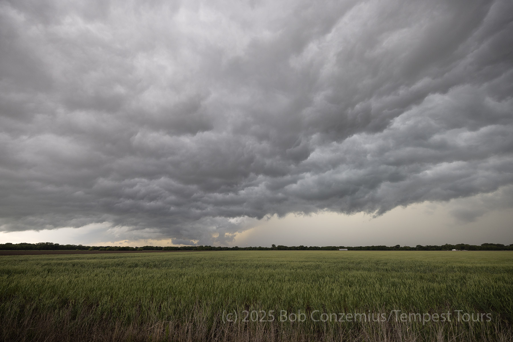 |
| There was some distance between the leading edge of the shelf cloud and the rain, allowing us to view the underside of the shelf cloud for some time. |
We found rooms in Emporia and drove back there to let the storm pass over us. We got a great sunset, so I took a couple more pictures. We stayed at the Best Western Emporia Inn and ate dinner at Applebee's.
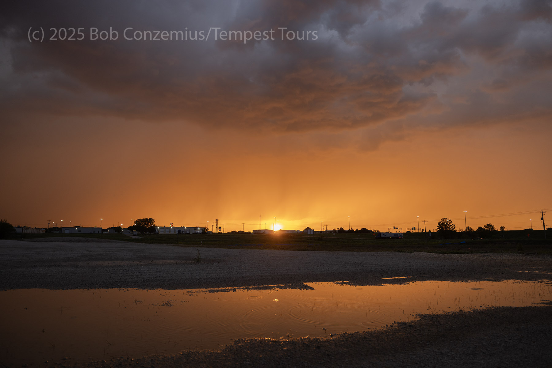 |
| Back in Emporia, we had a great sunset. |
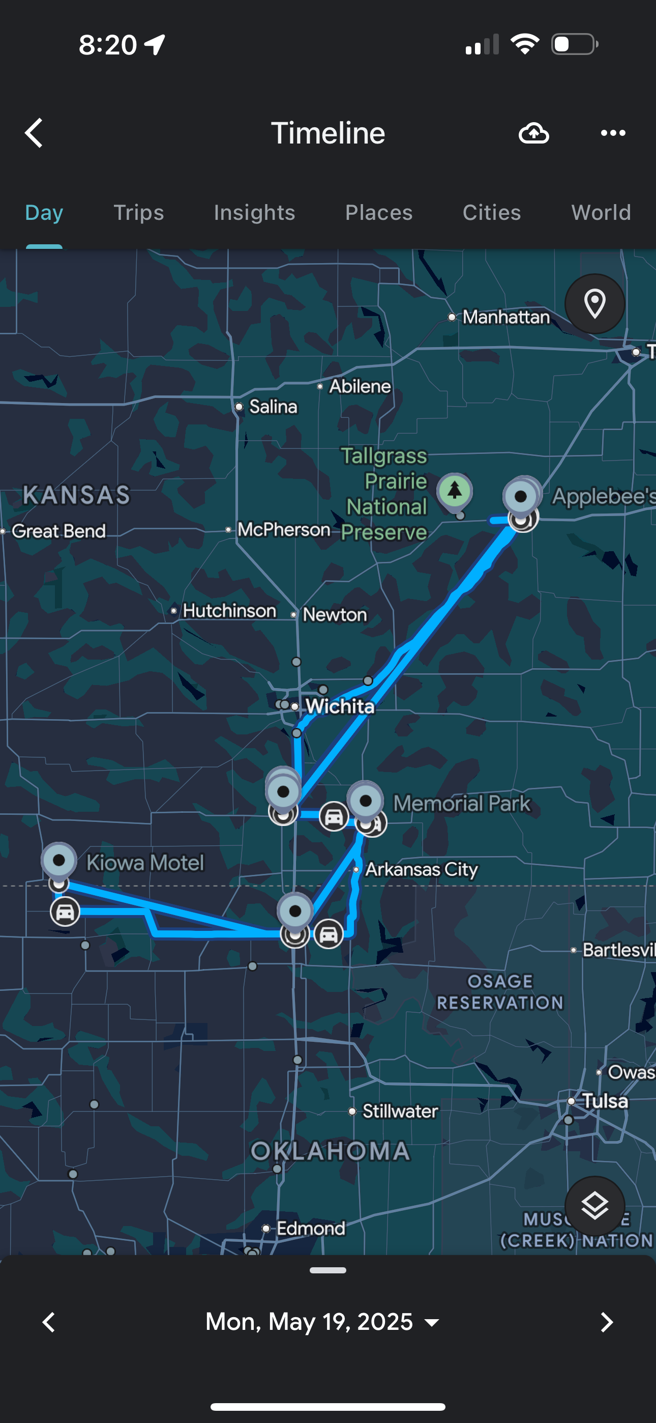 |
| Our travel route for the day. |
Back to Storm Chases | Home