See Bill Reid's summary of this event here. He was directing Tour 4A and was a bit closer to the Arnett tornado than I was.
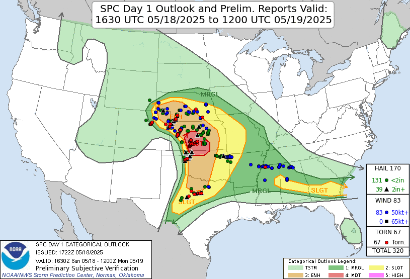
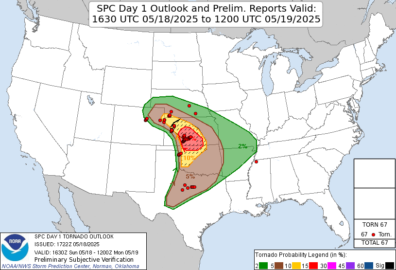
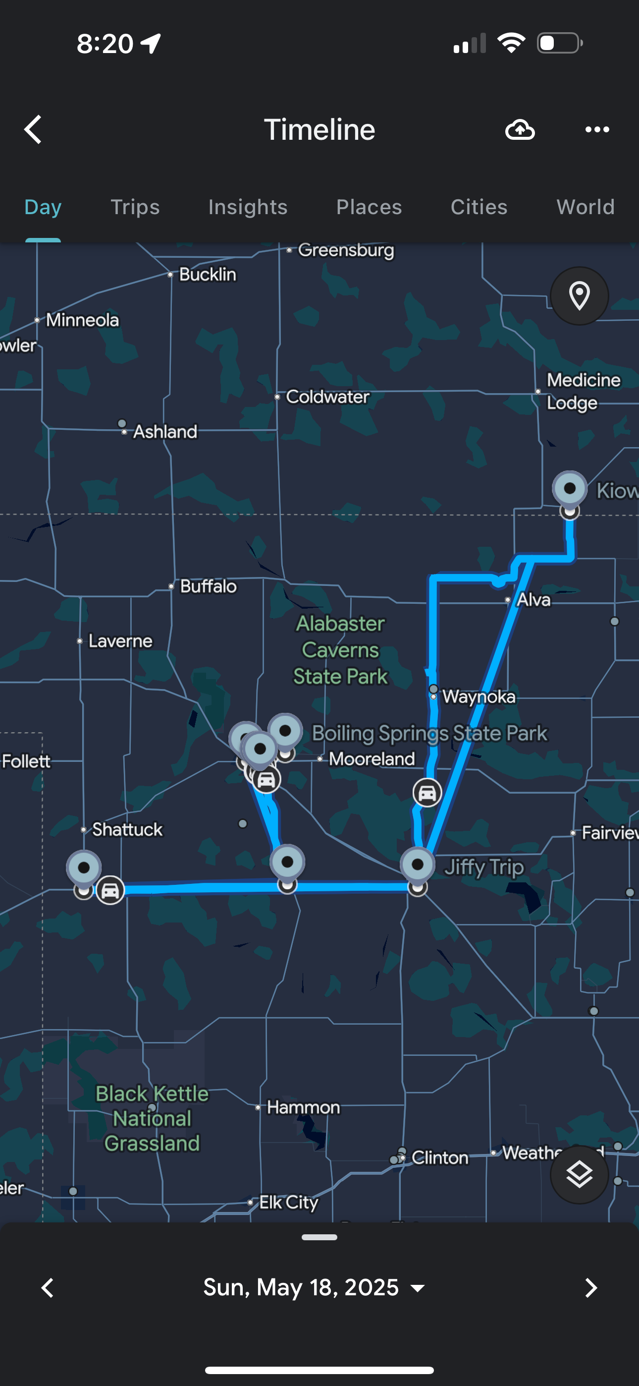
This event had the looks of a tornado outbreak. The Storm Prediction Center indicated a moderate risk of severe storms over parts of Kansas and Oklahoma. This moderate risk included an area with a 15 percent risk for tornadoes as well as a hatched tornado risk area (10 percent or greater chance of EF2 or stronger tornadoes). We had stayed overnight in Woodward, Oklahoma, and so we were already in pretty good shape for positioning. Because of that, we had a few hours between our morning weather briefing and storm time. We decided a trip to Boiling Springs State Park would be a good way to pass this time.
This is the text that appears underneath the picture.
This is the text that appears underneath the picture.
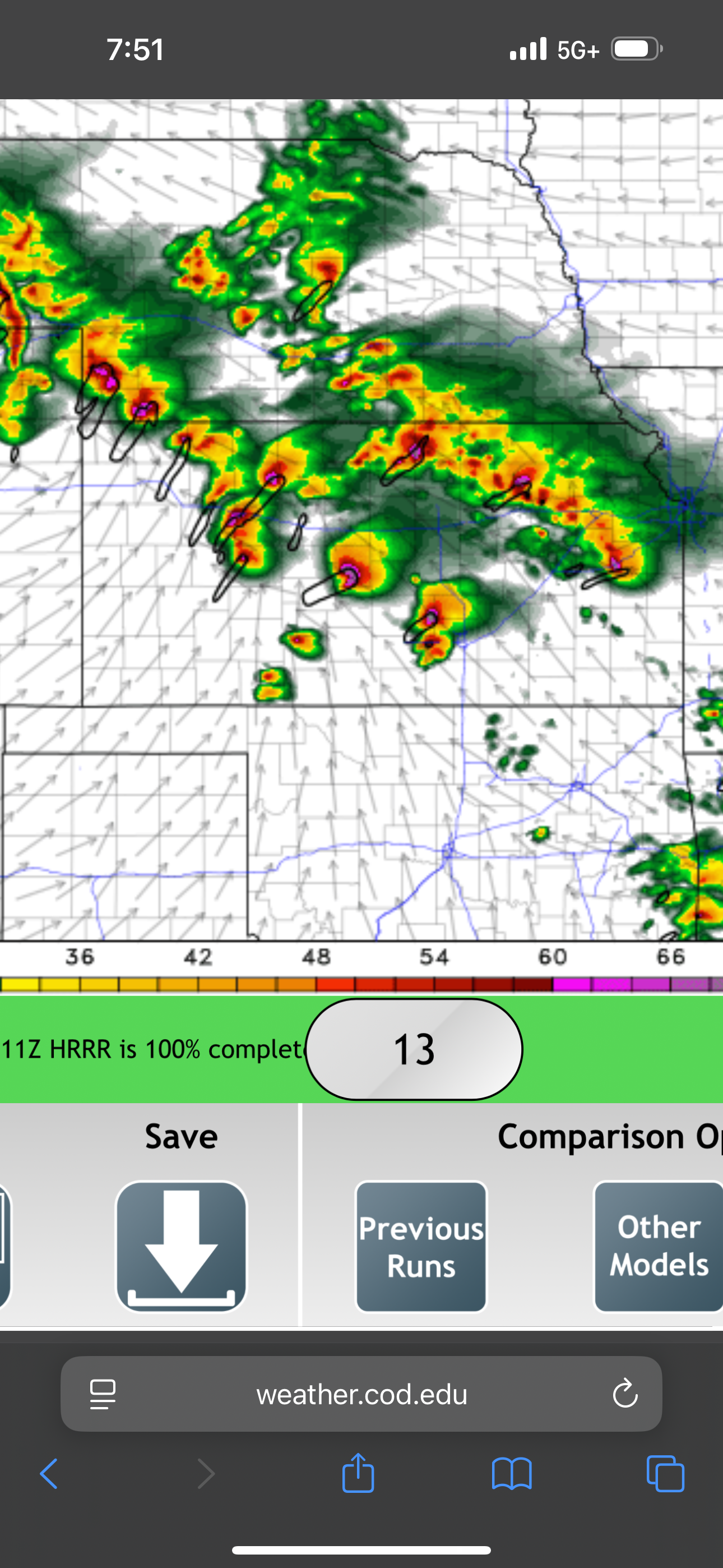
The convection-allowing models showed a lot of supercells.
Boiling Springs in Oklahoma.
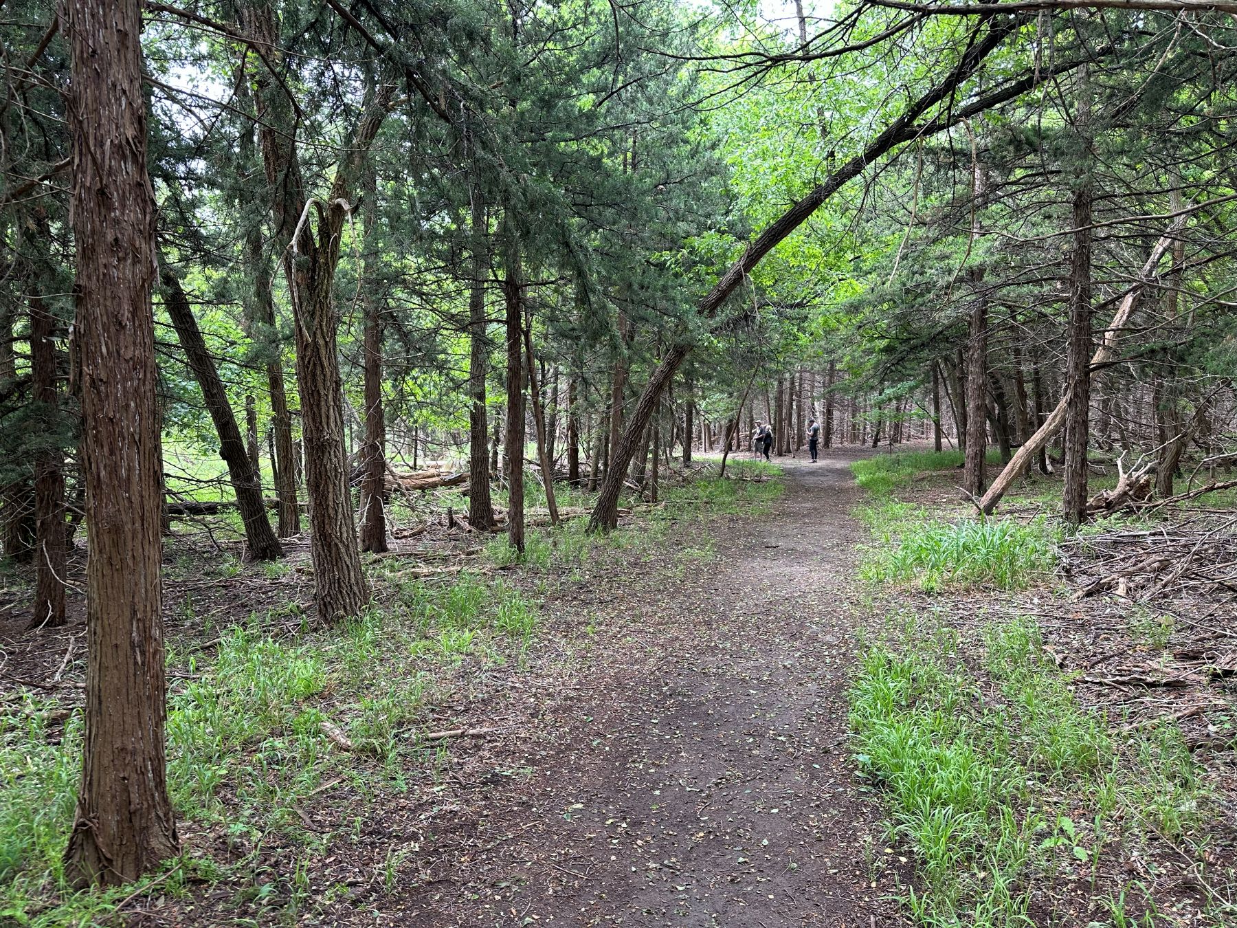
The Boiling Springs State Park was a fun place to visit. The boiling springs were interesting to see, but the more interesting part was the hike through the wood. We did some birding, and my Merlin app was able to confirm several species I hadn't seen before (painted bunting, white-eyed vireo, blue-gray gnatcatcher, horned lark). I also heard a northern parula, Carolina wren, eastern meadowlark, eastern phoebe, and tufted titmouse. We stayed until early afternoon and then returned to Woodward for lunch. We ate at Braum's, and Silver Lining Tours was also there. I said hello to Roger Hill.
A trail in Boiling Springs State Park. We observed a some migrating warblers here.
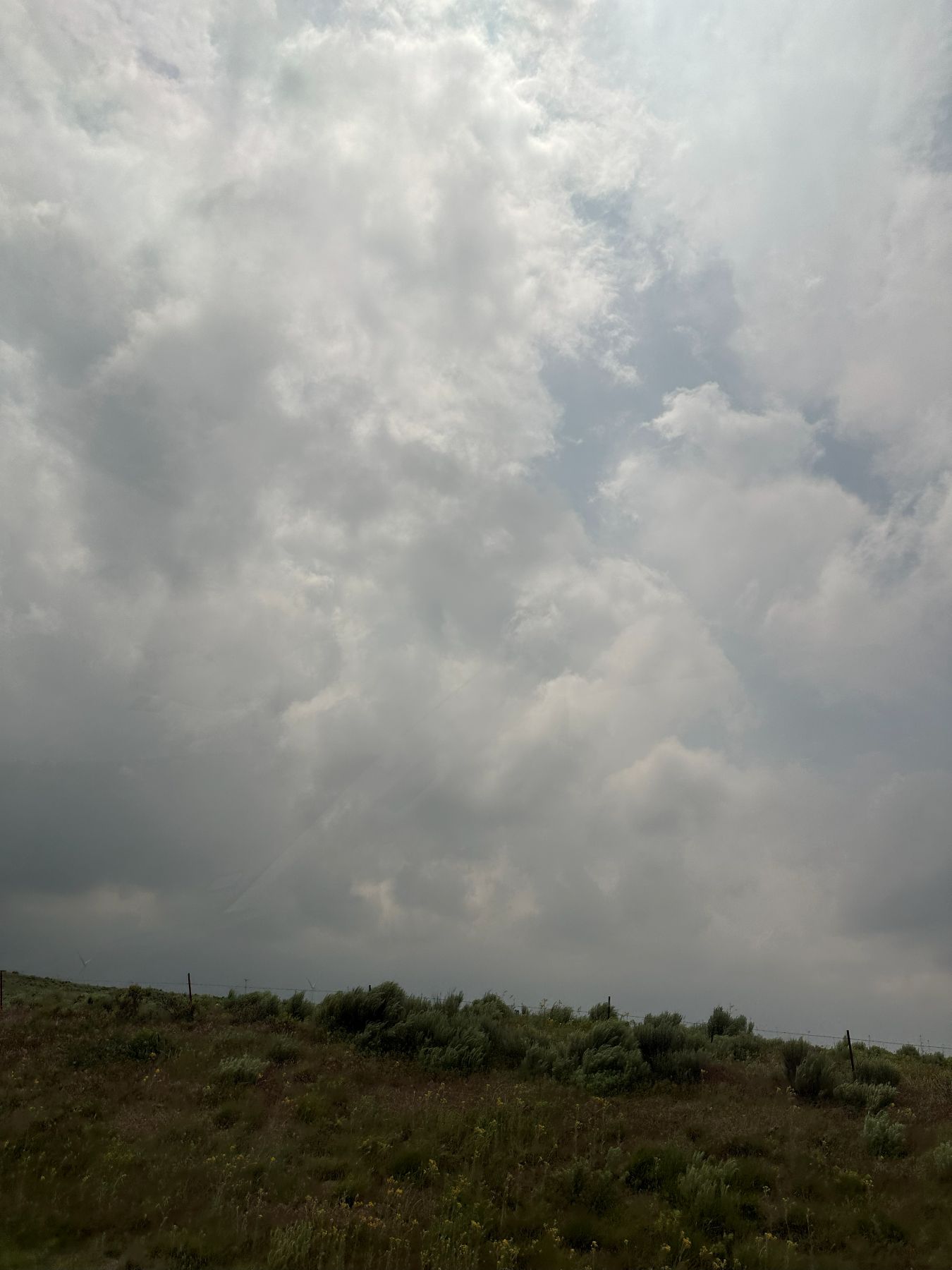
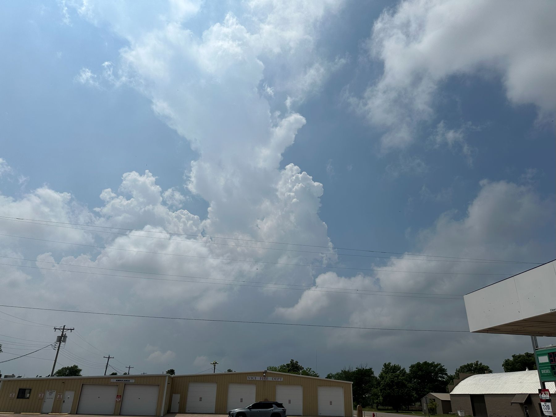
After a full lunch at Braum's, we decided to adjust our target area a little bit. We drifted south toward Vici, where a cumulus field had developed. Farther north, the overcast was a bit too stratiform for our liking. On our way southward, the skies quickly transitioned from a solid overcast to a field of towering cumulus. We stopped in Vici and kept our eye on satellite loops to identify any areas where initiation of deep convection (storms) might occur. One such area was just to our west-southwest. I considered our position to be ideal. You'll see a lot of towering cumulus pictures below, which means I was excited about our prospects for the day.
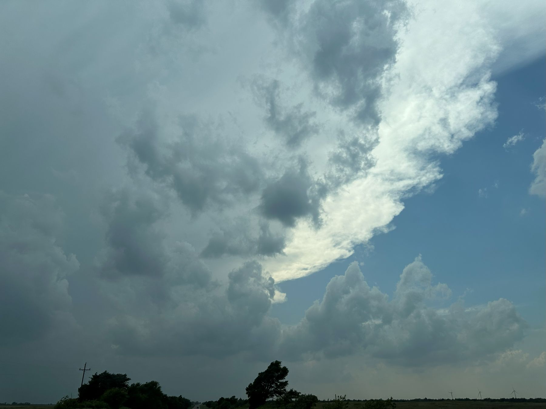
As we drive toward Vici (our general target area), towering cumulus are present.
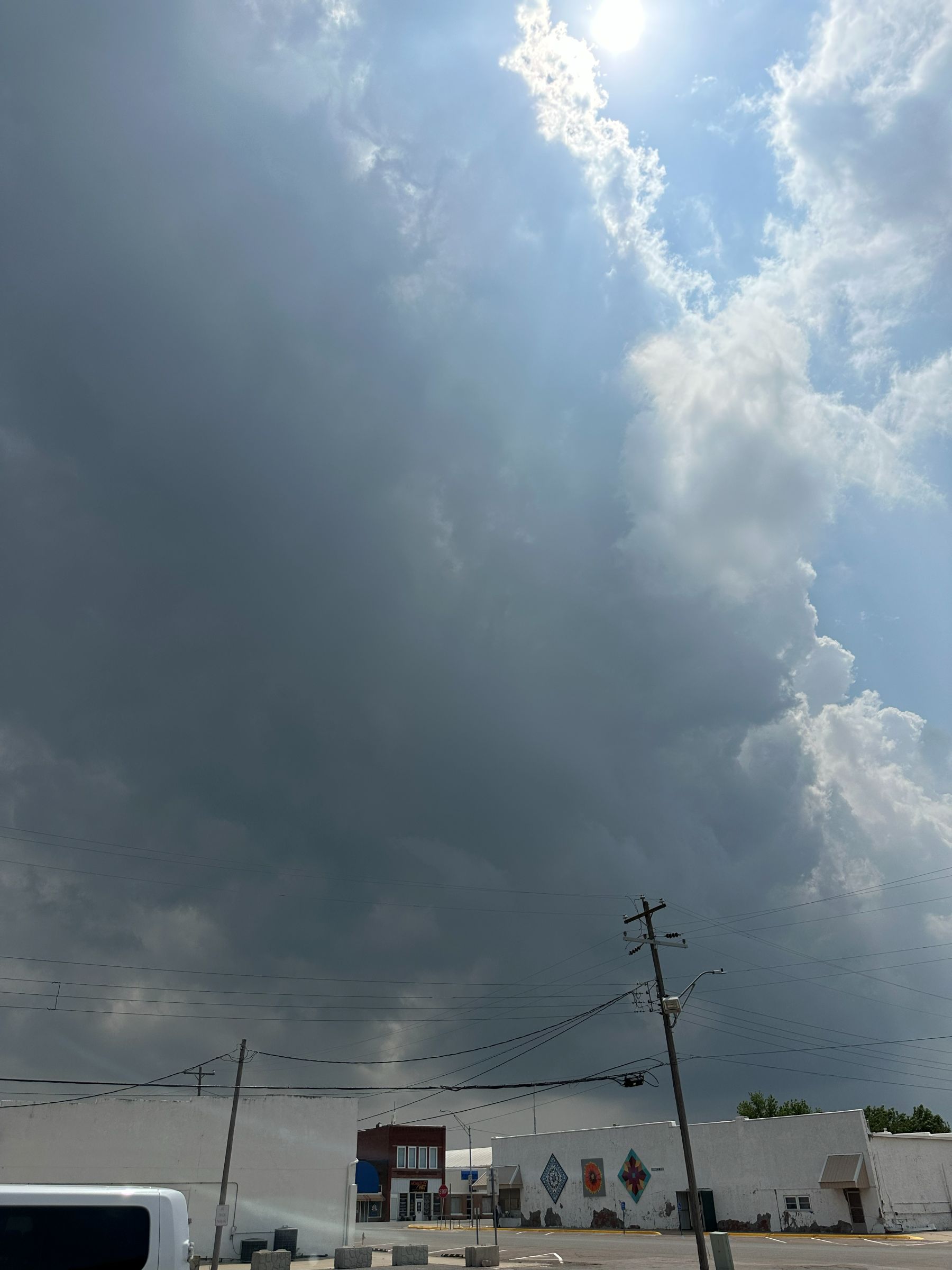
The skies are getting a bit darker near Vici. There is plenty of moisture available to this system.
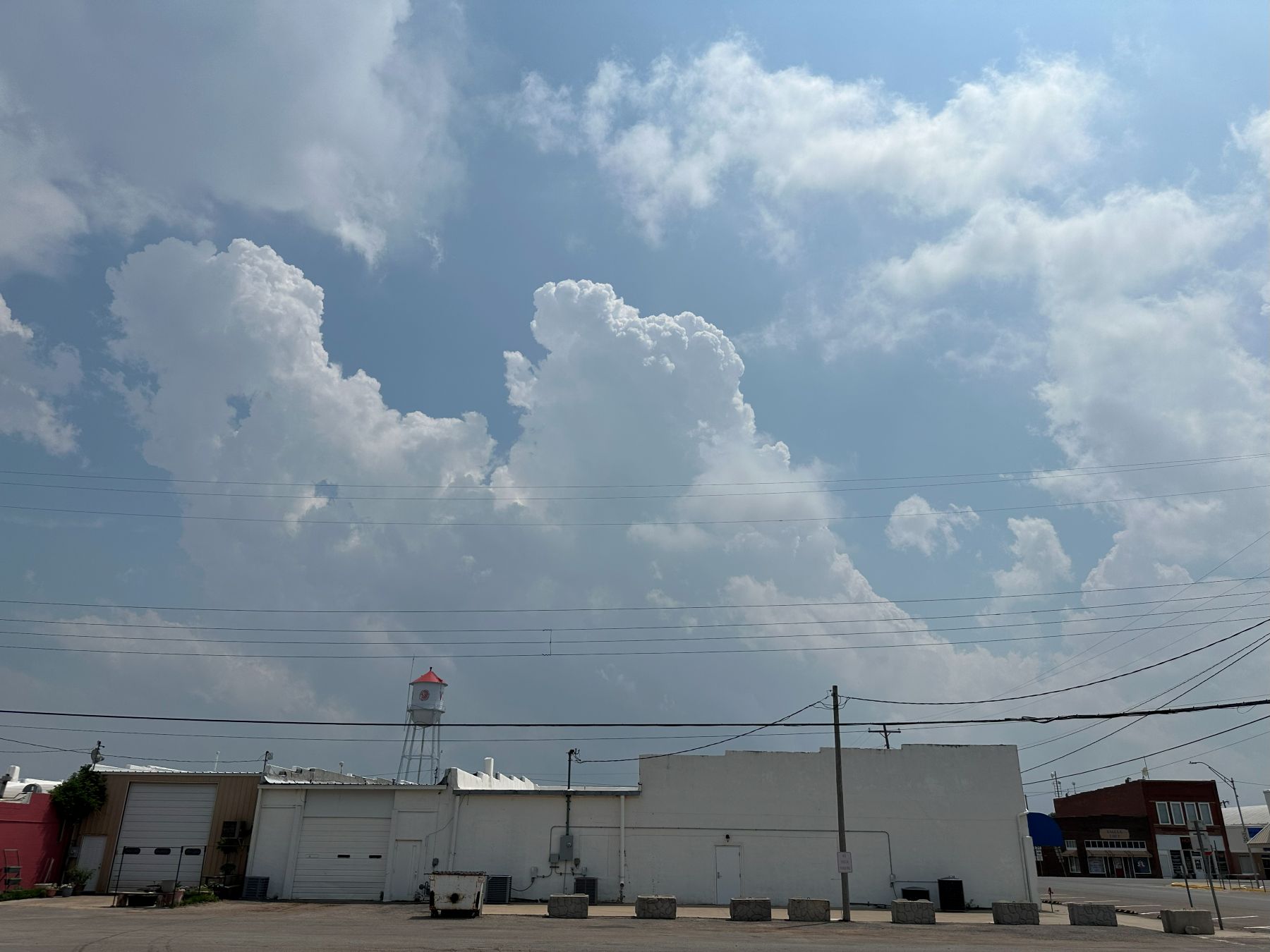
Dryline cumulus are percolating. Looking southwest from Vici.
Looking west from Vici.
Looking south. The wind shear is evident in the tilting updrafts.
The towers gradually get bigger with larger bases, but the real action will develop west of us.
There were a lot of chasers around. Our positioning was best to be on the tornadic storm early.
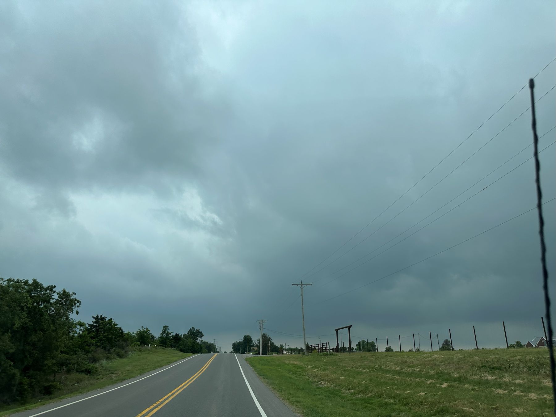
We were in the southwestern corner of a dense collection of chasers as shown on Spotternetwork. Given that the first storm was likely to initiate just to our west-southwest, I thought we were in great position to be some of the first chasers on the storm. Indeed, it went up where we expected, and we drove west from Vici to go get it. This took us to Higgins, TX. We stopped there and looked southwest toward the updraft base of the storm, but it was obscured by rain. We could see a firm anvil stretching far to the east, indicative of a healthy storm.
We now have a target storm. Westward from Vici toward Higgins, TX.
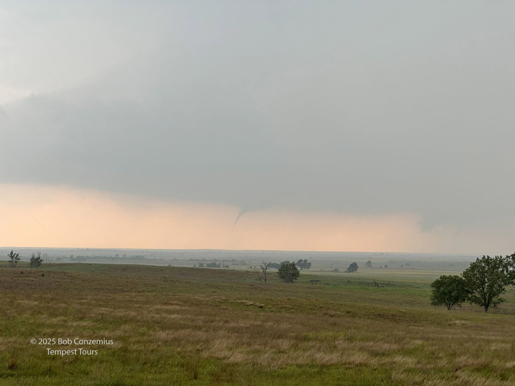
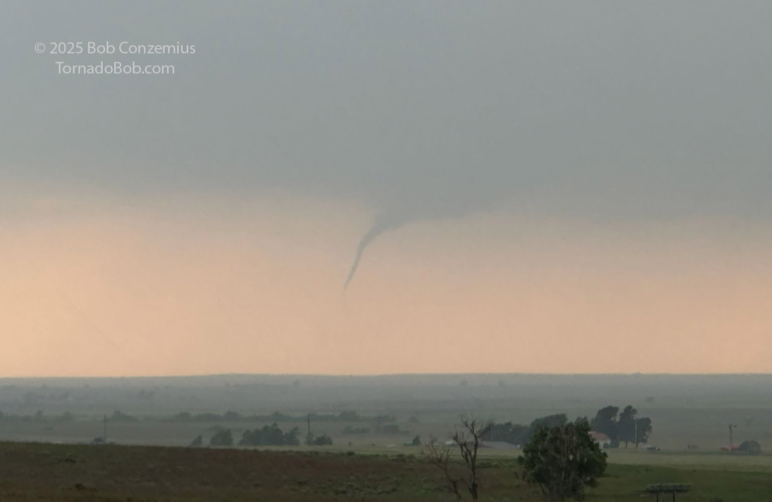
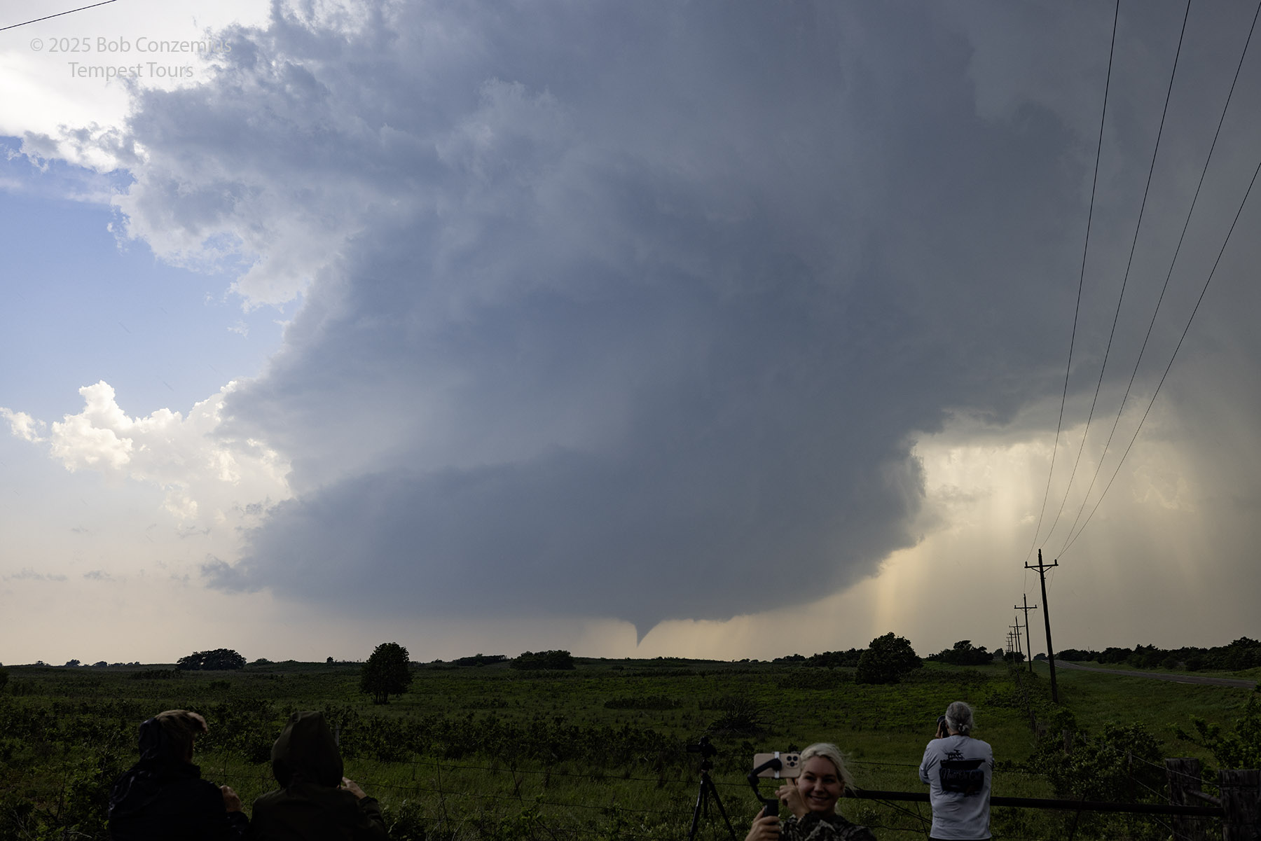
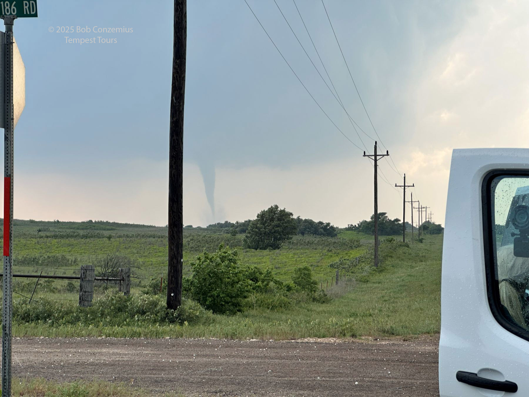
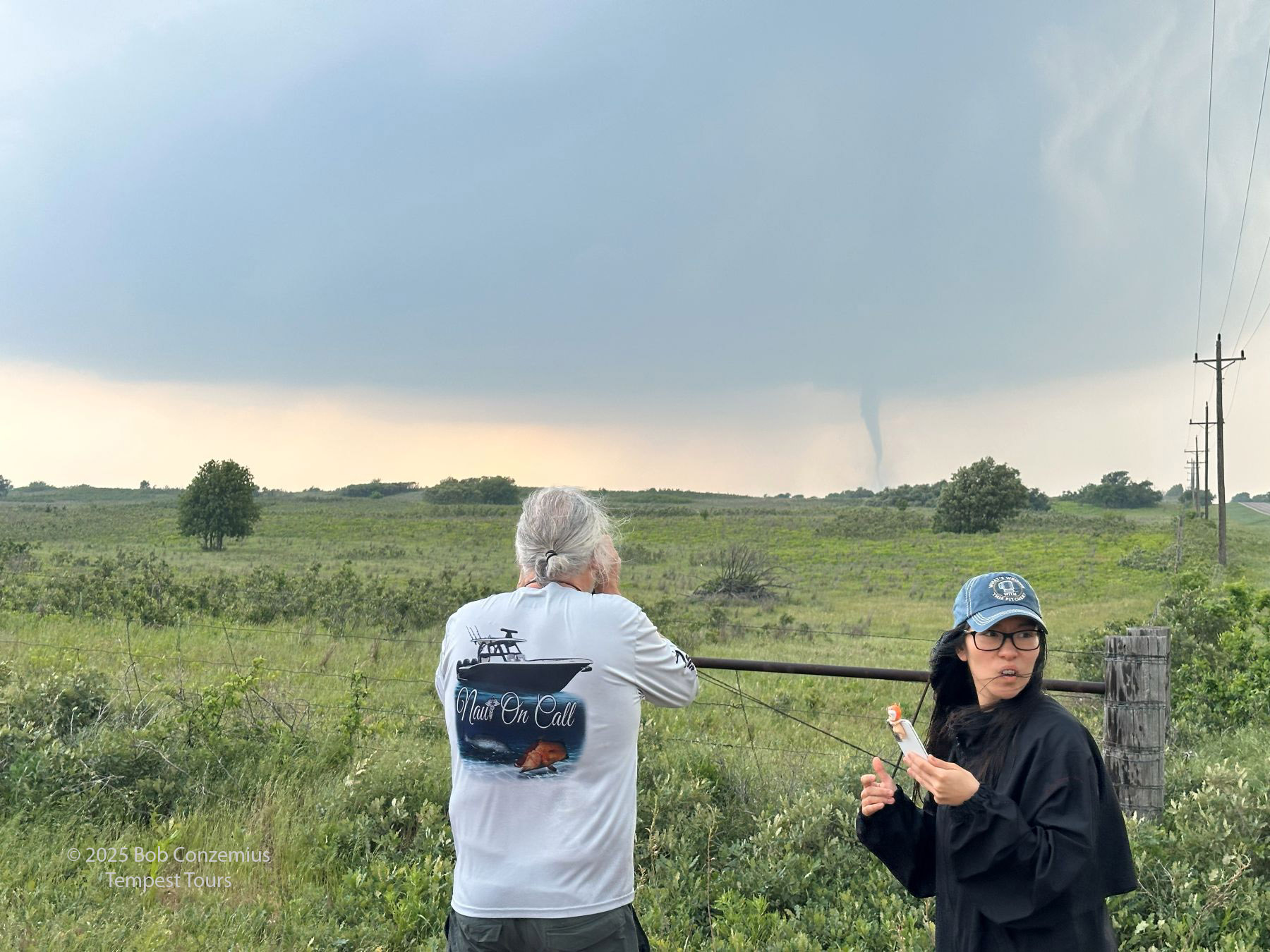
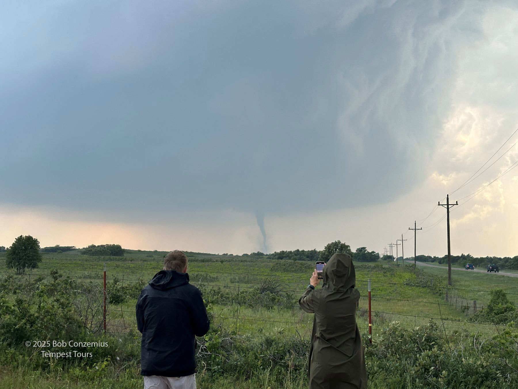
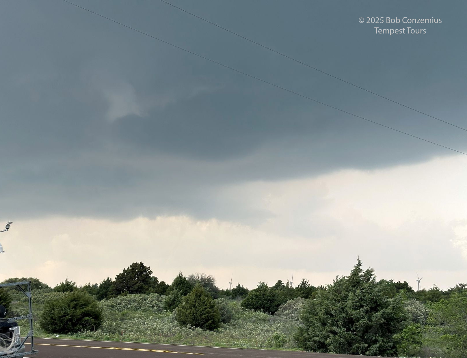
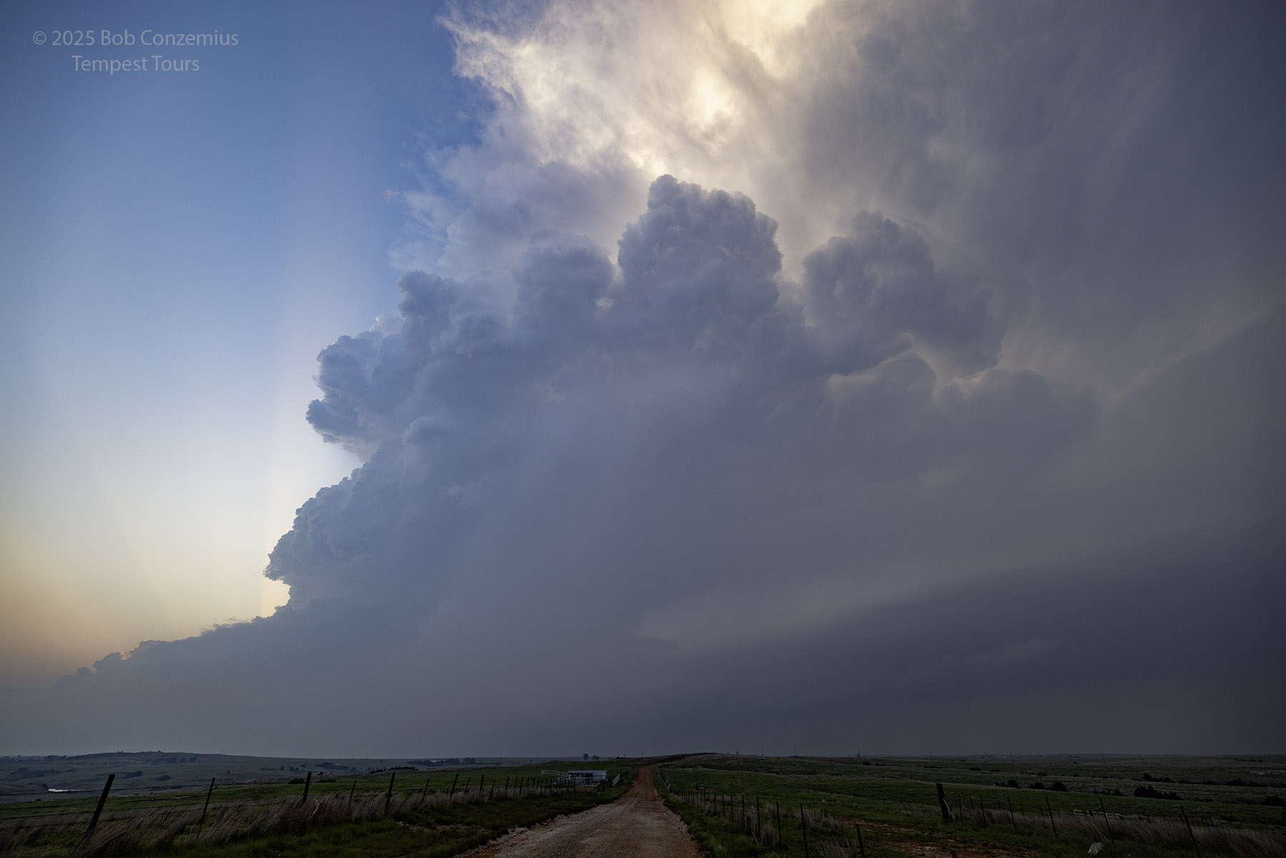
Hopefully, the storm would travel northeast and afford us a better view of its updraft base. We moved back east toward Arnett hoping to get a better view. It would have been good to get south also, but there were not really any good east-west roads to our south, and I wanted to stay ahead of the storm. It didn't take long for the storm to start producing tornadoes. Unfortunately, because I was trying to outflank the storm and, accordingly, afraid to commit to a south option, we didn't have a great view of the updraft base. A small, needle funnel descended from the base of the storm, and a debris cloud developed at the ground underneath it. We had our first tornado! Interestingly, this was an anticyclonic tornado, as revealed by chasers who were closer to the tornado. A second, cyclonic tornado was also in progress to its northwest. Someone pointed it out to me as we were loading guests back into the van after viewing the needle tornado, but I guess I didn't get any video of it. It was even lower contrast than the rope tornado you see below.
Our first tornado of the day! This one was actually anticyclonic. There's a second tornado far to the right, but contrast was bad.
A more zoomed in shot of the first tornado.
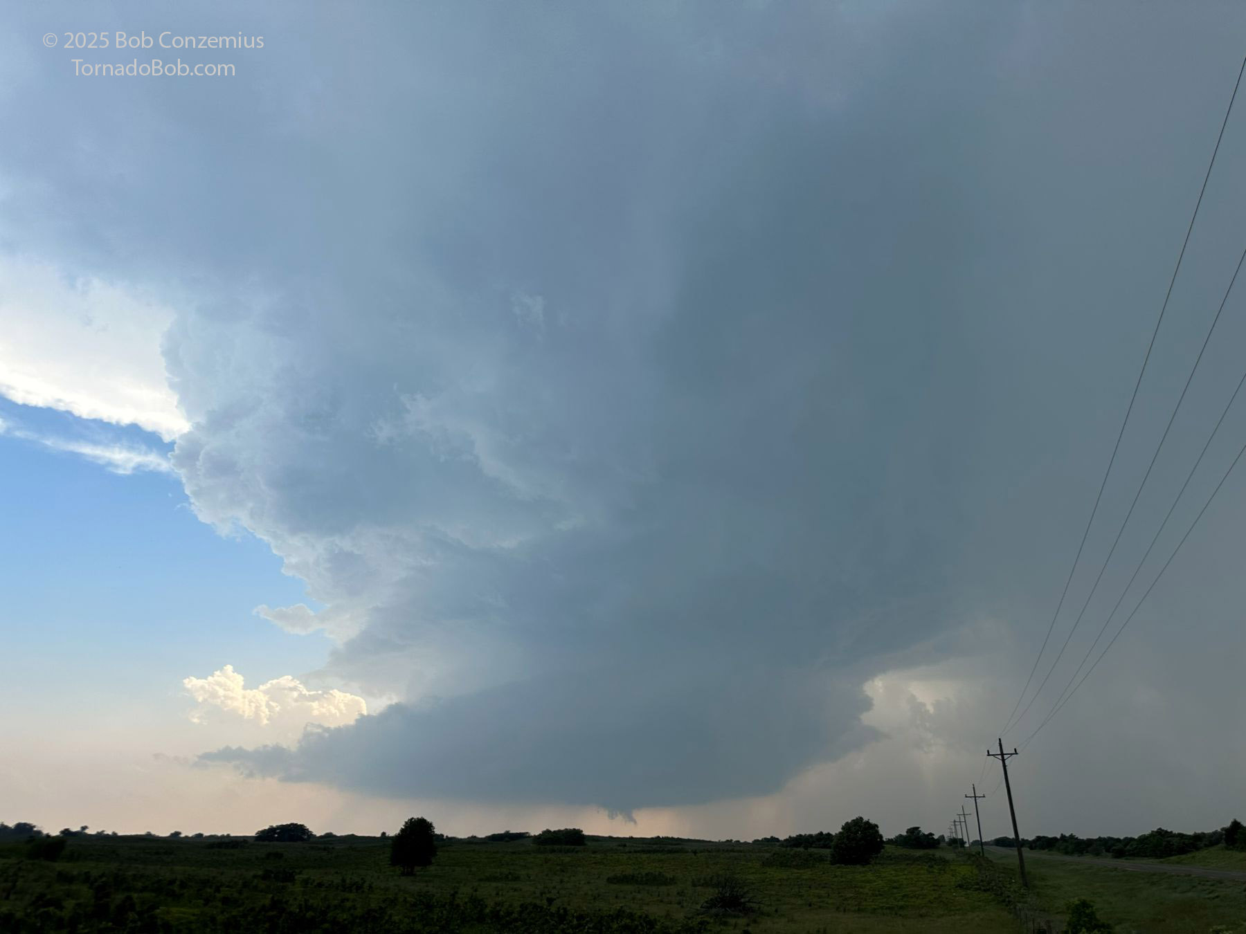
We were still getting hail, and I was wanting to get farther east to get out of the core of the storm. This actually took us a little too far east, causing me to examine my decision-making and realize that we would not be able to get out of the hail unless we took a road to the south. In retrospect, we did have time to do this as the storm wasn't moving very fast. The advantage of our eastern position is that we had a long time to sit at our location and watch tornadoes develop to our west.
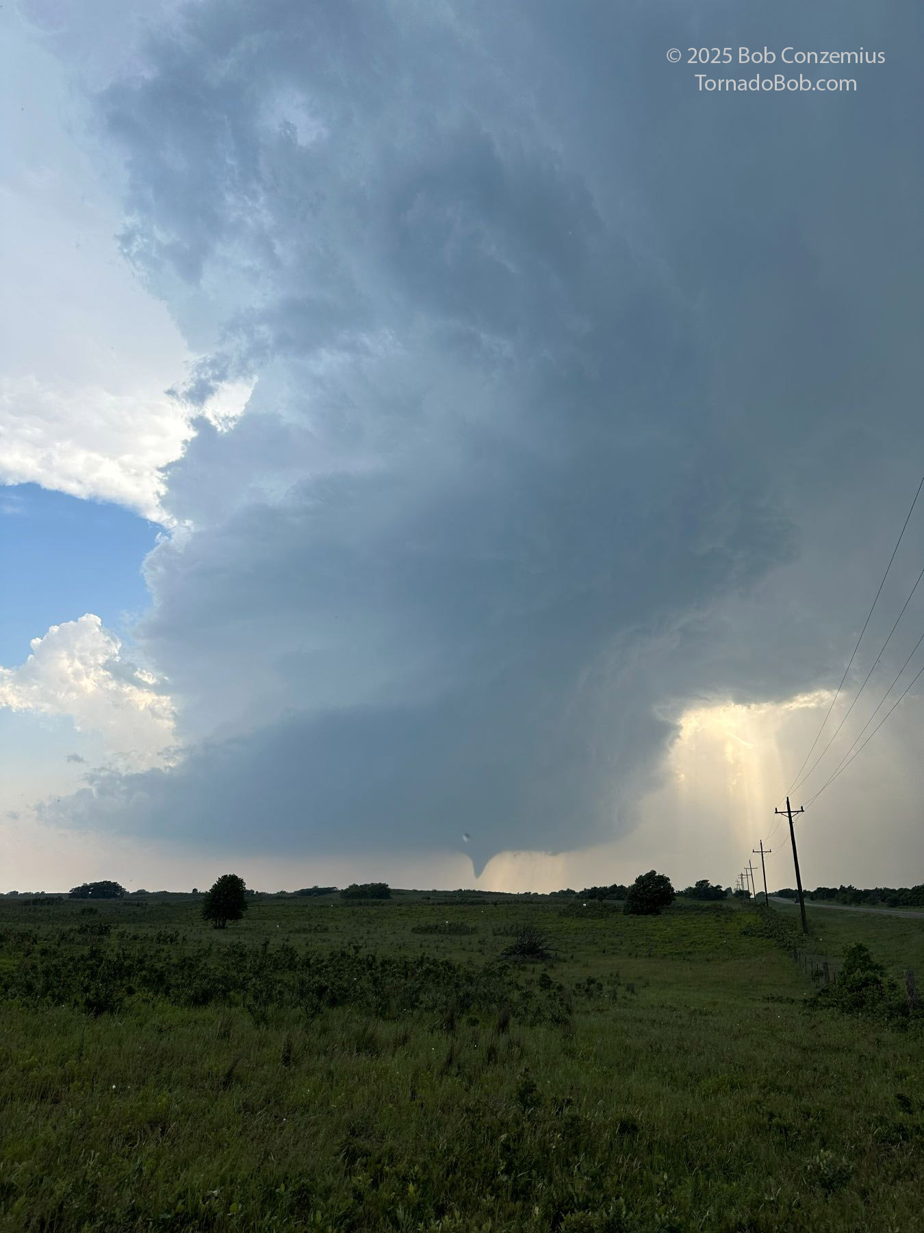
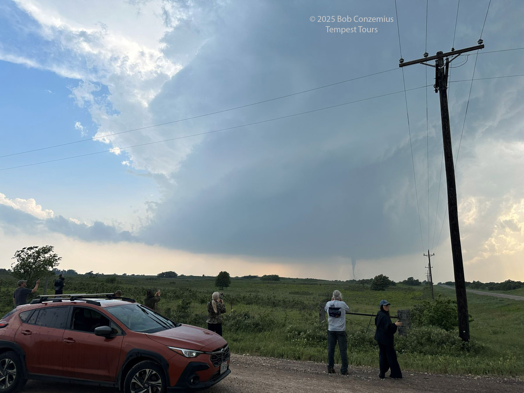
We backed off to the east due to hail. This is the view when we finally stopped. A wall cloud is present under the barrel updraft.
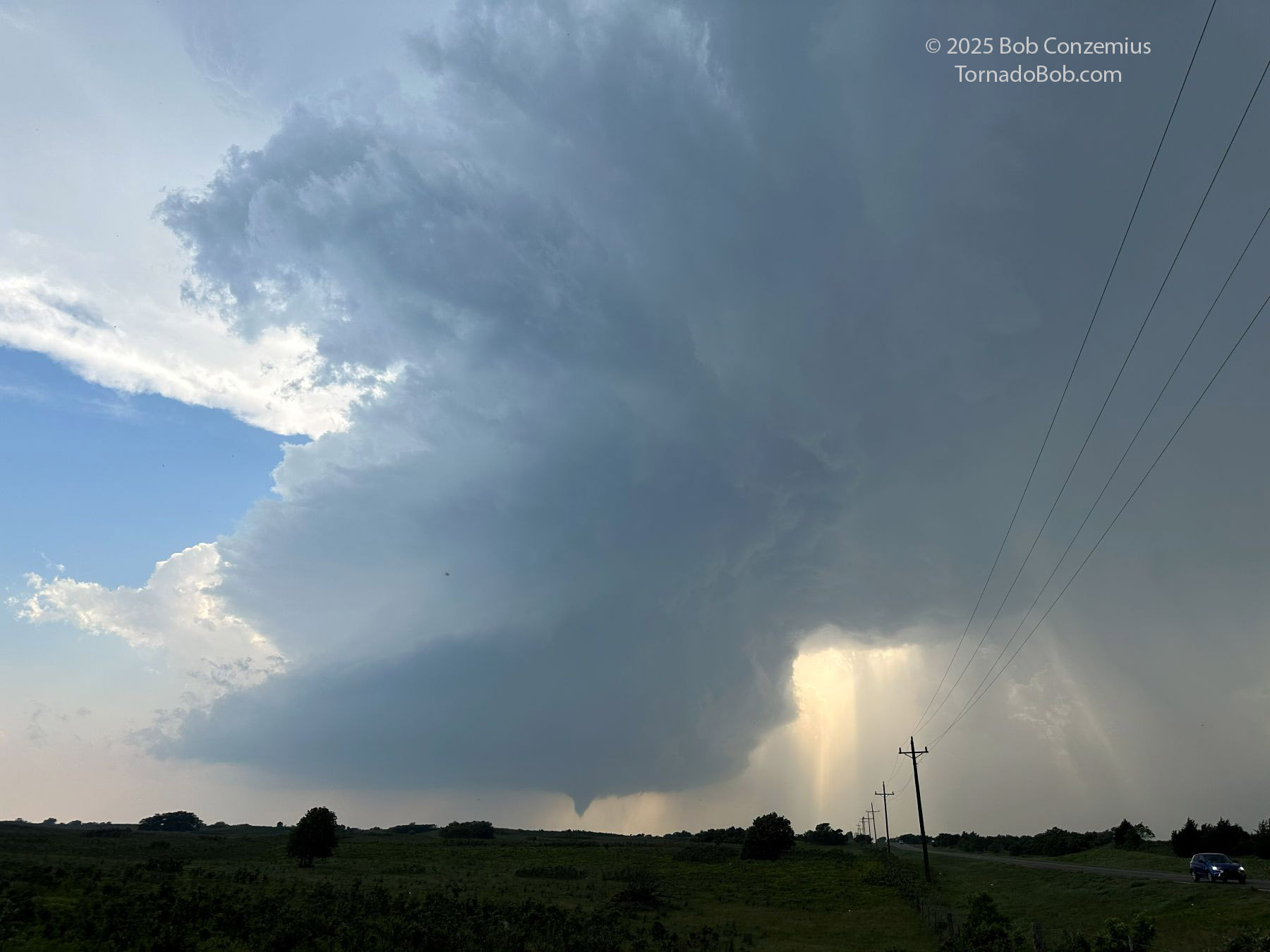
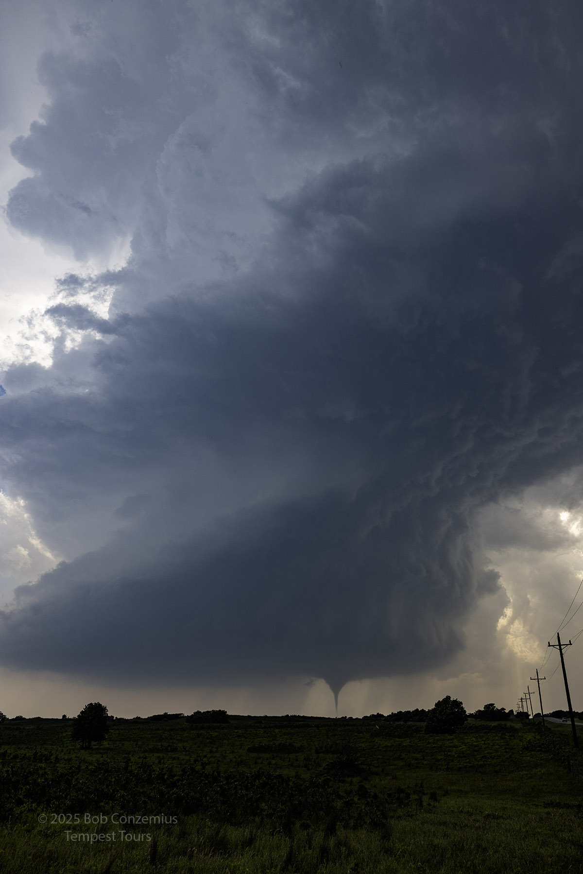
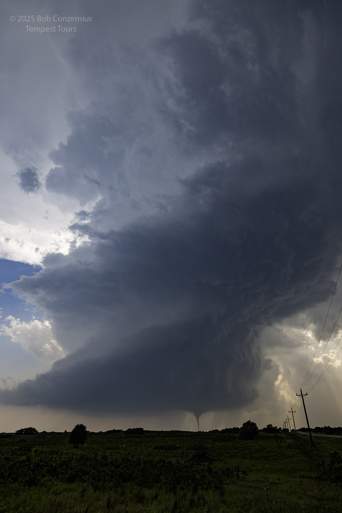
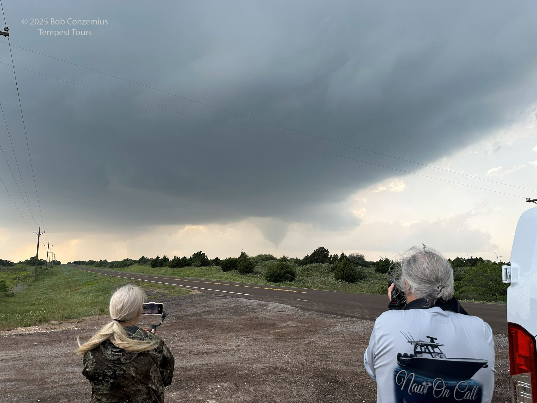
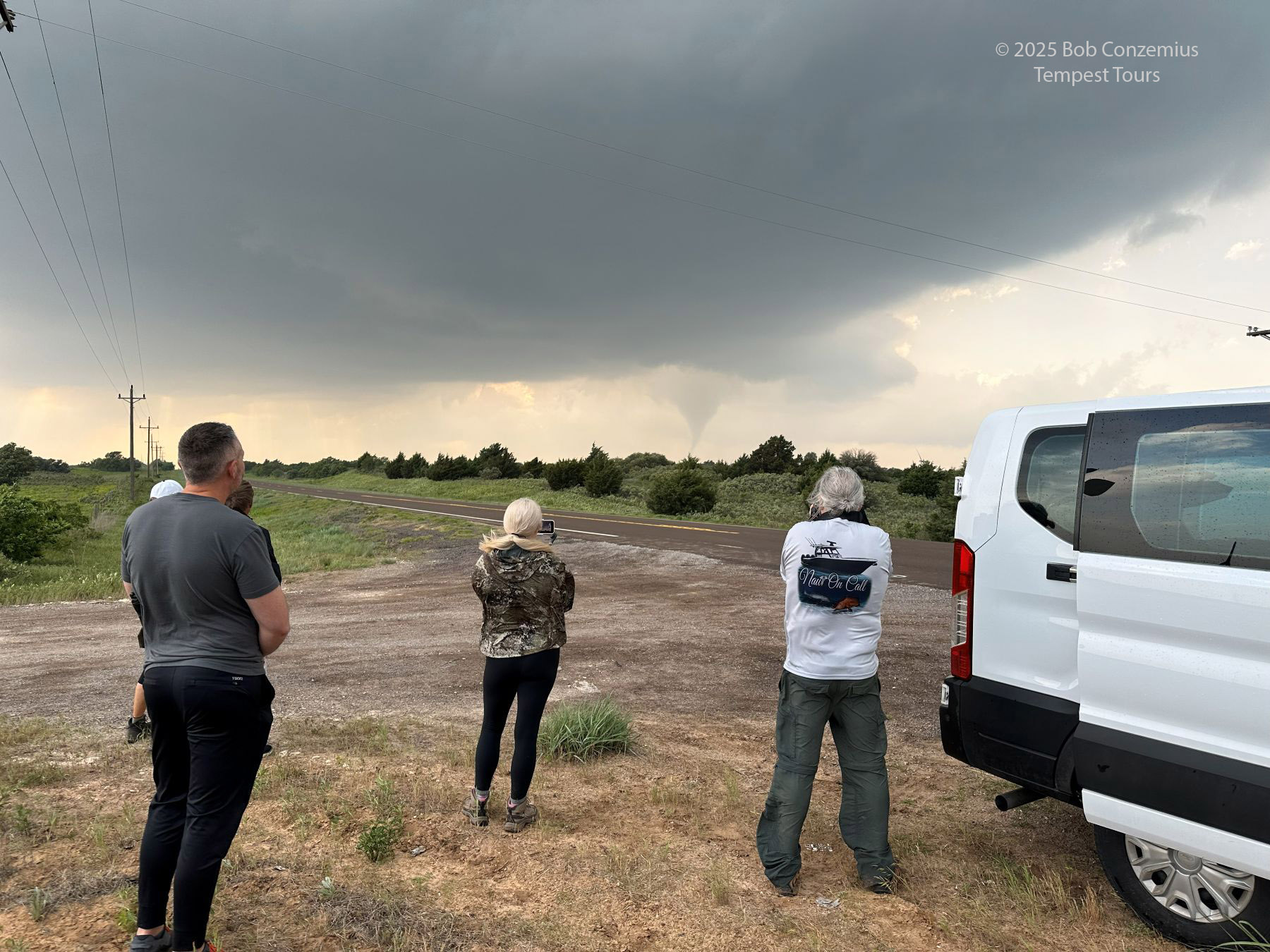
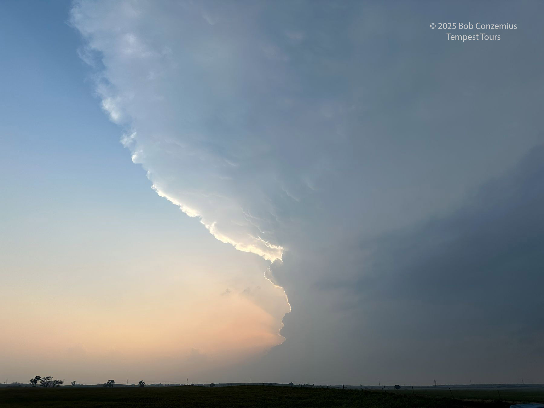
The strongest tornado this storm would produce developed next. There was a cloud visible when we were driving east toward our current deployment position, and that rotating wall cloud remained as we sat and waited for further development. It didn't take too long for another laminar funnel to appear from within this wall cloud, and we had our third tornado of the day. We watched the tornado as quarter size hail continued to fall at our location. It was not big enough to cause injury, but I was keeping my eye out for larger hailstones. At one point, I noticed a couple hailstones around two inches in diameter (or maybe slightly larger than that) beginning to hit the ground, so I told everyone to get back in the vans, but as soon as I yelled out my command, all precipitation stopped completely. We got back out of the vans and watched the tornado. I was about to set my camera up to take video of the tornado crossing the road to our west, but it quickly dissipated just before it got to the road.
A third tornado, a photogenic storm, and a happy guest.
Cell phone shot of our third tornado (and the strongest one, rated EF3).
Zooming in on the third tornado.
Wider shot showing both the tornado and the storm.
My best shot of the tornado and its parent supercell.
Okay, maybe this is the best shot.
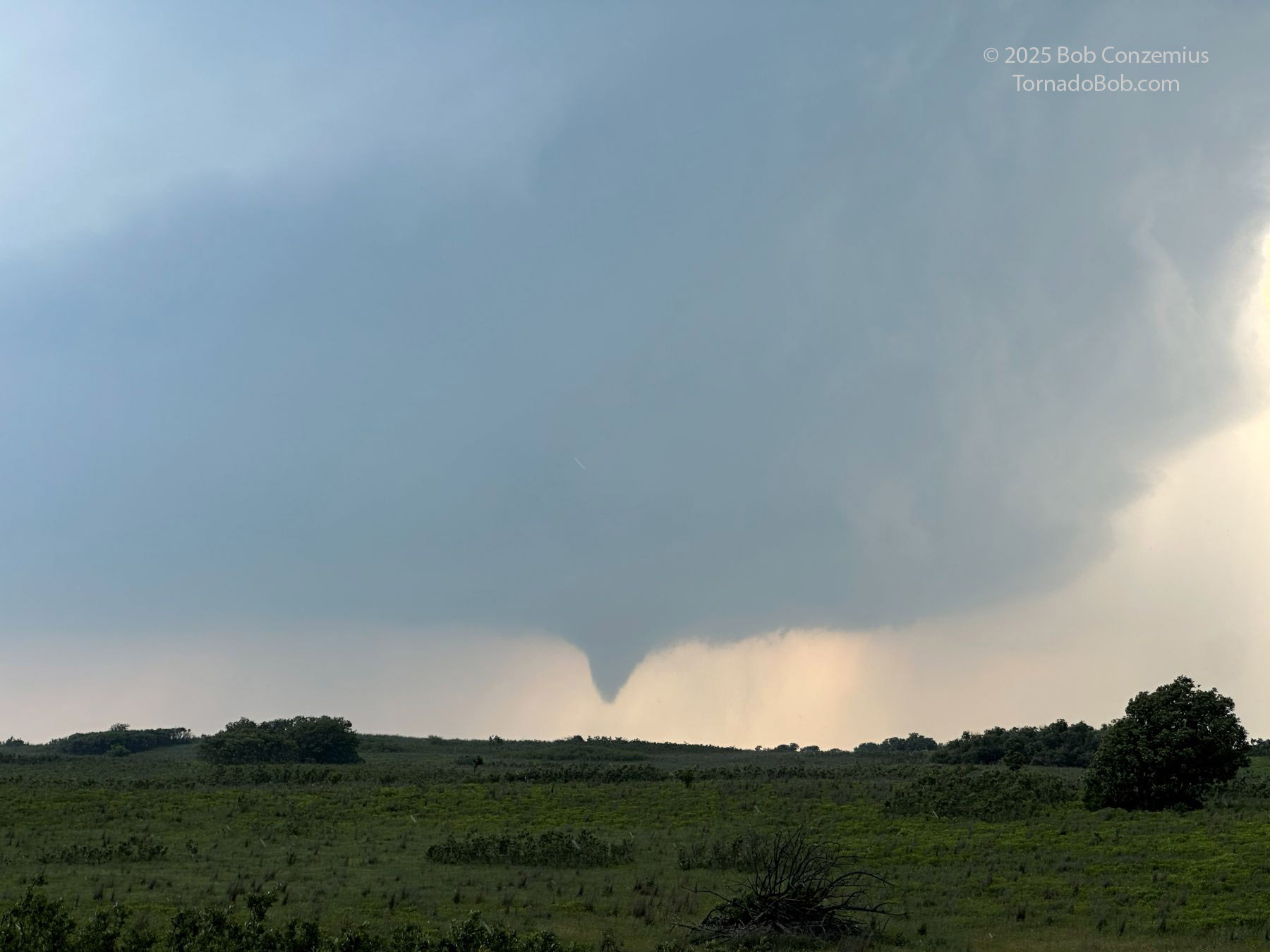
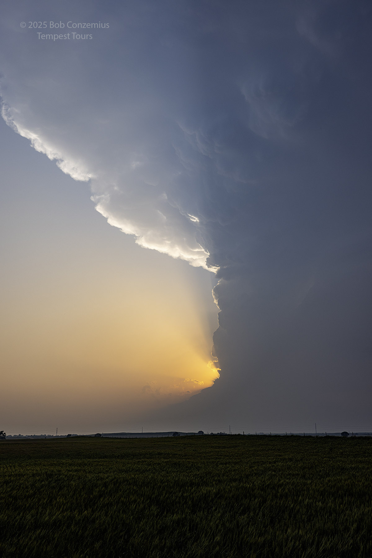
Nearly full condensation to the ground with a debris cloud visible. Look at the hail!
Guests enjoy the view of the storm and tornado.
The debris cloud is still visible.
Debris is a little more intense now.
It didn't take long for the fourth tornado to develop. Since the storm was progressing eastward, this one was a bit closer than the previous tornado, but it was still a few miles to our west-northwest. We watched this tornado for a few minutes until it, too, dissipated.
Tornado number four.
Full condensation to the ground.
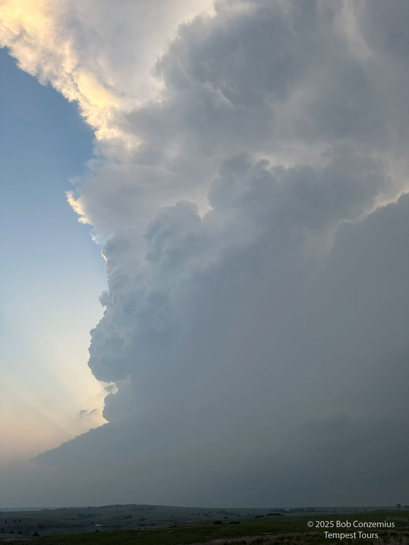
As the updraft base was now a lot closer to our location, we could see the start of a fifth tornado in the base. A broad funnel developed, but it never intensified, so we ended up not getting tornado number five.
Another funnel starts to develop, but this one would not form a tornado. The storm weakened after this point.
I had throught we'd be in for a long evening of tornadoes, but at this point, the storm began to weaken. It stopped producing tornadoes, and the base got a bit smaller and less interesting. Since the storm was less intense now, it was also not moving as much to the right of the shear vector, so it moved more northeasterly. We followed it northeast, and this took us toward Kansas. Oddly, our long evening of tornadoes was not to be. We followed a pair of storms north-northeastward until sunset as they slowly shriveled. There were additional storms in Kansas, but we would not be able to get to them until well after sunset, and the ones that were closest to us did not look that strong, anyway.
View near sunset near Waynoka, OK as we move north in pursuit of further storms.
My best shot of the sunset north of Waynoka.
Northwest of Alva, we chase the storm into a relatively roadless area and take our final pictures.
Our final deployment on a storm.
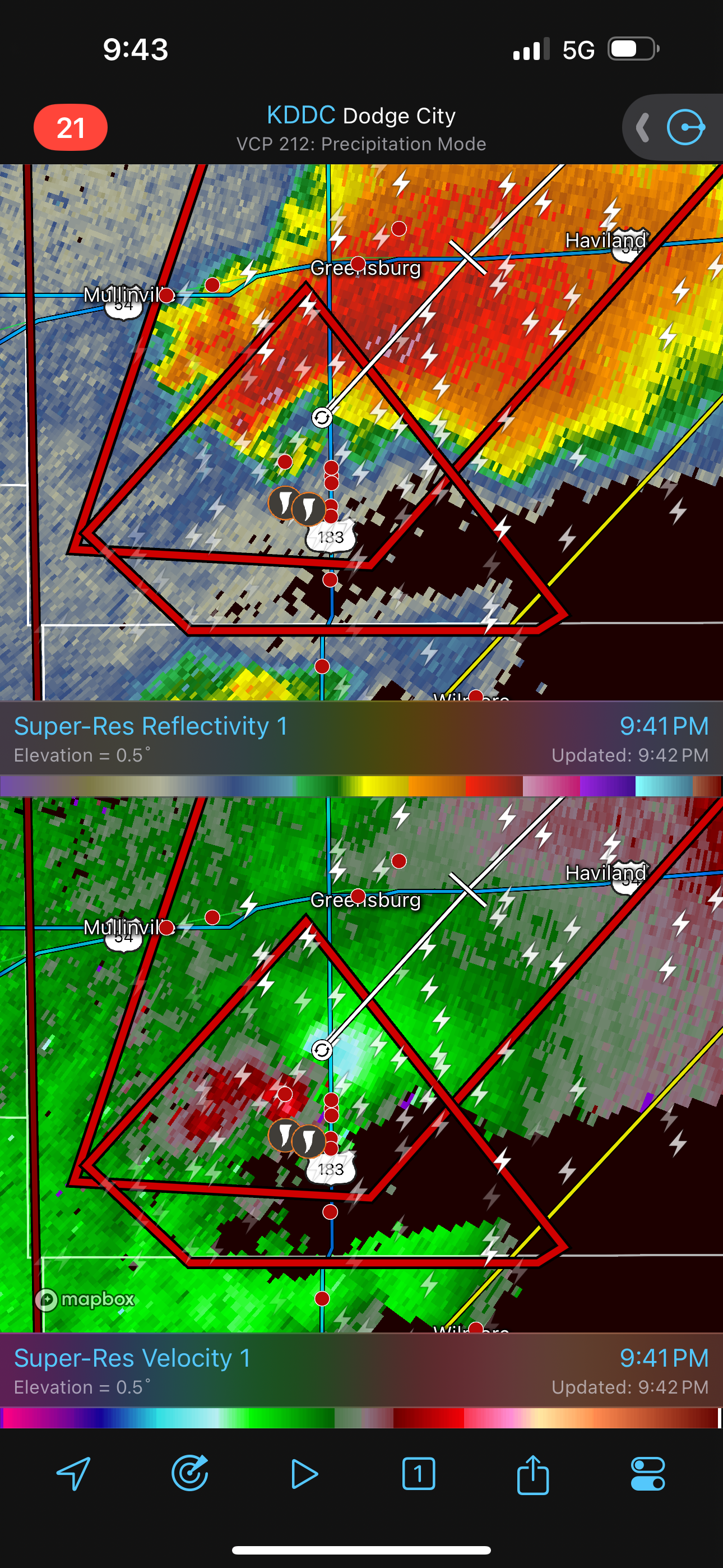
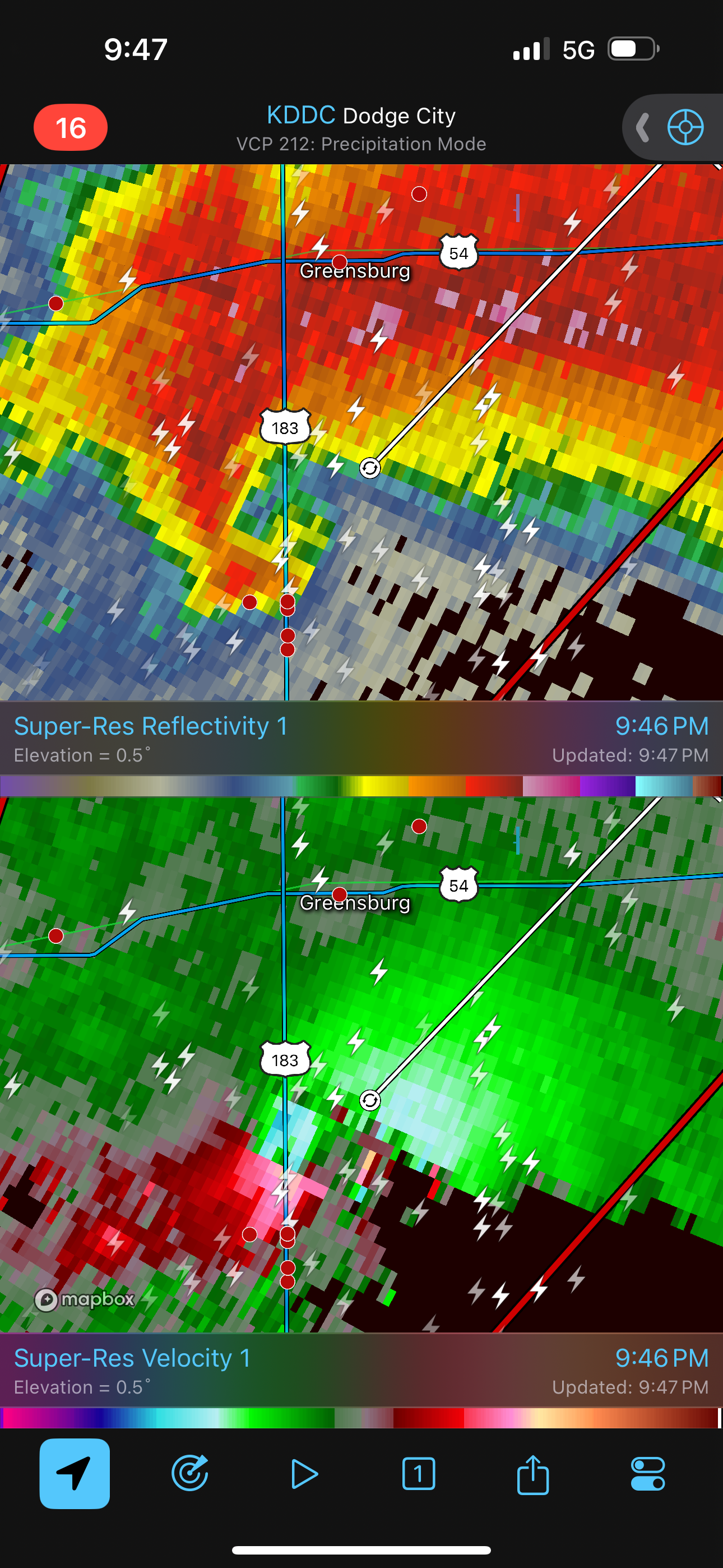
We found rooms at the Kiowa Motel in Kiowa, Kansas. I got into my room and started looking back at the weather for the day. I was also monitoring activity to our northwest and north. The storms were reintensifying. It seems like our storm was driven primarily by dryline dynamics, and the main show, driven by a shortwave trough, was actually going to occur during the later evening hours. I could see quite a bit of lightning to our northwest as a storm intensified and began producing a strong tornado as it headed toward Greensburg. Oh, no! Would Greensburg be devastated again? This appeared to be a large tornado very similar to the one that hit the town back on May 4, 2007. Fortunately, this time, the tornado passed a couple miles southeast of town. It was too close for comfort!
It would have been interesting to still be out watching those storms, but we had more chase days ahead, and we needed to get some sleep.
The storms intensified well after sunset and started to produce stronger tornadoes. I was worried Greensburg would get hit again, but the strong tornado passed just to the southeast of Greensburg.
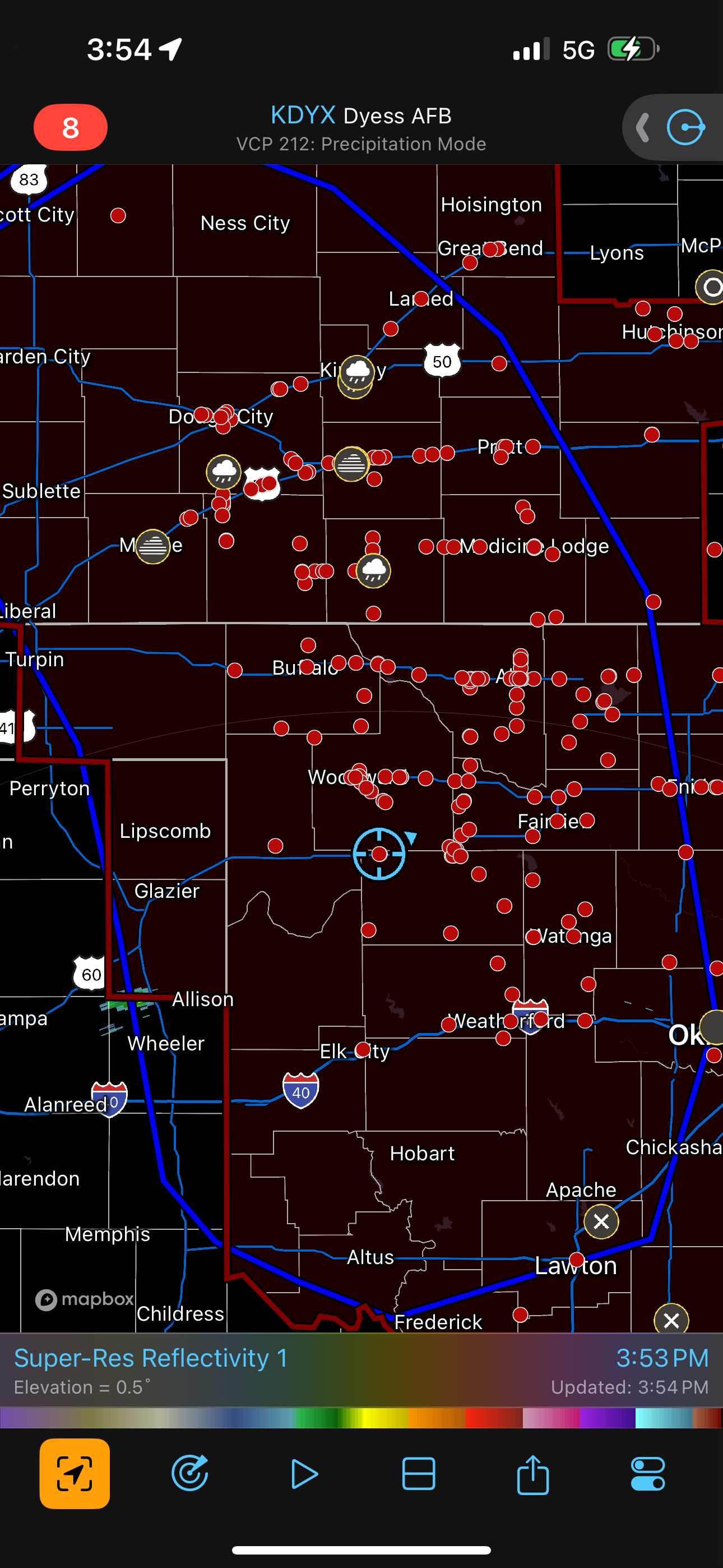
This radar shot indicates a strong or violent tornado is likely in progress.