The Electric Chase (Norman County Supercell)
August 28, 2016
Ever being the person who lets a sense of duty overwhelm his desire to go storm chasing, I had passed on a chance to go chasing the day before (I'm referring to August 27, of course). Because it didn't look like an outbreak of F5 tornadoes from stationary, photogenic supercells, I decided to mow the lawn, review a journal article, or put in a bit of work at Mt. Itasca or something like that. Of course, this caused me to miss a number of tornadoes around the Grand Forks area. I keep reminding myself that if in doubt, the Red River Valley of the North usually will have tornadoes if the conditions look marginal, yet when the time comes, I still fall into my usual habit of guilt-driven decisionmaking: I would really like to go storm chasing, but there are so many other things I SHOULD be doing.
Well, then, here it was-- one day later, and the atmosphere once again had large CAPE and minimally sufficient deep layer shear for supercells. I had managed to convince myself that I was just chasing in a reactionary manner, like I often have done the day after a good event that I did not chase, choosing to see parameters that looked good for storms and willfully ignoring those that indicated lesser storms than yesterday because I needed to make up for foregone opportunities. The atmosphere is not inclined to respond to such motivations. It has no inclinations to do anything at all. It only responds to the physical forces acting on it. The result of the reactionary chase is usually something less interesting than the day before, simply because the odds of two identically spectacular chase days in a row are pretty low. Thus, I was trying to convince myself to stay out of that reactionary trap. Such is the mindset of a chaser who doesn't put chasing as the number one priority in their life. You have to pick your chase days wisely.
Of course, I also had to finish that journal article review. Oddly enough, my focus was pretty sharp, allowing me to finish it before the end of the day, but it was late afternoon and a little too late to chase a target area that was three hours away. Nevertheless, with my evening free, I decided this might be the time to go out for some lightning photography. I had not done that in at least a couple years, and the lightning photography sessions are a little more laid back.
I still had to eat. While I ate dinner, I kept an eye on surface observations, radar, and satellite. Things were slow to develop, but as soon as a strong storm developed, I would leave. All I needed was a storm that showed promise of persisting after sunset. There was a lot of CAPE, and the forcing for deep layer ascent was not so strong, which was a good situation for isolated storms to develop. These can also be good situations for no storms at all as the boundary between great storms and no storms at all is subtle in these high-CAPE cases. There were small echoes on radar for about an hour or so, and then the daytime convective boundary layer began decoupling from the surface, which often means any small updrafts would disappear, leaving a quiescent atmosphere in their place, if the forcing was weak enough. This time, however, a larger storm began to organize east of Grand Forks. It was time to depart.
By the time this happened, it was almost 7:00 PM. Oh, well. An hours' drive west to the storm, combined with its eastward movement, would get me there before 9:00 PM, and I would have time to move eastward with it until I was close to home. I had not fully charged my car, but it looked like I could make it west and back with the 240 mile range I had.
I left home and brought up radar on my vehicle console. Fifteen minutes west of home, around Deer River, the storm started to take on an interesting shape. Very quickly, the Fargo-Grand Forks National Weather Service office issued a tornado warning on the storm. Although I was mostly amused by this development, my drive to the storm suddenly became a bit more urgent. The storm was gradually growing, and as I drove westward through Bemidji, it continued to look at least somewhat supercellular, but I noticed one feature that was particularly lacking: eastward movement. Because it had developed significant rotation, its motion became less aligned with the mid-level winds. Rather, it took root over Norman County as it ingested the high CAPE air in the Red River Valley. It was also a little bit south of me, so I would have to zig-zag south and west to get in front of it. This would really put a test to my EV range, but these warm temperatures were best for my battery performance, and I was beating the rated range by almost 10 percent. I could make it at least 125 miles out and return home with miles to spare.
For the past hour, the storm had grown a bit in size but had not done anything tremendously interesting, but as I got though Bemidji, the storm sent out a large appendage on its upshear (southwestern) flank. The appendage developed into a prominent hook with the type of velocity signature indicative of a major tornado. My casual lightning chase was potentially turning into a more frantic nighttime chase of a strong to violent tornado. I was still doubtful about seeing anything because I was a still an hour away. The storm was ominously lighting up the western sky when I turned south at Lengby. My intercept route took me into the White Earth Indian Reservation, where I promptly lost cell service. I would have to go visual.
 |
|---|
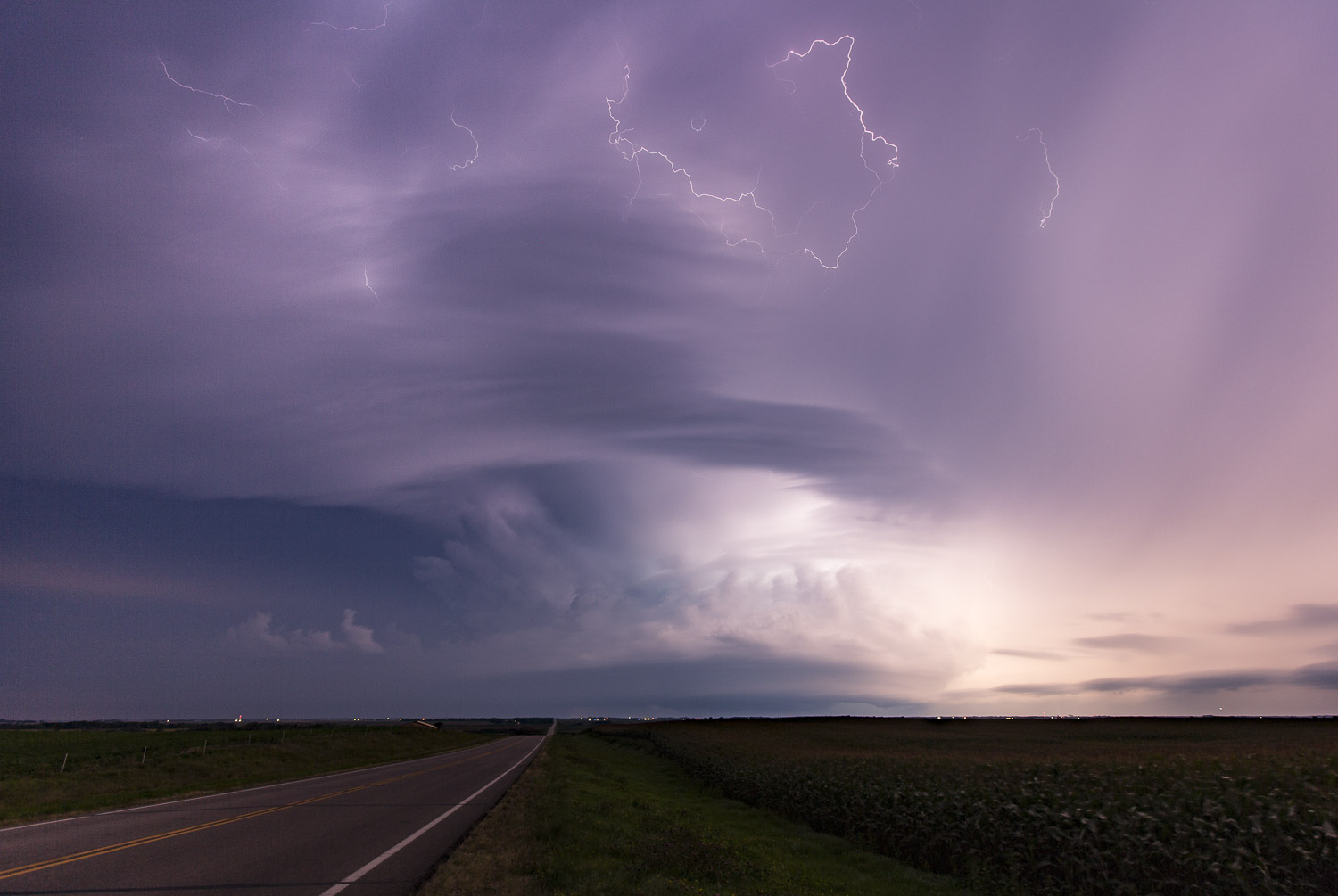
| Storm with an occluding hook. |
Going visual was not that big of a problem because there was a lot of lightning, and the cloud structure in the sky was easy to see. I was still pretty far north as the only structure to my west was an opaque, rainy sky from the anvil precipitation. I needed to drive to Highway 200, which would be the perfect spot to turn west for a quick intercept. There was very likely a large tornado in progress, and I might just get there before it dissipated. The anticipation was building!
My hopes were quickly dashed as I reached the four way stop and saw "Road Closed Ahead" signs prominently blocking both lanes of the westbound road. I spent a full minute or two in deep denial, choosing to waste my precious time desperately checking and re-checking the maps, which only confirmed the next westbound road was ten miles farther south, and that route did not look very fast, either, with winding roads-- a sign of slow speed limits. I still had no radar, but radio broadcasts indicated there was still a tornado warning on the storm with a potentially large and dangerous tornado. This was not a surprise given what I had last seen on radar.
I drove on the meandering road southward through the town of Naytahwaush, where I could finally go west, but I also saw my trip odometer go past the 125 mile distance that I had marked as the point of safe return. It would now be necessary to charge before I returned home, and there were no fast charging options. The City of Bemidji had been kind enough over the summer to install a couple 30 amp charging stations, so I knew I would be able to stop there, but those stations were only 30 amps and would only give me 22 miles of range per hour of charging. There was a 40 amp outlet in the city park in Walker where I had charged last summer. That would get me 29 miles of range per hour, but this was not a designated charging location, so I was not sure it would be available this time. I plotted a route to the Baxter Supercharger, but it was out of range for me. It looked like I would be spending time in Bemidji.
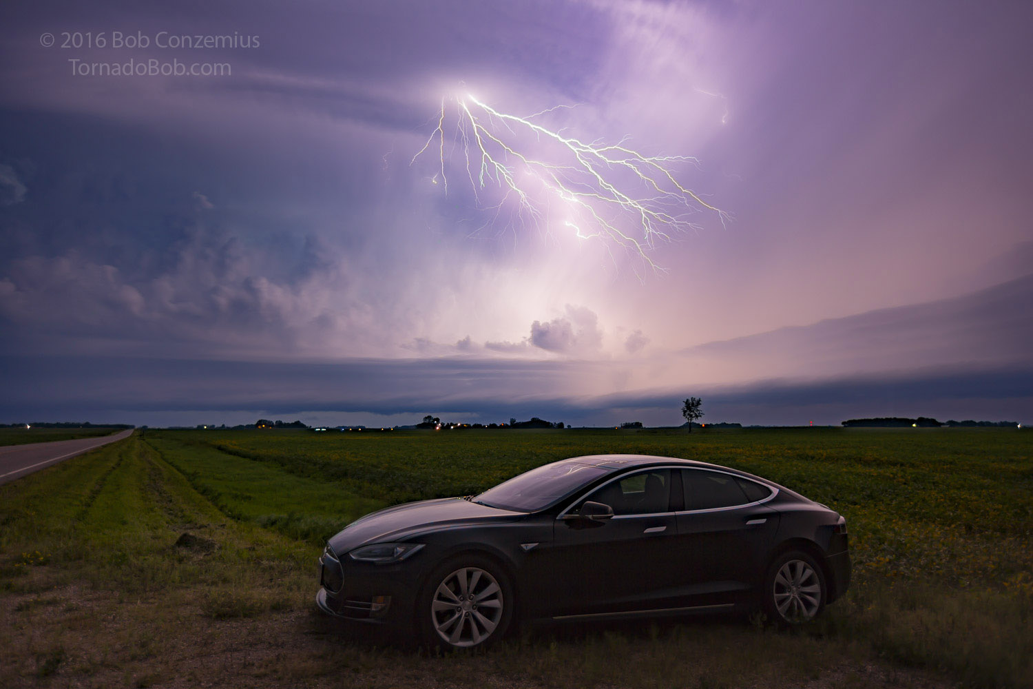
As I drove up a hill west of Naytahwaush and cleared the trees enough to see the sky in front of me, I caught my first glimpse of the updraft base. It was indeed large, circular, and very threatening. I could see large blocky lowerings but no tornado. I scouted out a field driveway to pull over and snap some pictures while looking for tornadoes under the base. The lightning was continuous, and in my excitement, I had a hard time keeping my hands steady enough to set up my tripod and camera.
 |
|---|
| A supercell with continuous lightning. |
These continuous lightning storms are often not very good for still photos. This one was turning out to be no exception. I was not getting any good bolts in my shots, so I decided to take a video clip because that would at least capture the rapid fire nature of the lightning.
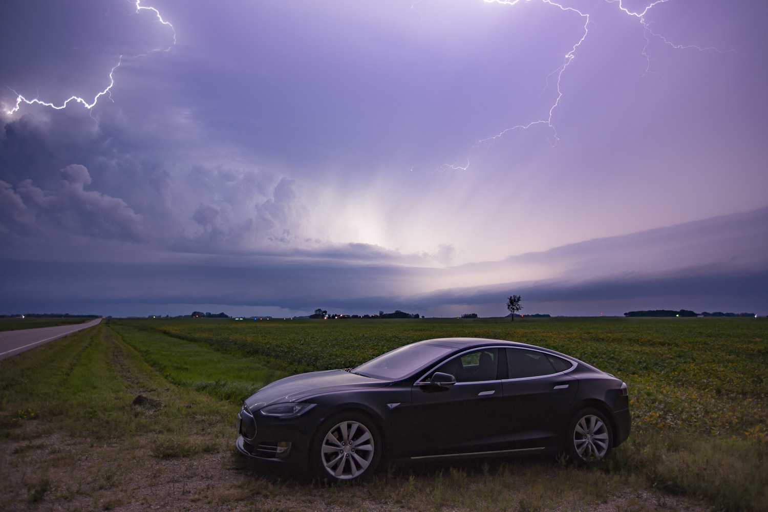
After taking the video, I realized I was still pretty far away, so I continued west, further past my return range. I pulled over again after only a couple miles because the terrain was very open, the view was great, and the storm was actually a little closer than I had previously thought. I pulled over and snapped quite a few more stills.
 |
|---|
| A supercell with continuous lightning. |
As my camera was on tripod clicking away, I checked Radarscope again. The mesocyclone was still intense, but it was getting broader. Radar echoes now appeared directly overhead. The storm had increased substantially in size, and previously clear areas had filled in with heavy precipitation. The storm was now transitioning into an outflow-dominant complex. The inflow band I had seen to my north was getting thicker and was starting to look more like a shelf cloud (or maybe a roll cloud-- it was still not attached to a deep updraft). It was a good time to begin the trip home, but I still wanted to take a few more stills.
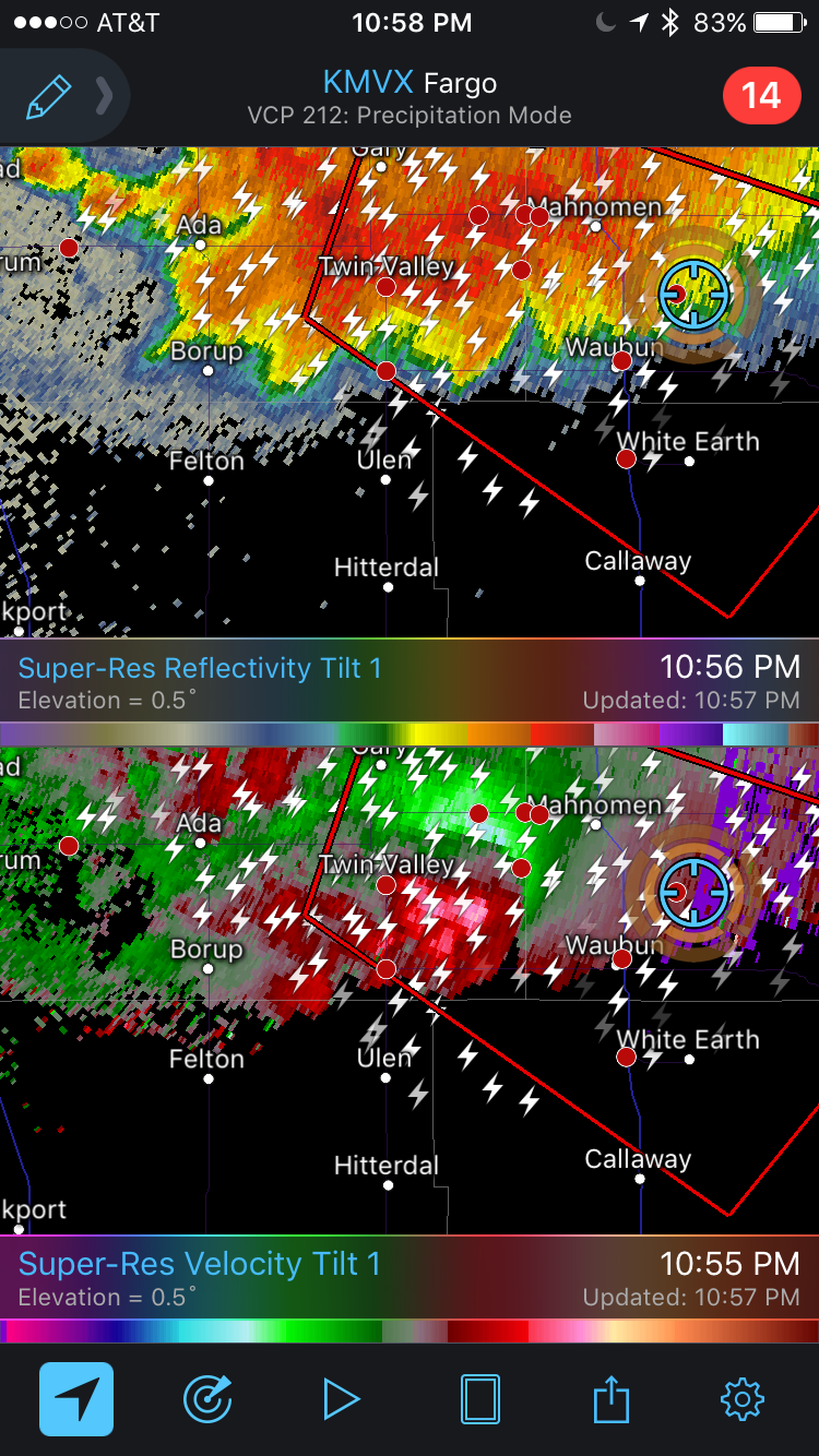 |
|---|
| Radarscope revealed a strong mesocyclone but now lacking strong gate-to-gate shear-- just a broader circulation. |
 |
|---|
| I kept on shooting for a few minutes. |
Returning Home
After a few more minutes of shooting, the first drops of rain began to fall. I was now aware that the whole complex was moving south more quickly toward me, and it was definitely time to head back home. I plotted the distance to Bemidji, which showed I had plenty of range left to get there. However, I had committed myself to driving through heavy rain, which meant I would be chewing up range much faster on the way home. No longer was I exceeding my rated mileage by ten percent. I was probably ten percent below rated mileage. This drop in range is not limited to electric cars. The physics of wet roads affects gasoline cars the same way, but the convenience of stopping for only a couple minutes to refuel at many filling stations along the route (even at this late hour) makes most drivers completely unaware of the worse mileage. As I watched the remaining range fall as precipitously as the rain, my mind added up the time I would be spending in Bemidji and recalculating the expected time of arrival back home. Hmmm.... well, at least there's enough room in the car that I can fold down the rear seats and stretch out for a nap.
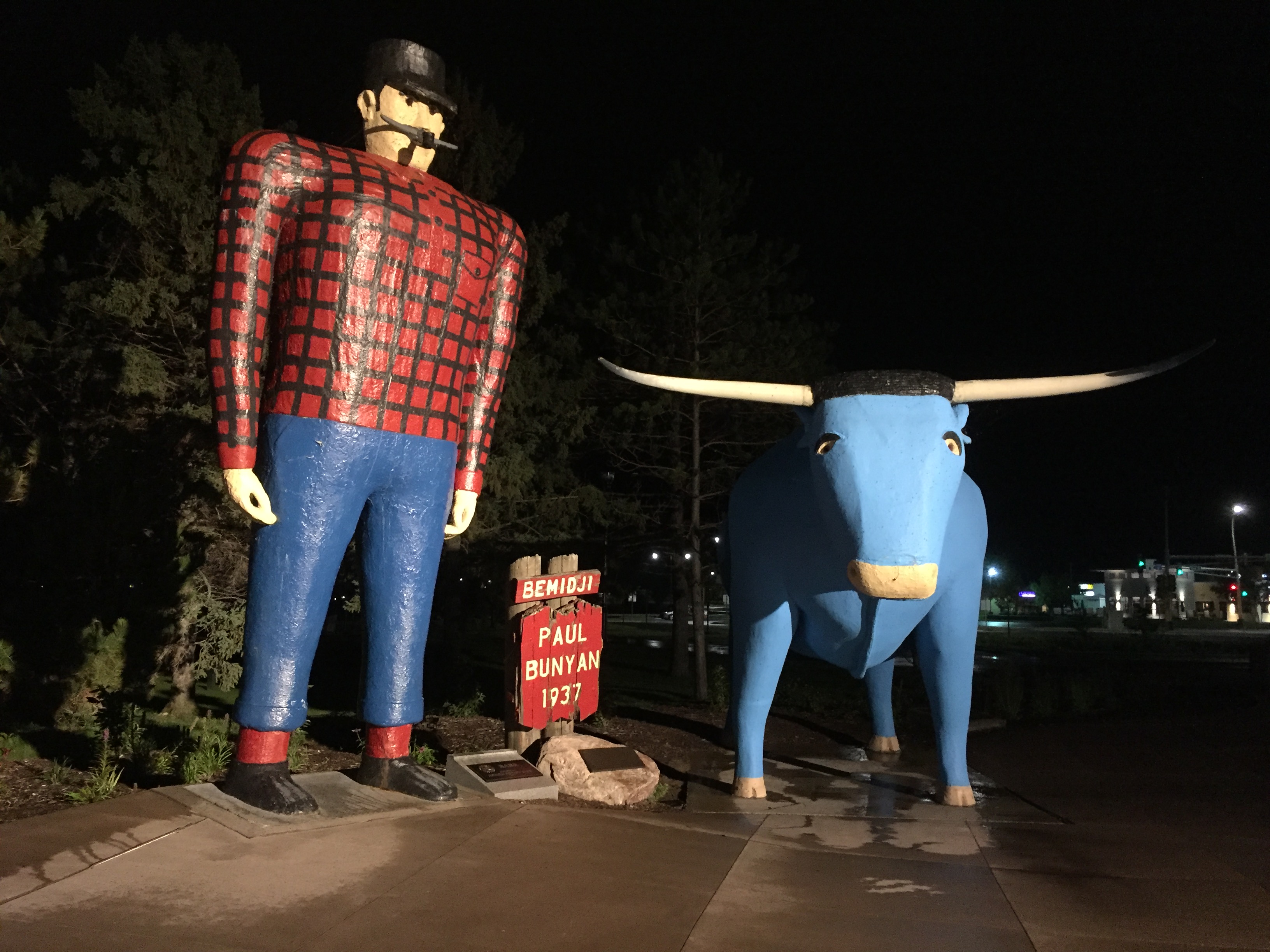
I arrived in Bemidji with 25 miles of range. The two chargers were at the city hall and at the park featuring Paul Bunyan and Babe the Blue Ox. I opted for the latter. I parked my car, plugged in, and looked around for a place to hang out. The coffee shops had long closed. The only remaining open establishing were bars, and there were only drunk people there this late. I did not want to deal with that. My limited experience with intoxicated people at bars at this time of night (and Sunday in particular) has told me that most have a heightened sense of rejection. It's the one mental function that actually becomes stimulated by alcohol as all others are fading. I would be unable to tell people I was just charging for a couple hours and wanted to return home. I chose to remain literally in the shadows, away from street lights, so that I would not be detected.
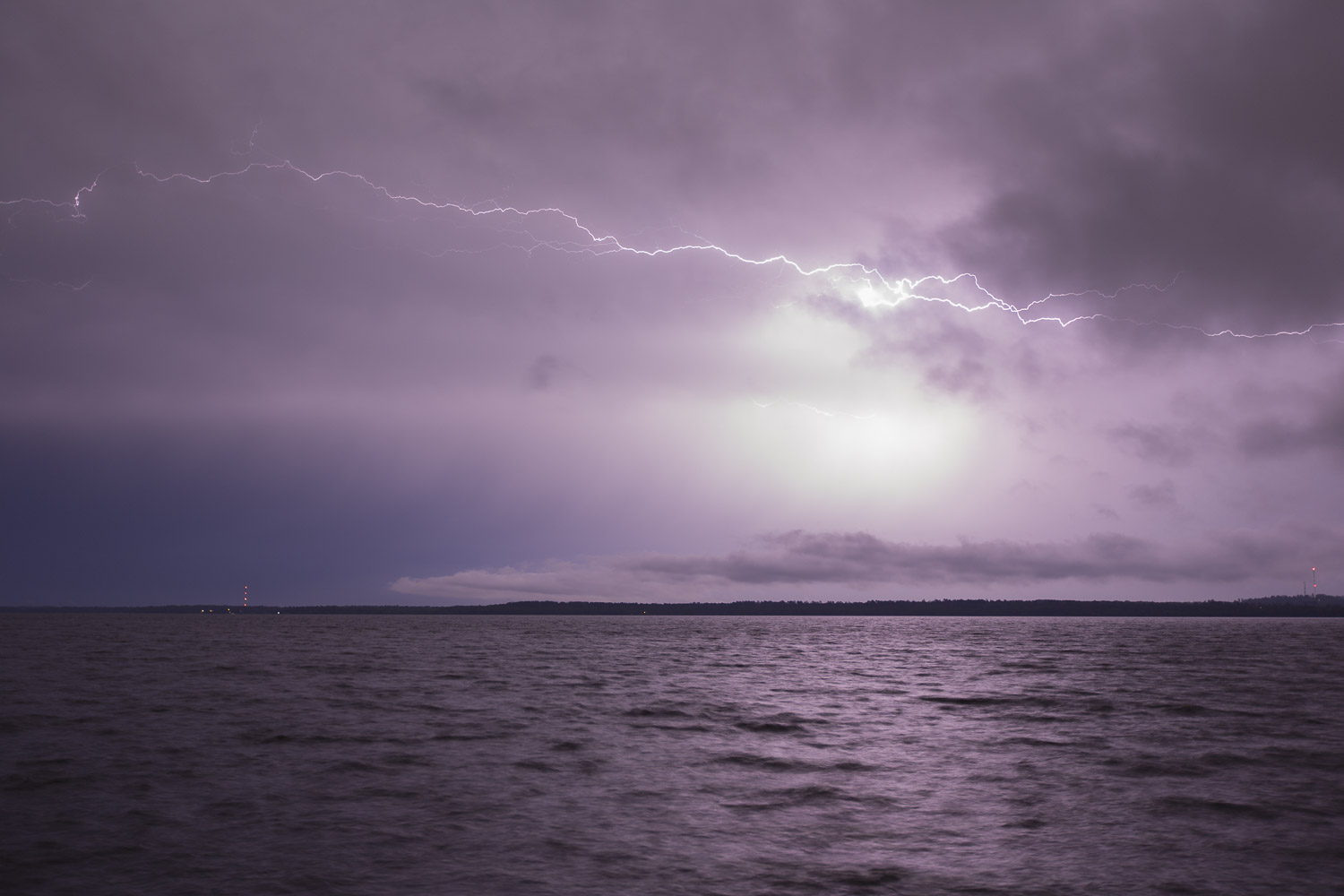
I did not feel sleepy. I was actually really hungry, but I had no food. The only calories I could find was a Pepsi from the pop machine. I waited out some heavy rain from the northern edge of the storms to my south and then set up a camera to shoot approaching storms from the north over Lake Bemidji. I barely got started at that before low clouds rolled in and shut down the view of the bolts. I returned to my car and took a nap for the last 30 minutes. By about 3:30 AM, it was time to leave.
 |
|---|
| Paul and Babe. |
 |
|---|
| Lightning over Lake Bemidji. |
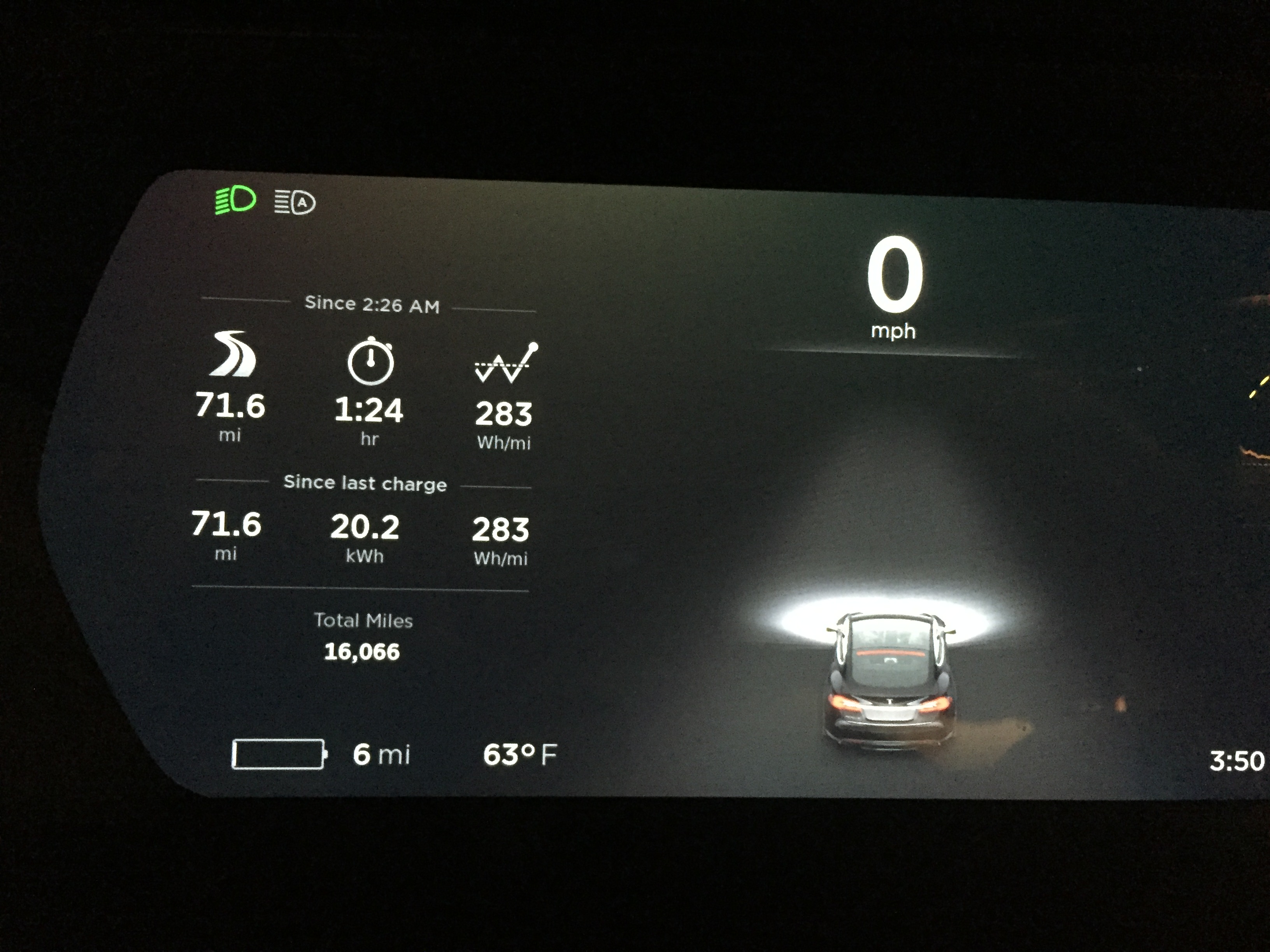
I pulled out of Bemidji, and before I even reached Highway 2, the car warned me that I had to keep my speed below 50 mph to reach home. This seemed inconsistent with my estimates, but the roads were still wet, and as I watched my range disappear again, I came to the conclusion that I would indeed need to drive conservatively to keep some padding on my range. The nap, combined with the Pepsi I had consumed, kept me awake, and I also needed to watch for deer. Finally, at 3:50 AM, I pulled into my garage with six miles of range. To date, that has been the lowest I have gone.
As it turns out, the tornadoes from that storm were not very damaging, and the one that I thought would have been a large and violent tornado actually turned out to be weaker multivortex event underneath an intense mesocyclone. It visually appeared as several small tornadoes that formed in succession underneath a larger area of rapid rotation. That's still pretty impressive, and it caused some damage, but the damage was not as widespread as I feared it would be.
My conclusion from this chase is that there need to be more fast charging options to the west if I am going to make a habit of chasing these Red River Valley storms. One option is to stay overnight in Fargo and Grand Forks the previous night while charging, have a leisurely morning, and start with a full charge right in the target area. The other option is to wait until fast charging stations are built. Tesla has it in their plans to build Superchargers at both Fargo and Grand Forks, but that hasn't happened yet. North Dakota is one of two remaining states in the contiguous 48 without a Supercharger (the other is Arkansas). I hope that changes soon, and I hope North Dakota gets its first Supercharger before Alaska does.
 |
|---|
| Six miles of range back in my garage. |
 |
|---|
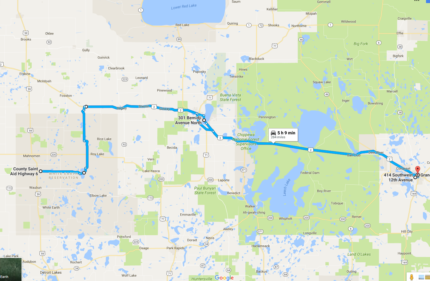
| The chase route: 284 miles round trip. |
Back to Storm Chases | Home