These drop-down menus link to the top auroras of each year. For 2012 through 2018, click on the year to see a calendar linking to all events for that year.
April 9, 2022 Auroras
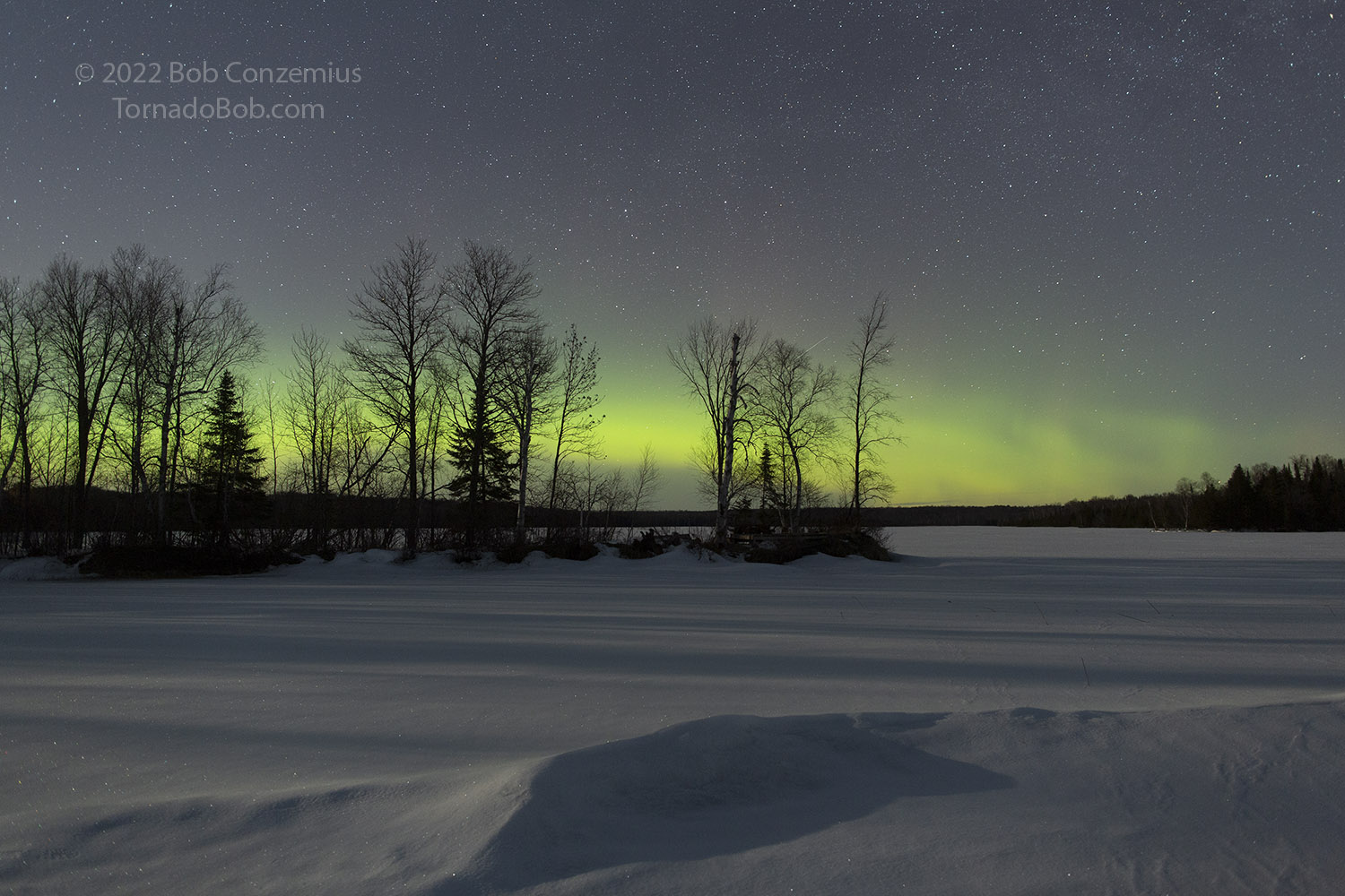
Grand Rapids and Wabana Lake
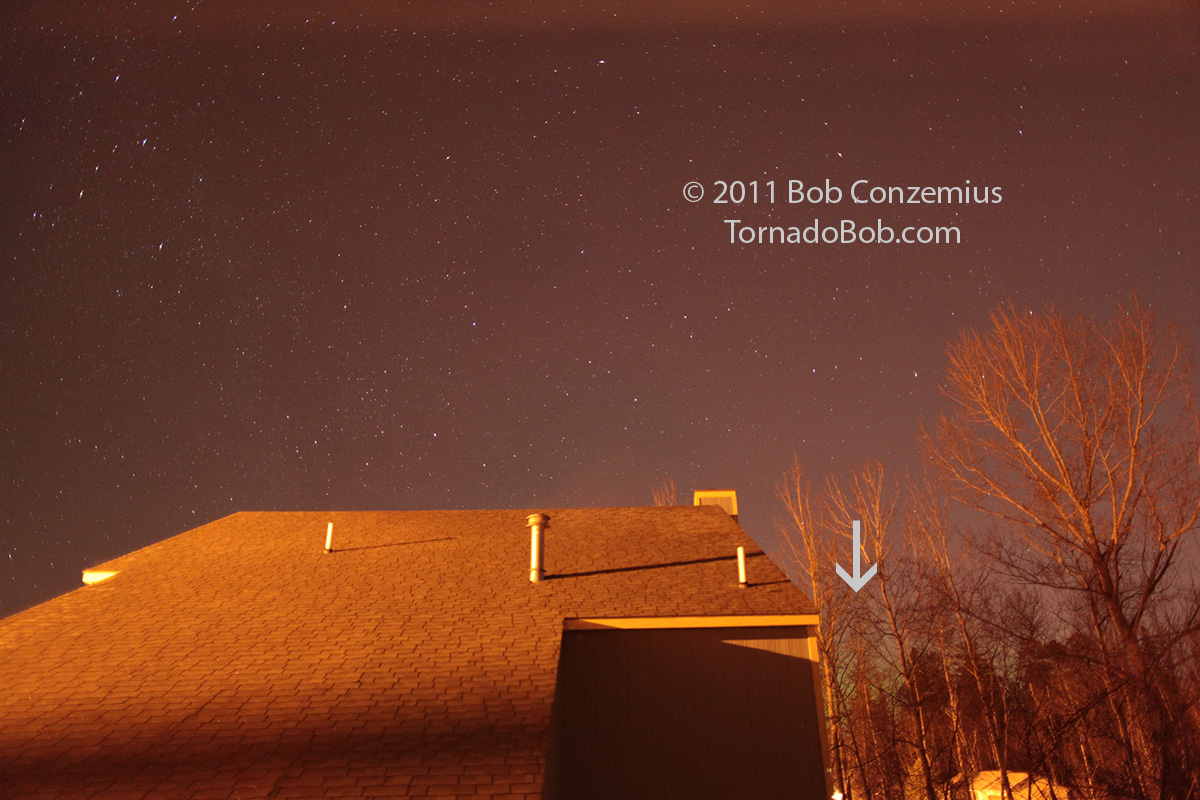
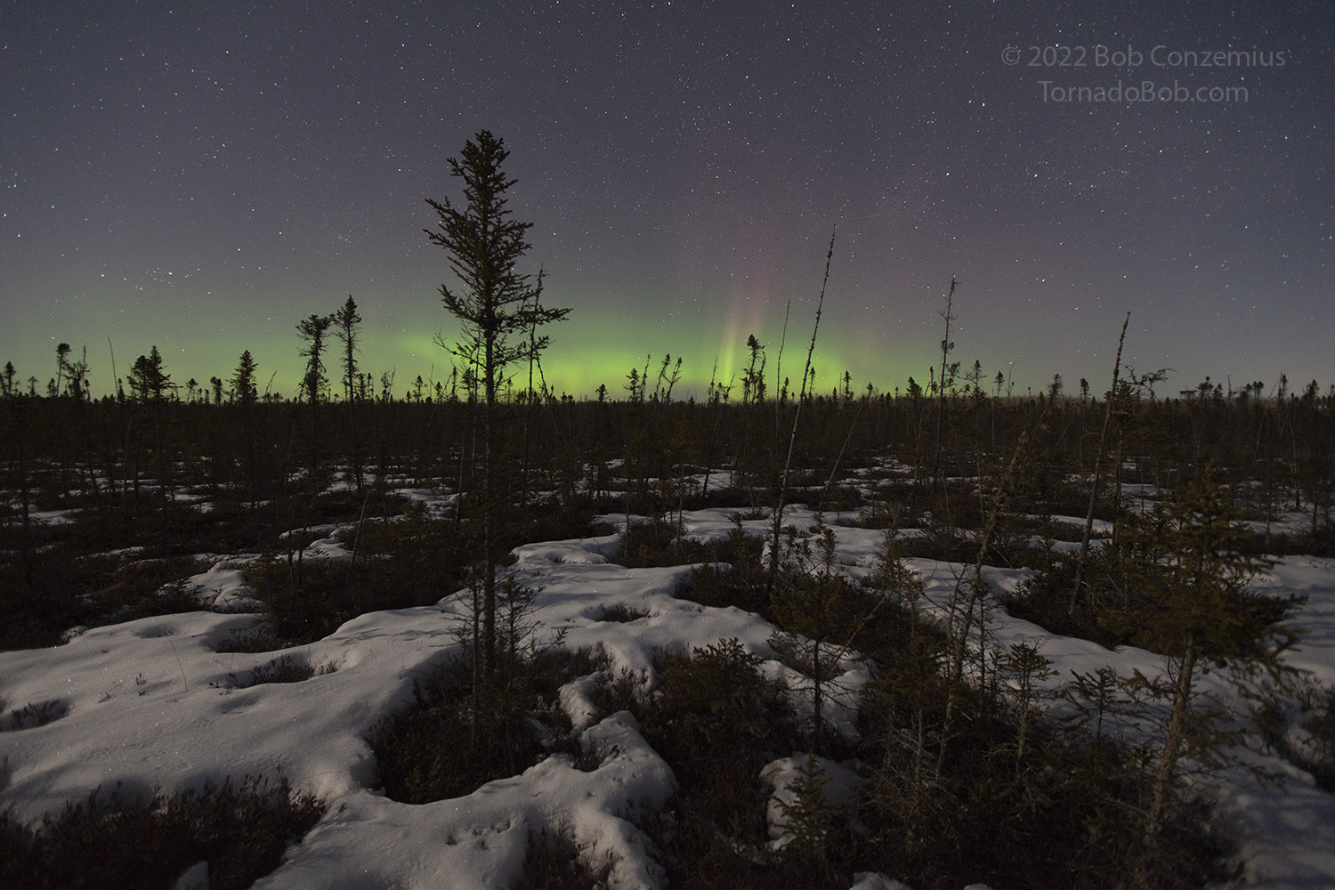
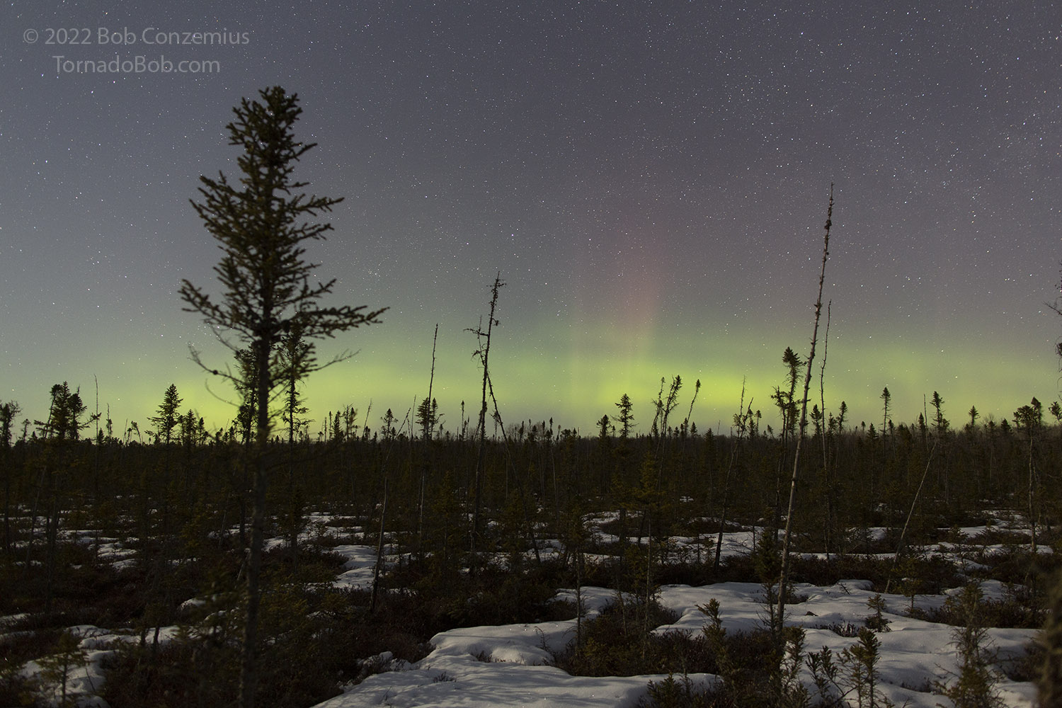
I don't think this aurora show had anything to do with a specific solar event such as a flare or a coronal hole. The magnetic field in the solar wind strengthened slightly (to around 8-10 nT), and the magnetic field vector was pointed almost due south. Nearly twelve hours of the resulting negative Bz brought the auroras out. Interestingly, my interest in this show caused me to miss a much stronger geomagnetic storm the following evening, but I cannot get too upset about that. I had an entire night of cloud-free photography, and while the moon was up, I was able to play around with putting some foregrounds in my shots. I normally tend to focus on the auroras alone, so that's mostly what you see in my shots, but I think the shots look a little more interesting with some context in them, such as something near where was I standing when I took the picture. These give the viewer a sense of being in the location where I was standing. Without a moon, these areas are often a little to dark, and I am never satisfied with my attempts to "paint" these objects with light in order to illuminate them.
Whatever the case with the foreground, I was keeping an eye on the solar wind conditions, like I seem to do almost 24/7, to see what the chances for auroras would be in the evening. There was nothing spectacular going on, but as the evening wore on, Bz was persistently negative. It was not enough to get me out the door right away. GOES Magnetometer data didn't show any significant disruptions to Earth's magnetosphere, and the North Dakota Dual Aurora Cam (at the University of North Dakota in Grand Forks) did not show any auroras. I was convinced the auroras would come out at some point, but things would probably not be spectacular. I decided to go to bed.
I just wasn't sleepy. I checked the North Dakota cam again at 12:30 and saw an auroral arc had developed. I said to myself, "Okay, I'm going out.", and out I went.
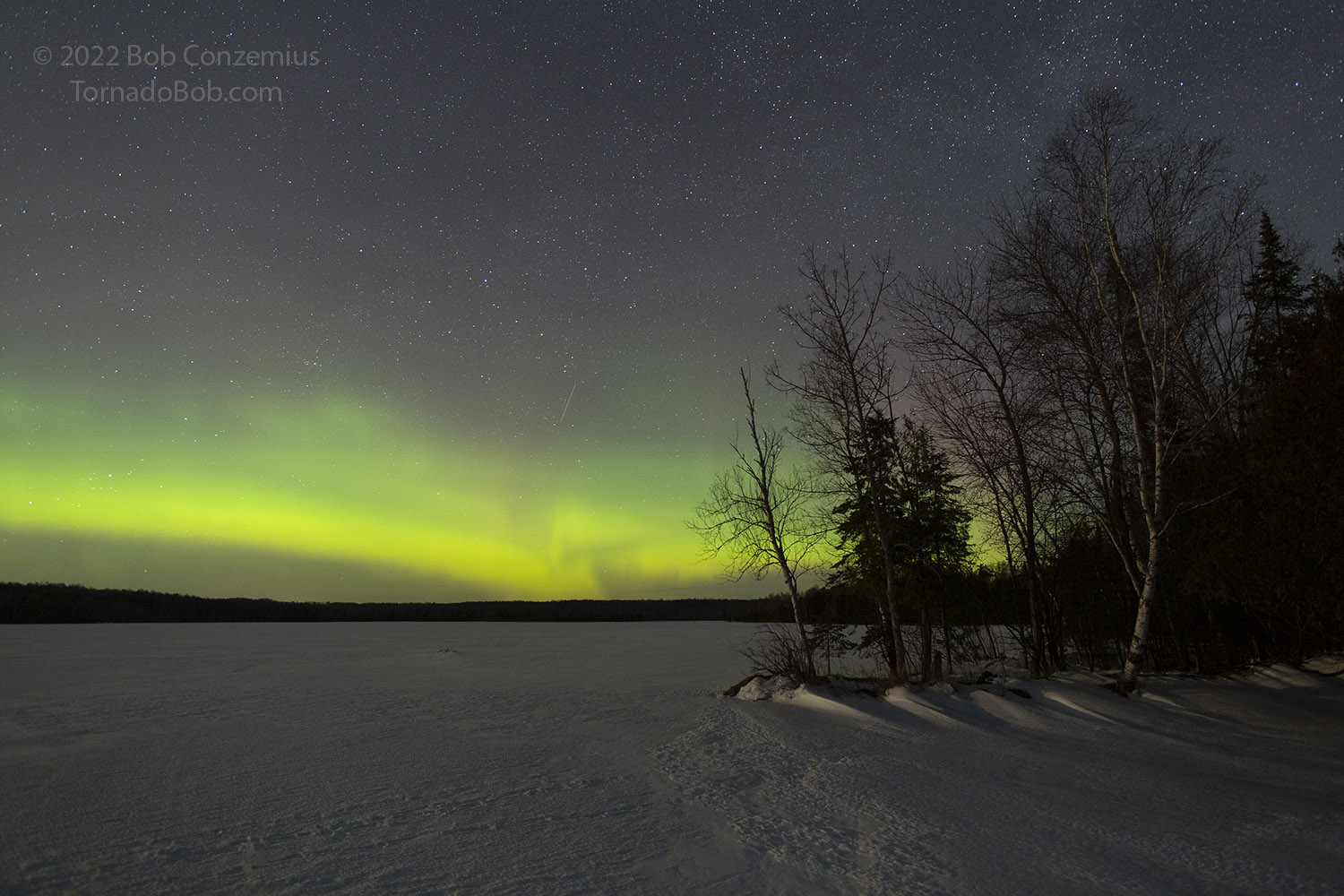
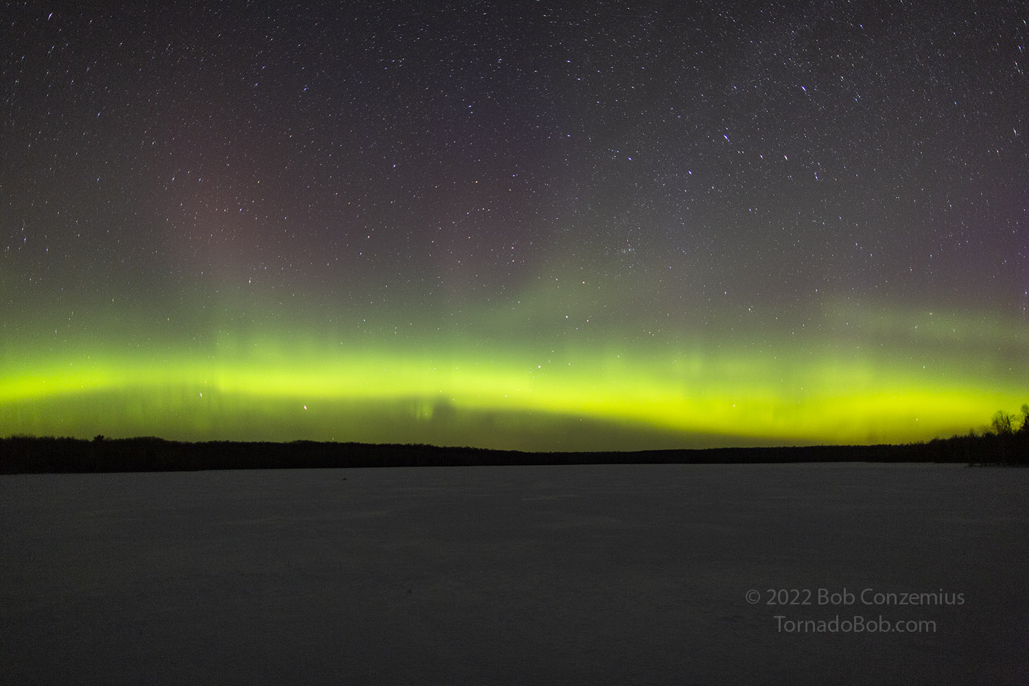
When it's really a good show, I can see it from home before I go anywhere to shoot. I looked north and thought it looked a little brighter, but the moonlight often makes the horizon look brighter. I take a glance at McKinney Lake as I drive past on my way north beyond to somewhere beyond the city limits, and I could easily see the arc there, and it looked like the eastern side of it was much brighter and thicker than the rest. Was this the start of a substorm? I had better stop soon in case it was. I stopped at the city limits and set up there. Once I got my camera gear out of the car, the brightness had settled down a bit so this was not a substorm. The moon was 50 percent illuminated and shining a nice light on things, so I decided to compose a few shots.
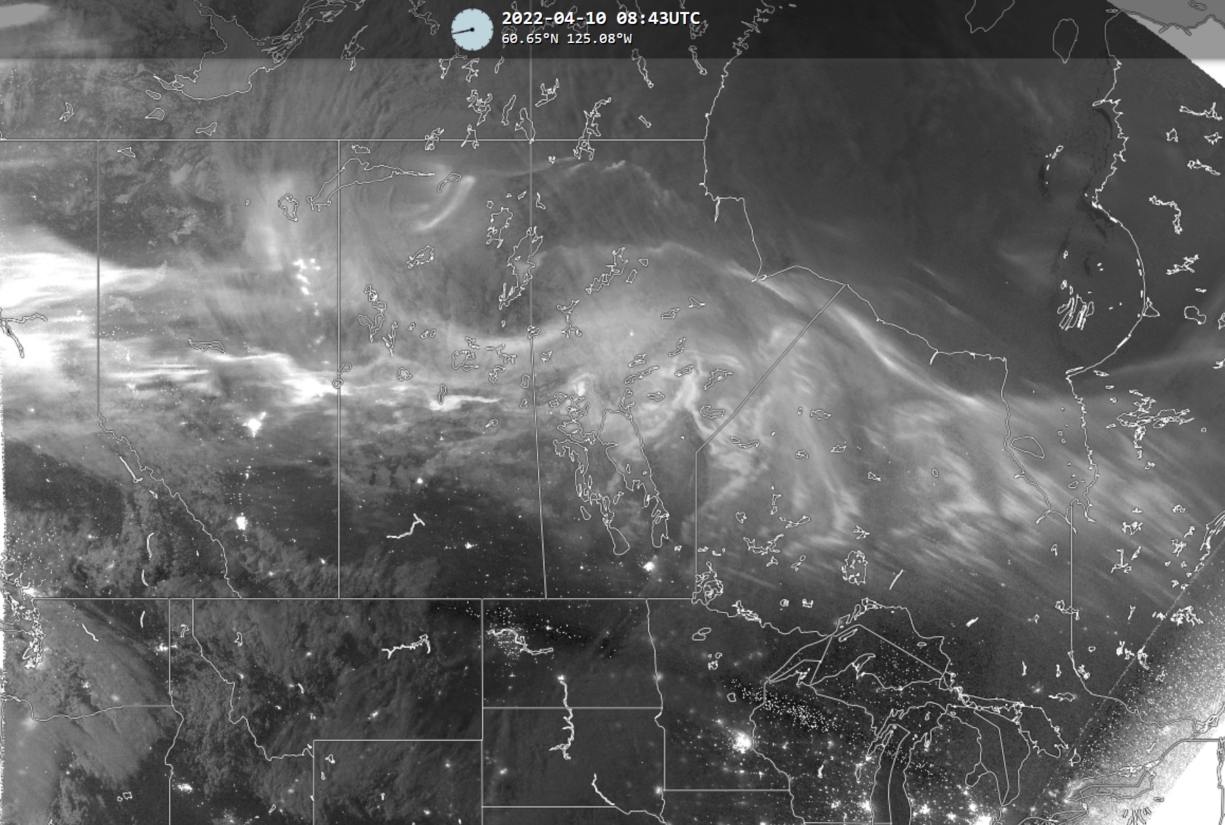
I was out shooting during all of the three passes of the Suomi NPP satellite, which has a VIIRS instrument on board that can see the aurora. Suomi NPP is a low Earth orbit satellite (probably just under 500 km altitude), and as it makes northeast-to-southwest passes over the area, it scans what is below it. The satellite data are processed and then overlain on a map to show where the satellite saw auroras. The first of these is plotted just below. For the first pass, which happened at about 1:38 AM, I didn't have a good enough overlap between satellite image and my picture to map features between the two, but for the others, I did have enough overlap. More on those below.
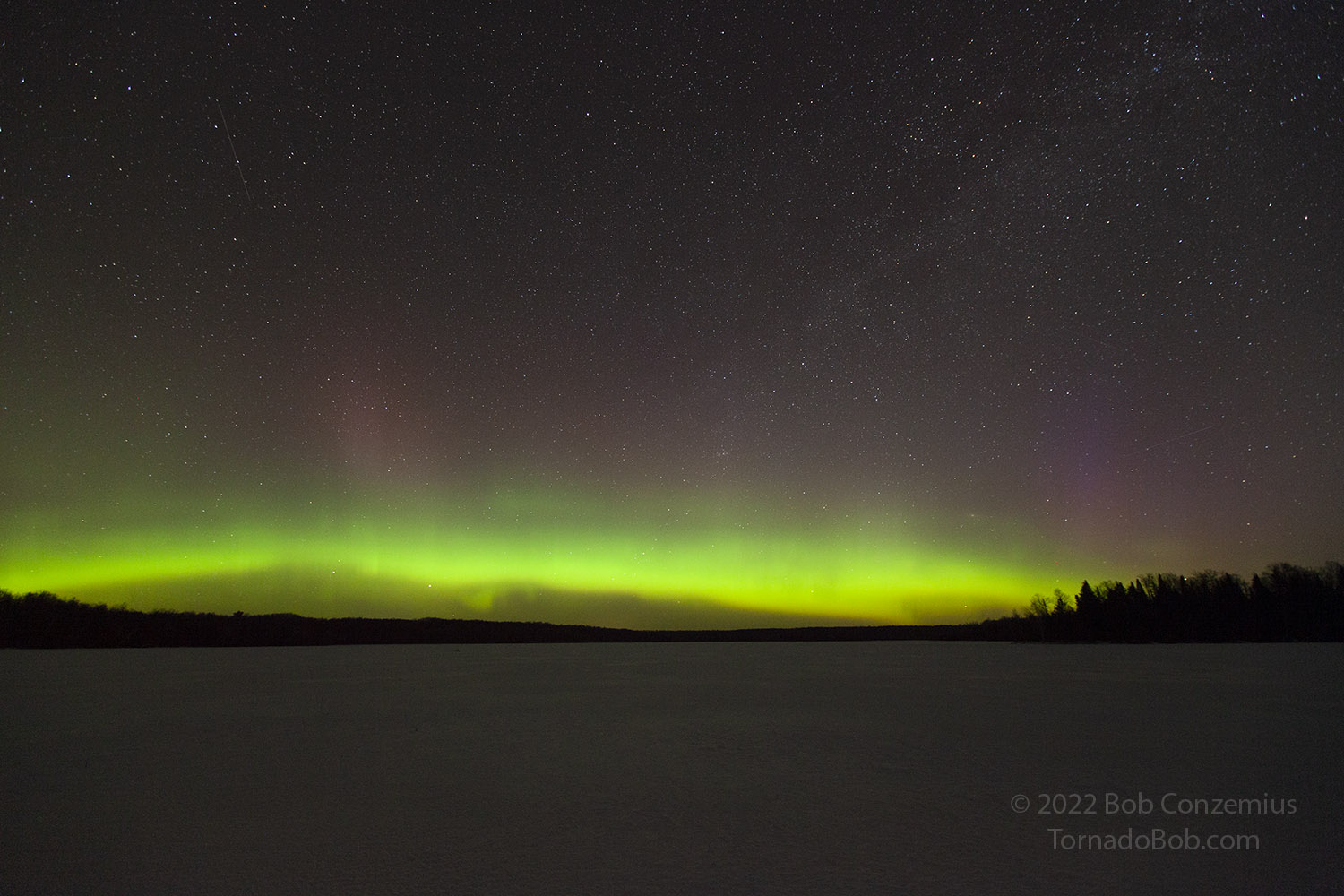
Moonlight illuminates a black spruce bog while auroras illuminate the northern horizon.
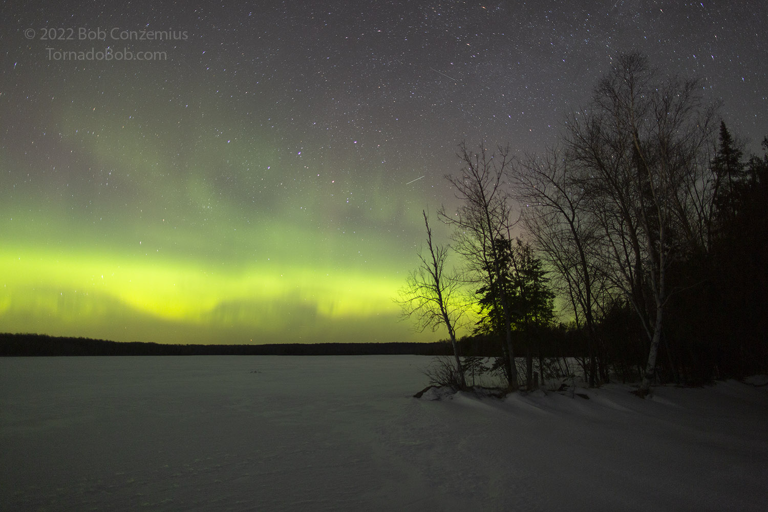
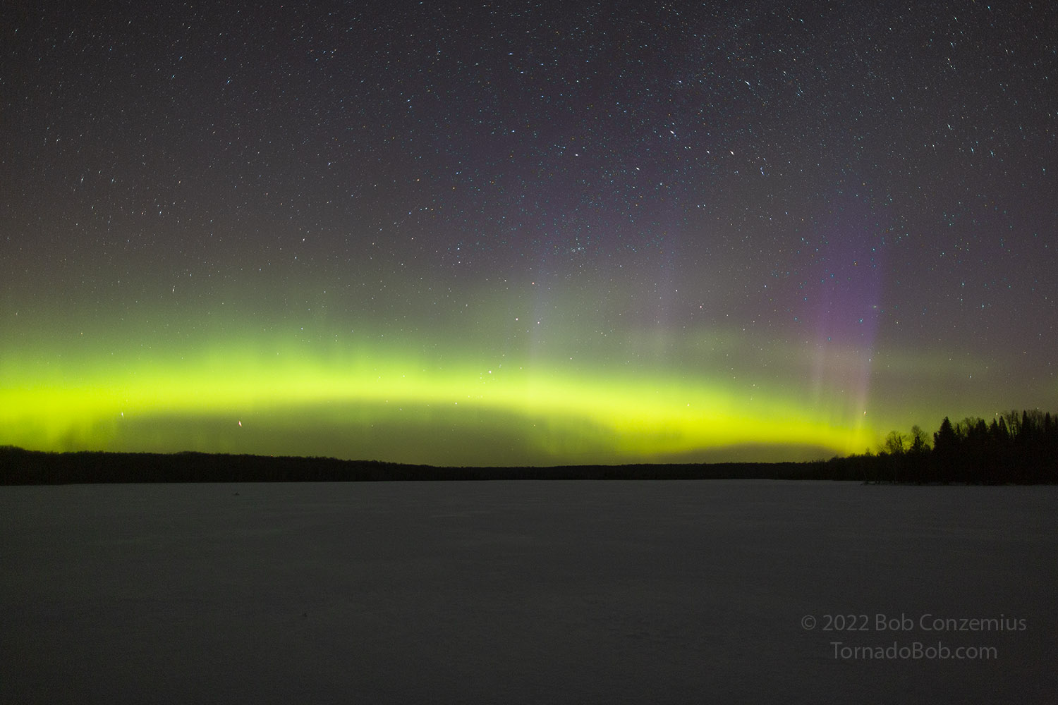
Here is a shot with my 24 mm lens. Suomi NPP Satellite was passing overhead when this shot was taken.
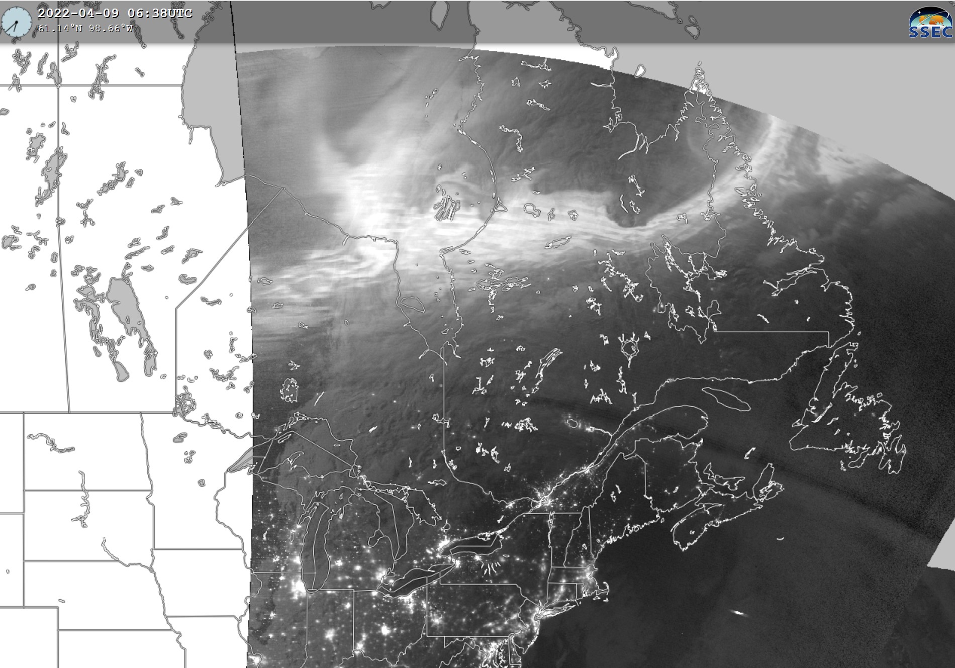
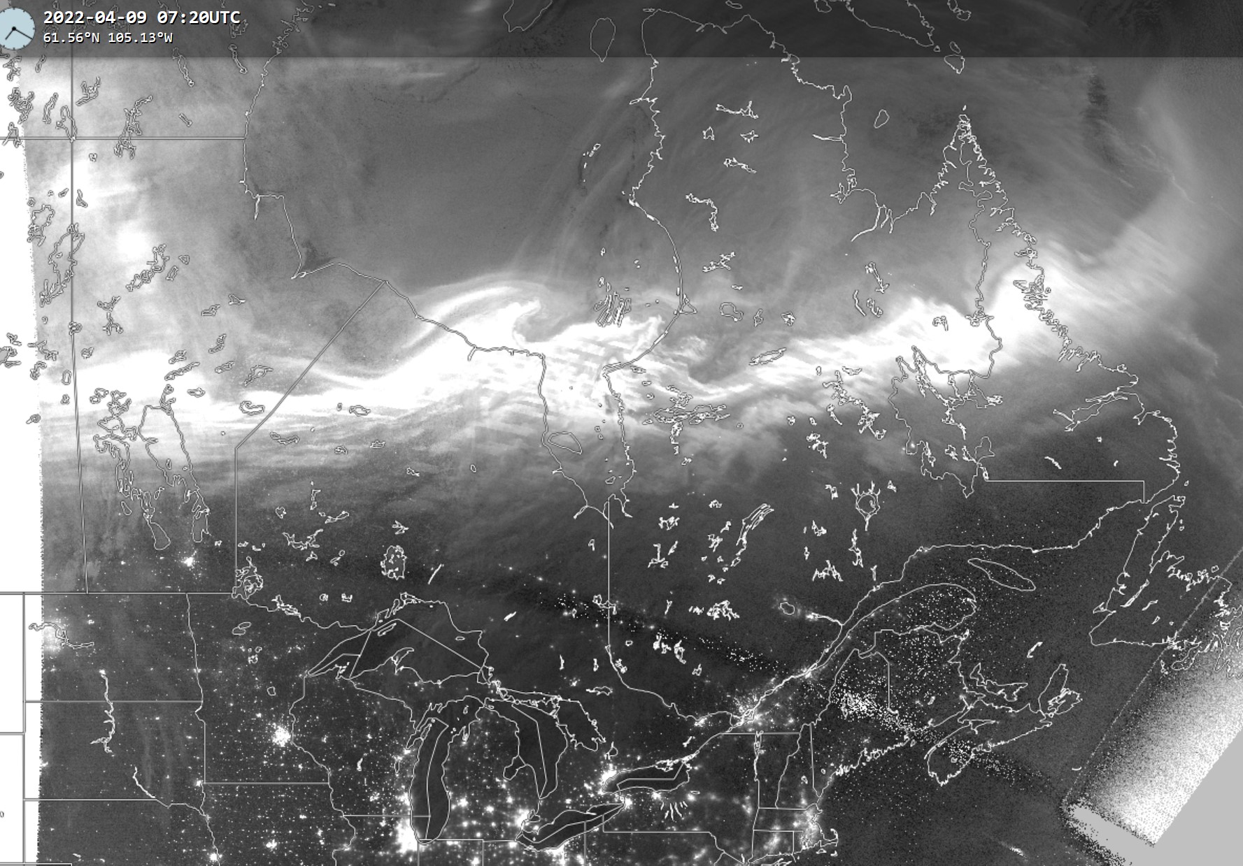
Here is what the Suomi NPP satellite saw when it passed overhead starting around 0638 UTC (1:38 AM Central Daylight Time).
The show was limited to the northern horizon, so I figured I'd head up to Wabana Lake where I have a better view of the northern horizon. I also thought about Lake Winnibigoshish, but it would take an hour to get there. Since my shooting location on Wabana Lake is out a bit from shore, I thought I better get out and shoot there before the ice melts.
Bz stayed south. I got out on the lake and started composing shots with whatever I could see in the foreground. This was mostly snow-covered stuff on the lake. There were also trees along the shore. Along the eastern shore, there was some nice illumination by the moon, which was now getting a lot lower in the western sky, so I made an effort to get to that part of the shore.
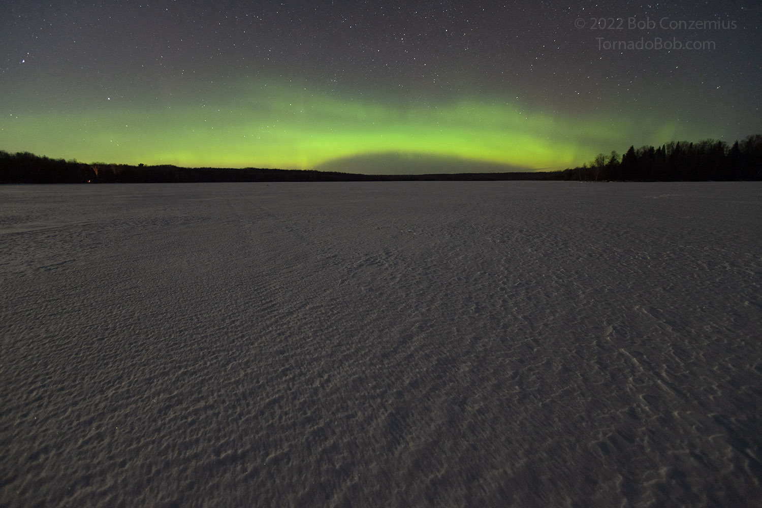
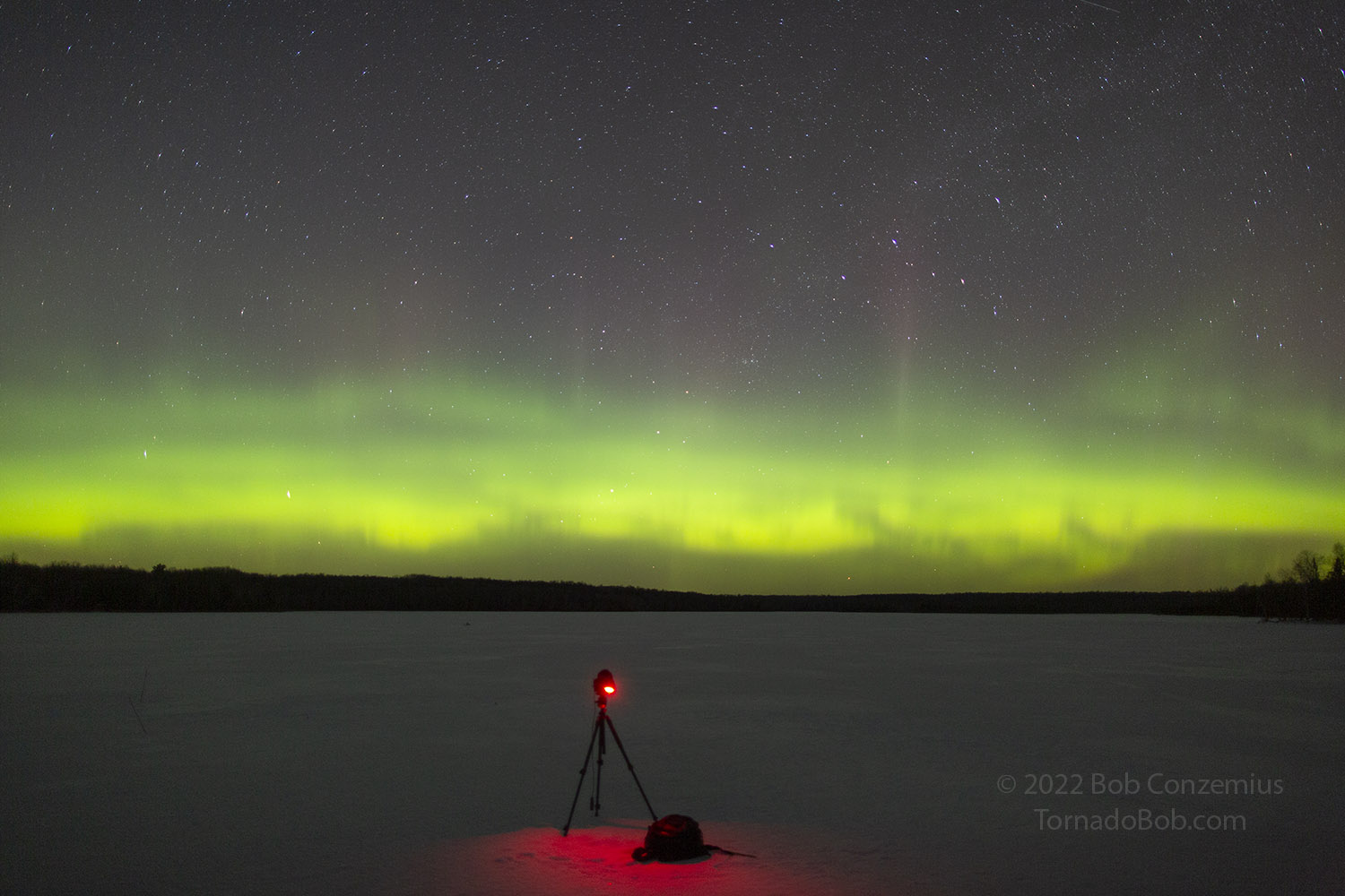
My first image from Wabana Lake at 0726 UTC (2:26 AM).
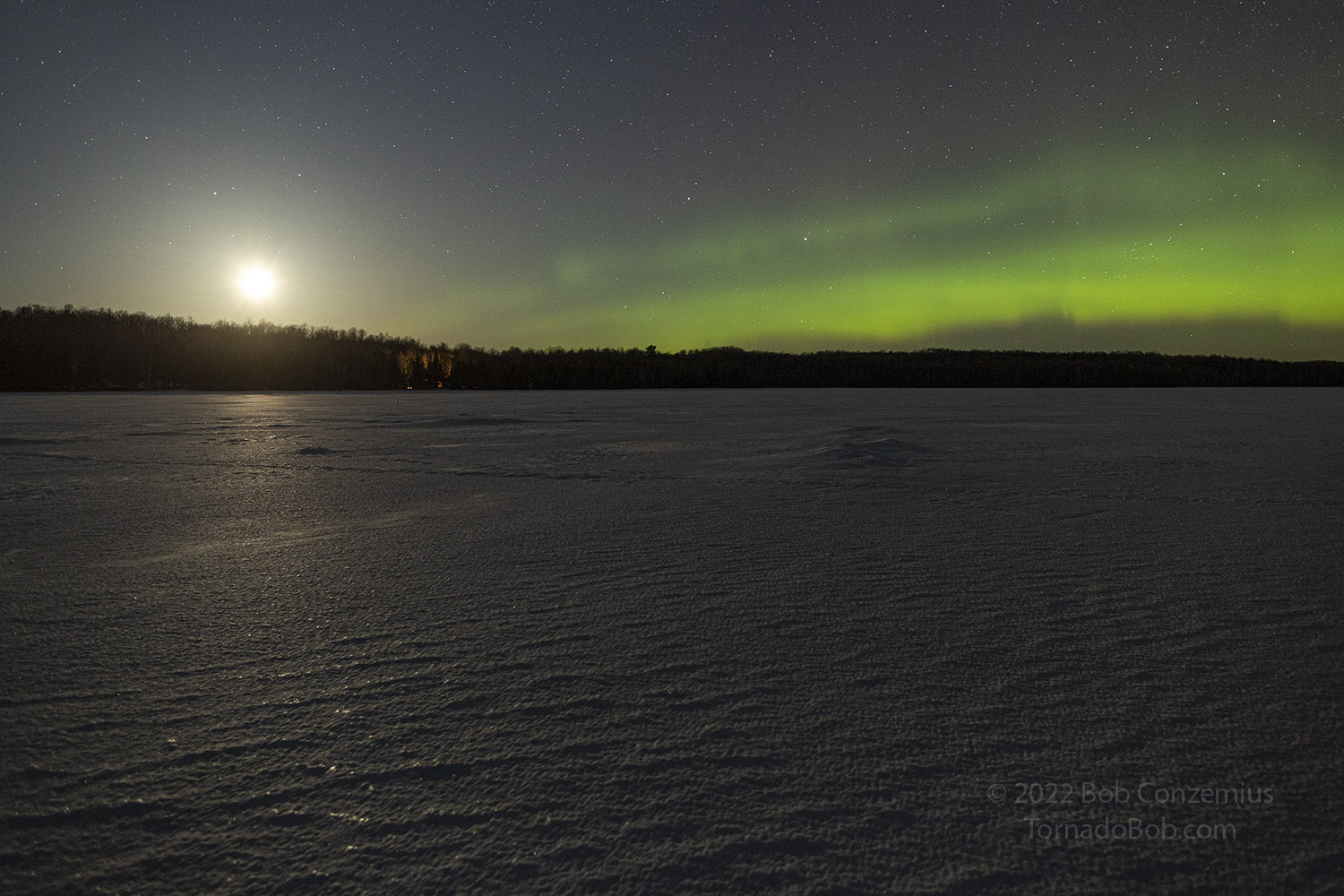
16mm shot from Wabana Lake with the moon still shining.
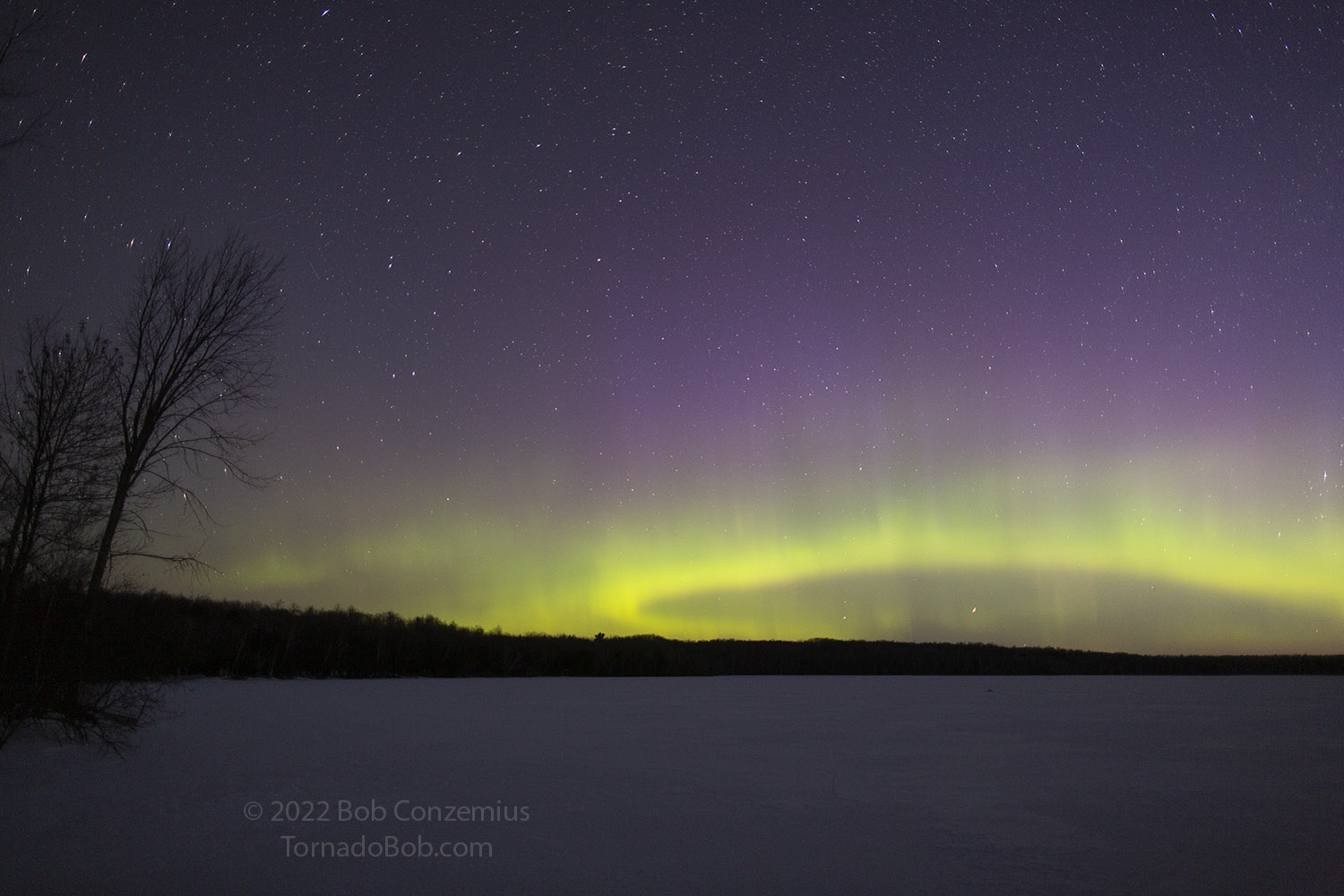
The moon is about to set near the western edge of the auroral arc.
The moon-illuminated eastern shore of the lake makes a nice foreground.
The moon set, and the auroras brightened.
I then went back to my first spot, where the other camera was still taking a time lapse.
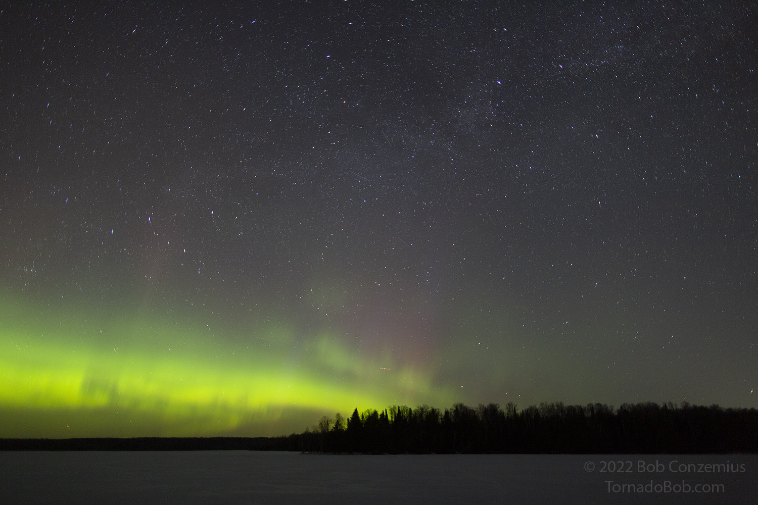
I also pointed northeast to try to get a part of the Milky Way in the shot.
Soft, southward-radiating features develop in the auroras.
In addition to the radiating features, a few colorful columns appeared.
Sunrise approaches, so I pointed my camera northwest.
So here is the part where I made the other satellite comparisons. While I was out at Wabana Lake, the Suomi NPP satellite made two overpasses (I tried to look for it in the sky but did not spot it). When I came back home, I grabbed some images from the Real Earth satellite viewer at the University of Wisconsin. I looked carefully at features on my images and matched them to the satellite as well as I could. Since the satellite takes quite a few minutes to make its overpass, the image timestamp is not perfectly accurate. My guess is that the image is timestamped at the beginning of the scan, because my most closely matching camera images had timestamps about three or four minutes after the satellite timestamp. Those are the images I annotated below. I also annotated the features of the satellite images.
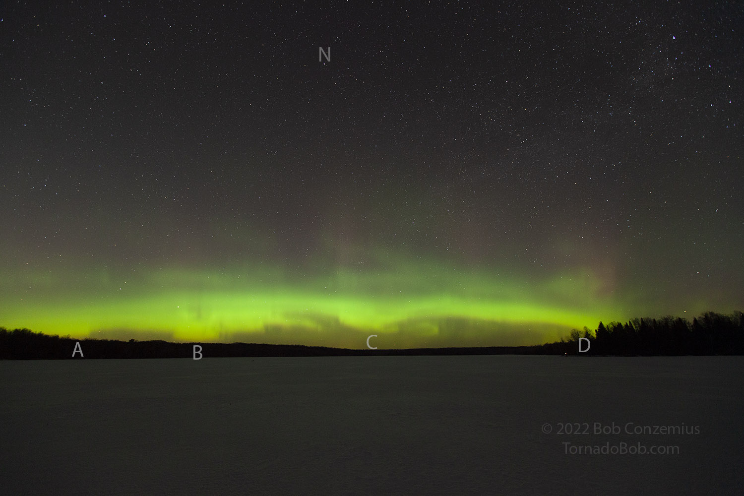
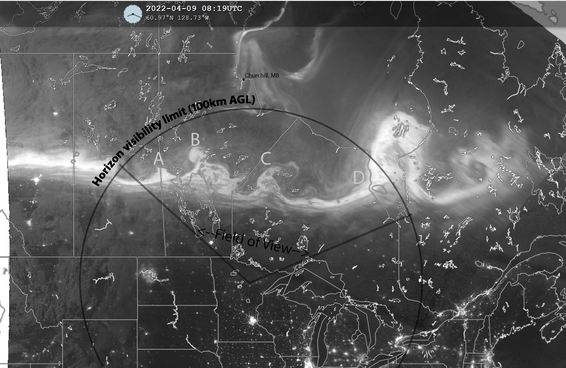
The first overpass was at 3:19 AM CDT. I found four features in my image that I could line up with the satellite. I also calculated the theoretical maximum visibility for auroras using the curvature of Earth, an unobstructed horizon, no light refraction, and neglecting my height of six feet. Since the base of the auroras is typically about 100 km above ground level, my calculations indicate how far away you could see something that is 100 km above ground. It turns out that it's about 1100 km, which allows me to see not quite to Churchill, Manitoba. I can see to Port Nelson, which is the next bay farther south. If the auroras reach to 200 to 300 km AGL as they typically do, people in northern Minnesota would be able to see bright auroras above Churchill (they would be sticking up out of the horizon), but they would not look very bright from here because auroras typically are brightest near their base (maybe up to 150 km AGL, in which case the tops of that stuff around Churchill would be visible). On my images, there are some dim features right at the horizon, and the satellite image shows some dim auroras around Churchill, so that probably is the Churchill stuff you can see on the horizon, but I'd like to get something more definitive than that. Maybe I'll go out on one of our big lakes sometime and watch the Churchill webcam at the same time so I can match up what I see on the horizon with what the Churchill webcam shows (do a YouTube search for it, and you will probably find it).
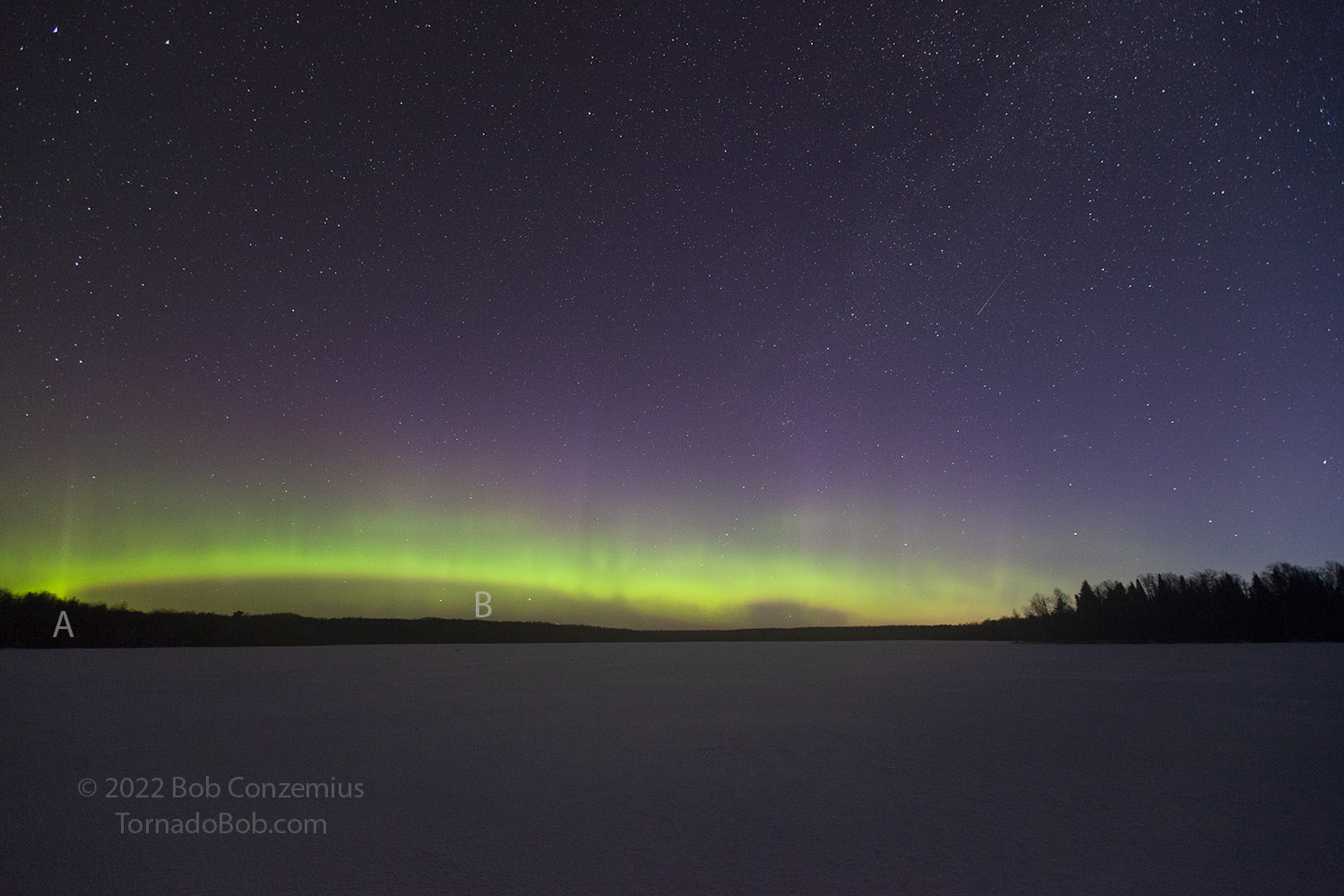
Suomi NPP satellite image at 0819 UTC (3:19 AM CDT. Click on the image to see my corresponding picture.
Best-matching image to the satellite photo above (taken at 3:22 AM CDT, about 3minutes after the satellite timestamp).
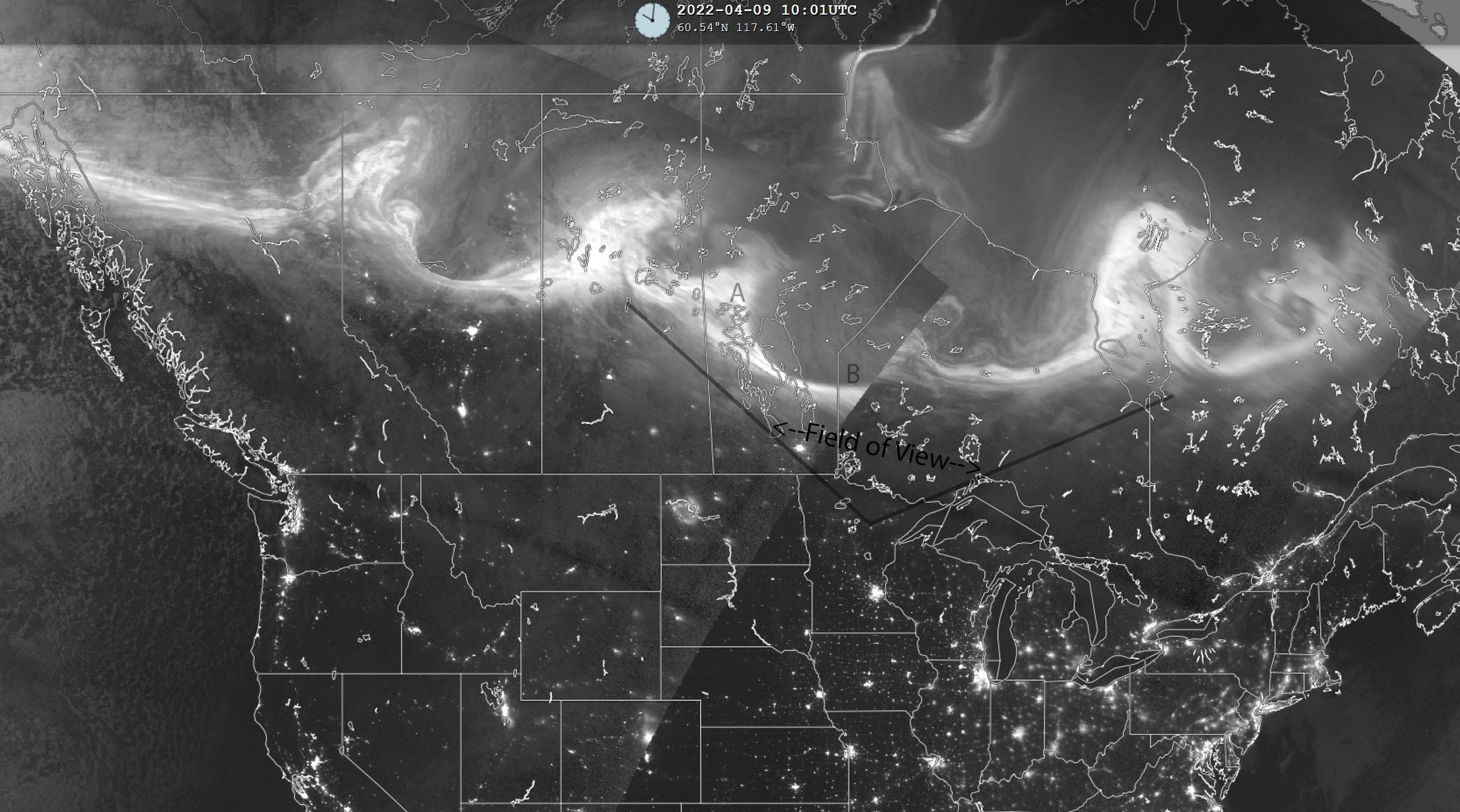
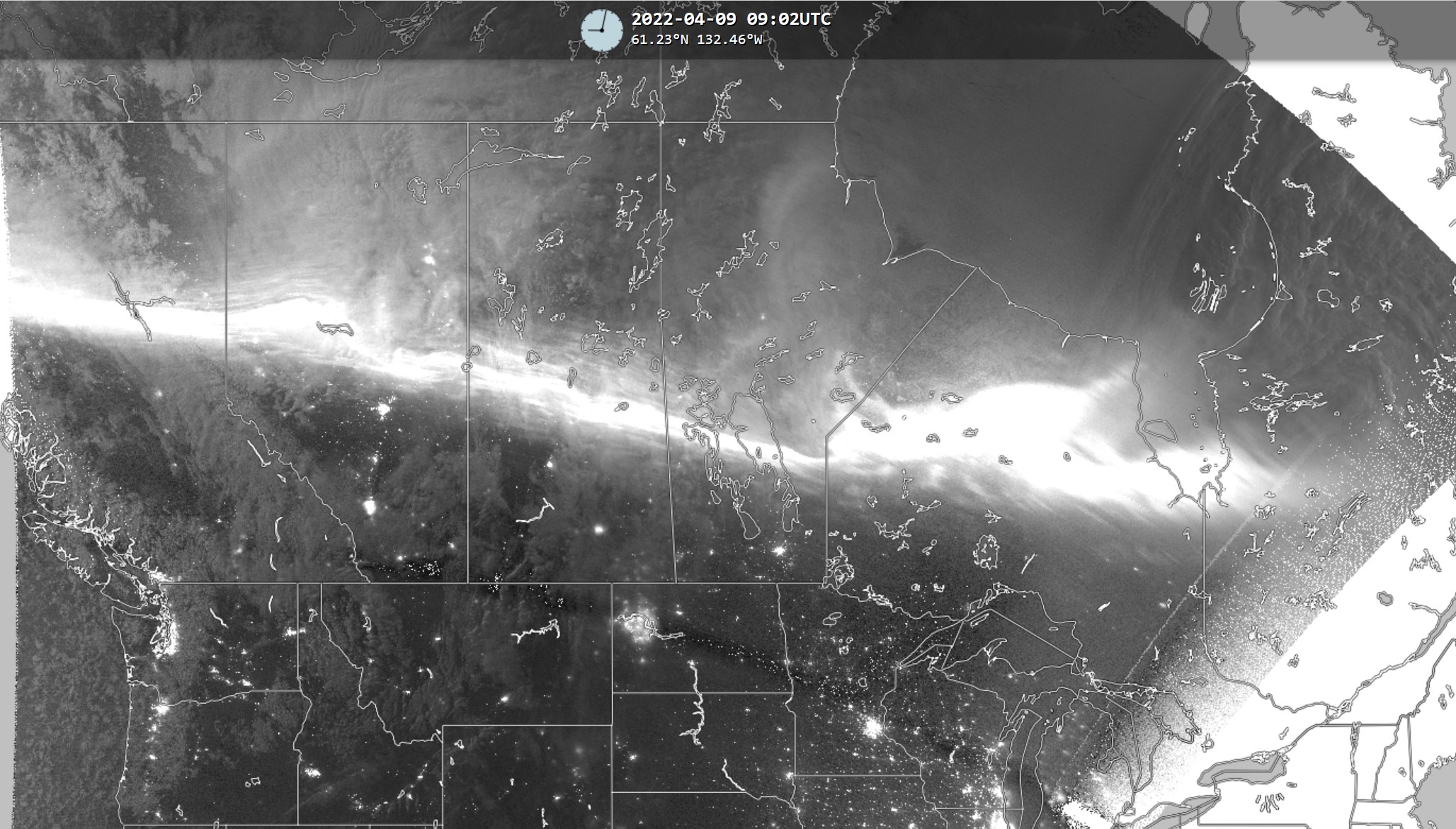
My second overpass comparison is from 5:01 AM. The overpass at that time of day is typically well west of Minnesota, so the eastern side of its scan only covers the auroras in the western half of my image.
Satellite overpass around 1003 UTC (5:03 AM CDT). Right side of the picture is old. Image from U. of Wisc "realearth.ssec.wisc.edu" SSEC.
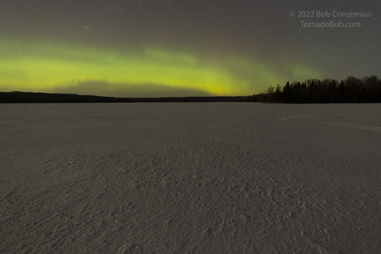
Here is my best corresponding 16 mm shot (5:03 AM) during the satellite overpass.
NOAA-20 satellite also has a VIIRS instrument on it, but my comparisons with that satellite were a bit more difficult. It turns out, there's a 12-minute lag between the timestamp on the image and when the satellite flew over the auroras. At 0732 UTC, the satellite passed over the auroras, just after I had started shooting at Wabana Lake. Based on my analysis above (I did not annotate these images like I did with Suomi-NPP), you can see the feature over and north of Lake Winnipeg is the left thicker area in my shot, and the feature over southern Hudson Bay (the western most part of where the auroras are over the bay) is on the right side, dipping into the northeastern horizon.
NOAA-20 Satellite passed over the auroras at around 0732 UTC (2:32 AM). Image from SSEC
Corresponding image I took at 0732 UTC (2:32 AM) when the satellite was passing over the auroras.
The second overpass looks vaguely similar to my picture, but the auroral band to the right of the feature near the center of my shot is a bit thicker on the satellite image, whereas my picture shows a less extensive thick area.
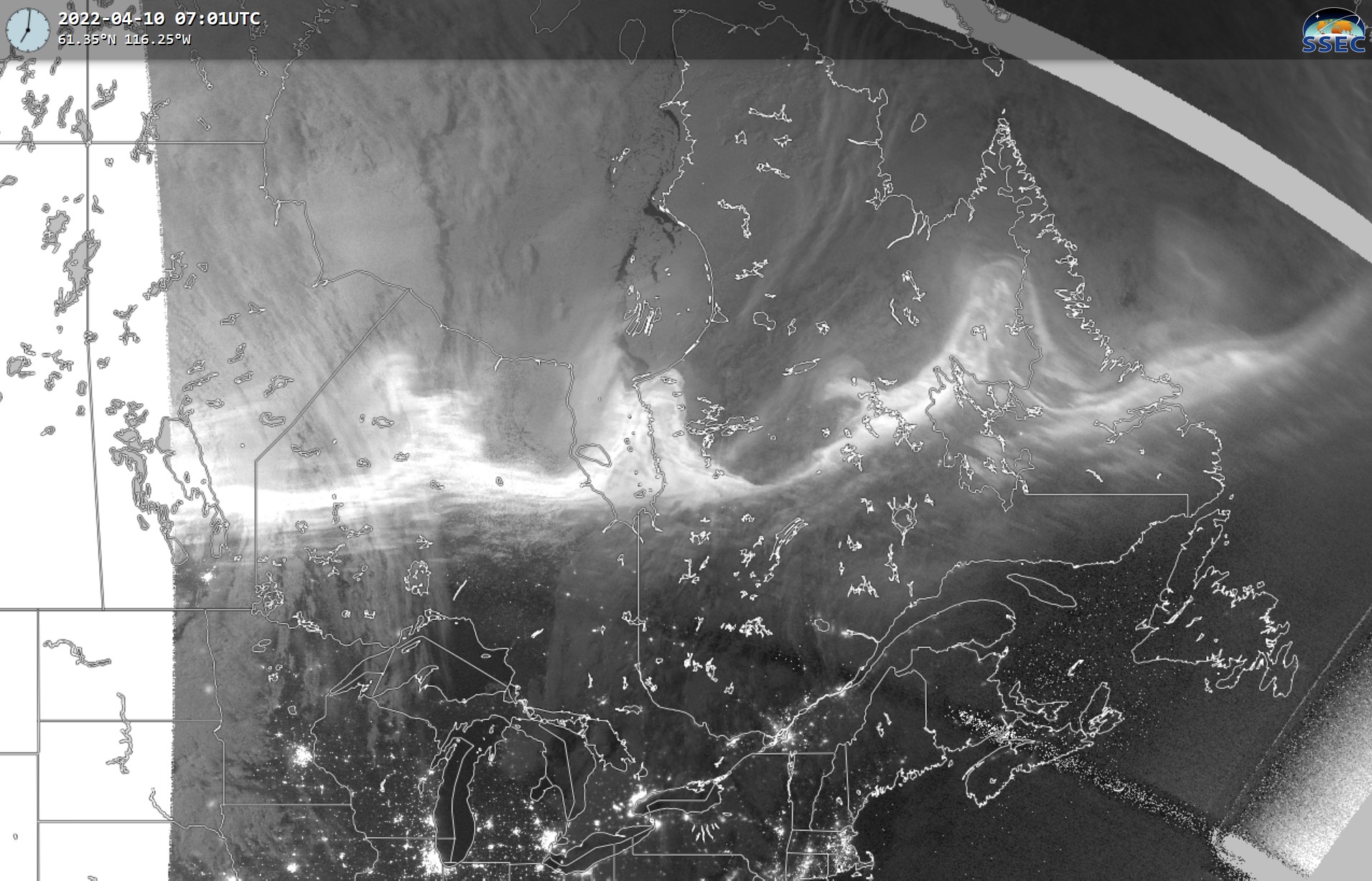
The NOAA-20 satellite passed over the auroras at about 0913-0914 UTC (4:13-4:14 AM) (image courtesy of SSEC)
My corresponding shot at 4:13-4:14 AM.
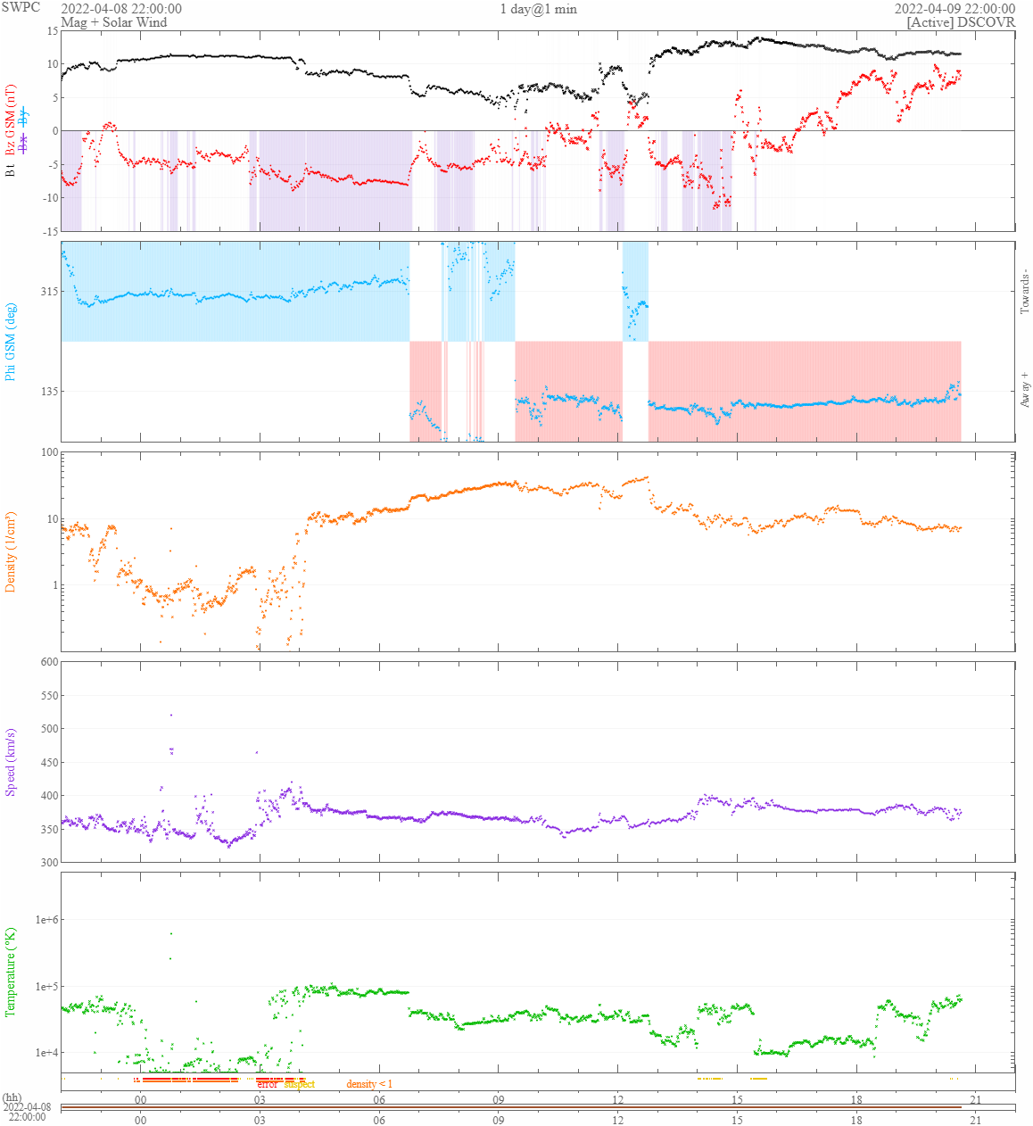
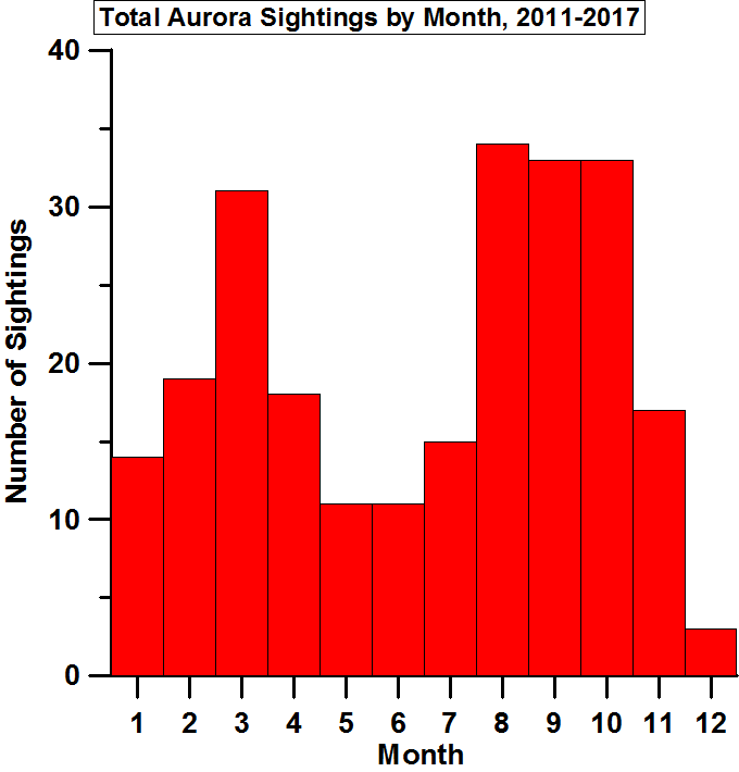
Finally, here are the solar wind measurements taken by the DISCOVR spacecraft, which is located at the L1 Lagrangian point (a relatively neutral gravitational point between the earth and sun). The L1 point is located about 1.5 million kilometers toward the sun from Earth. The red line in the top graph shows Bz, which is what aurora photographers pay most attention to. If it stays persistently below -5 nT, northern Minnesota can see auroras, particularly if the time of year is close to the equinox. There is something about the orientation of Earth close to the equinoxes that makes its magnetic field more vulnerable to the disruptions that cause auroras (I have verified that-- see my aurora sightings by time of year plot.
Solar wind measurements during the time I was shooting (06 to just past 10 on the bottom of the figure).
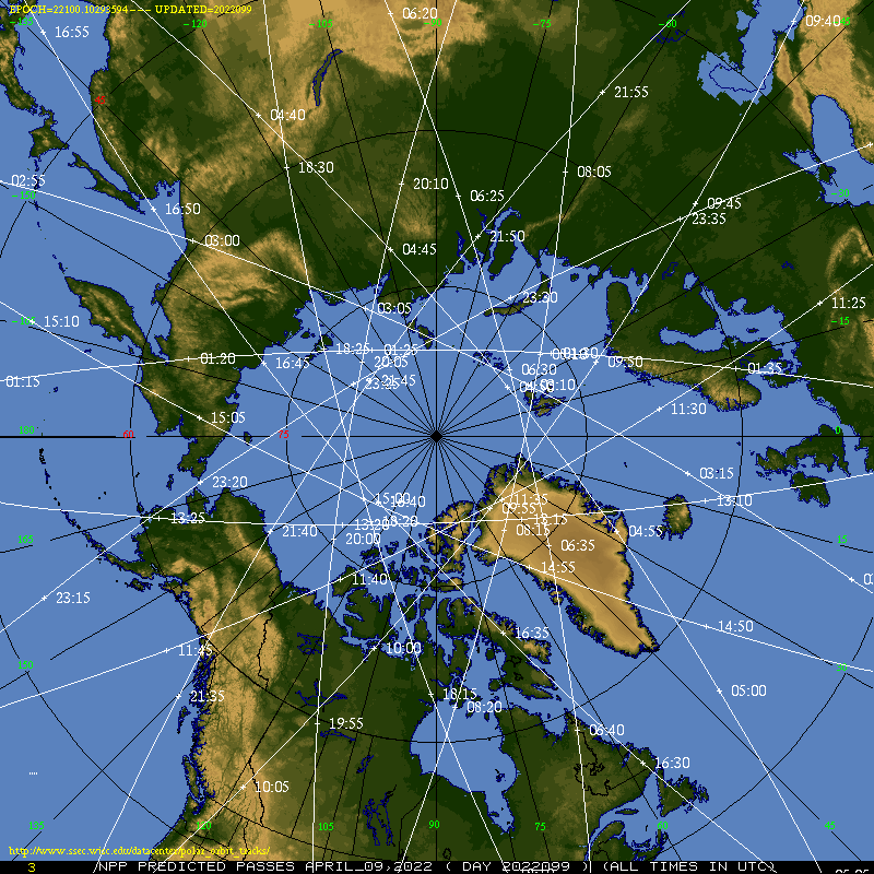
Overpass times for the Suomi-NPP satellite.
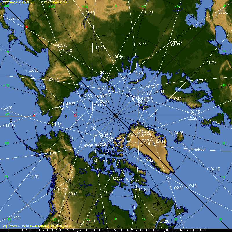
Overpass times for the NOAA-20 satellite.
An additional note: understandably, I went to bed pretty early the following evening. It probably wasn't a bad idea since there were a few more clouds forecast for this second night. My commitment to the previous night's event and resulting early slumber caused me to miss an even better show of auroras. They were partially cloud-obscured but were much higher in the sky. They maybe weren't as long-lived in their farthest south phase. The satellite overpasses show how far south they got (during the overpasses-- they might have gotten a little farther south before the satellites came by). Below are the satellite images from the following night that you can compare to my earlier images.