July 9, 2021 Supercells
Nebraska Panhandle
We had arrived at Murdo too late to have a good meal. In fact, the hotel proprietor did not stay up to give us our keys. He gave us instructions on how to find the keys to our rooms. We checked in and had a decent night's sleep. I awoke hungry and wanted some food, so I walked over to the truck stop about half a mile away and grabbed a breakfast sausage and cheese muffin. It was cloudy. A cold front had moved through, and we would have to go south to find a risk of supercell storms.
We drove west on I-90 to Kadoka and then south through Martin and Merriman, a route I had taken numerous times before. At Merriman, we turned west toward Chadron as it appeared the best chances for storms would be in the Nebraska Panhandle, and it would be better to get west before south. When we got to Chadron, there were some storms developing to our southwest over the mountains in Wyoming, and there really wasn't much going on directly to our west, so we drove south toward Alliance to give ourselves a chance to get to those storms if nothing developed in our somewhat more preferred area in the far northwestern corner of Nebraska. The convection-allowing models showed some more discrete, isolated storms in that area, but it also showed a slightly stronger storms to the south. On radar, the southern storms were stronger than anything farther north, but they just did not look particularly well organized or interesting. Visually, what we could see if them indicated they were rather high-based. We decided to hold in Alliance for as long as we could before going after the southern storms or until a more interesting storm developed farther north.
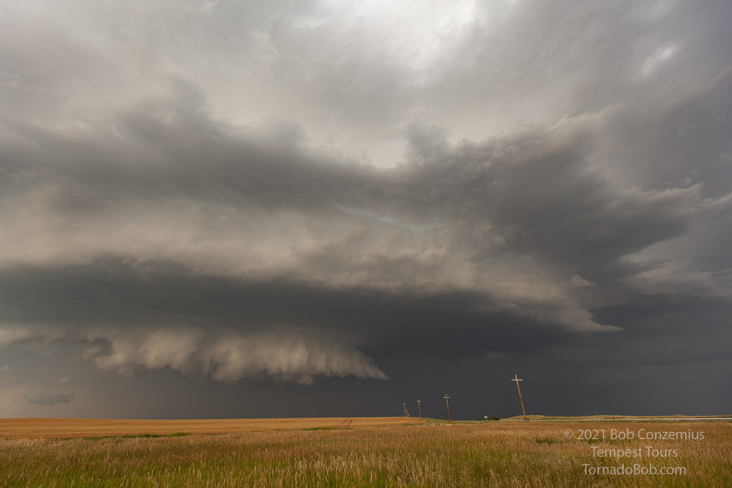
After more than an hour, we got our opportunity. A storm developed right where the CAMs forecast in the northwesternmost county of Nebraska, and it moved slowly southeast toward Crawford. Our chase was on! We took the most direct route of intercept (Nebraska Highway 2 to Nebraska Highway 71) and got to the storm very close to Crawford. It had a nice base, well separated from the rain, and a pretty large anvil. We sat an watched it about 20 or 30 minutes, and during that time, the line of cumulus along the inflow band of the storm grew and developed into cells. The storm was obviously firing on some sort of boundary, and it would be around for a while.
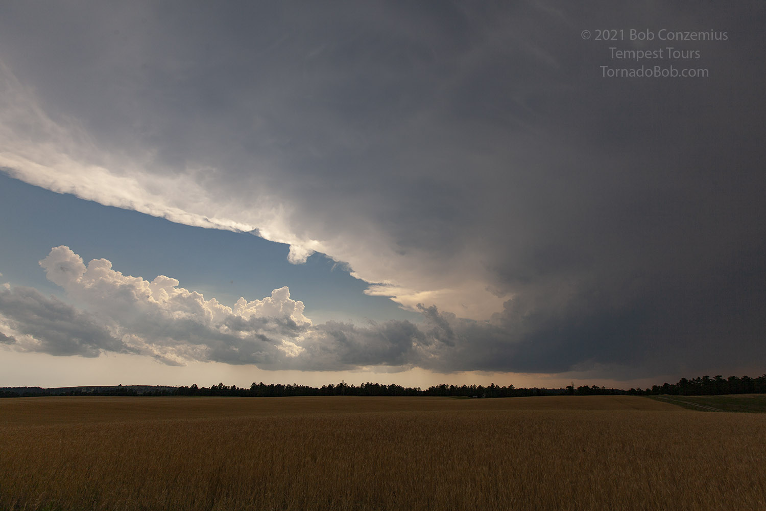 |
| Our first look at our storm. The base initially looked small, but the anvil was growing. |
 |
| As it moved closer, multiple updrafts formed ahead of it. |
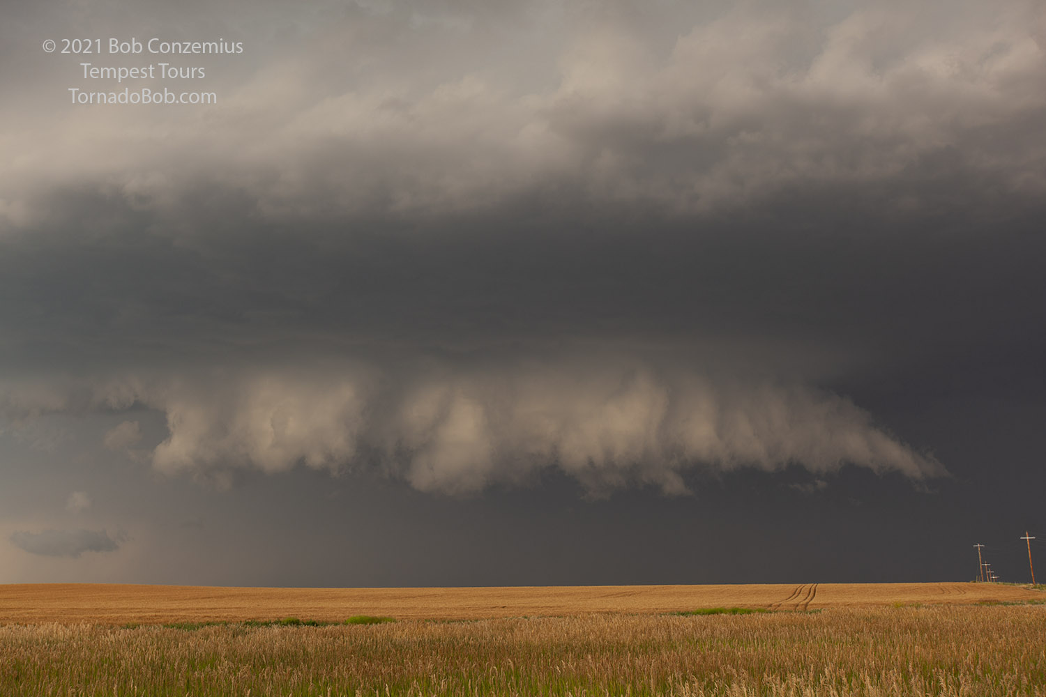
With the new updrafts intensifying and about to become storms, we became concerned about our south route getting cut off, and we decided to drop back south quickly in order to avoid any large hail or heavy rain that would slow our progress. We had time to stop again for a few minutes and take pictures of the somewhat more linear looking storm now just to our north.
 |
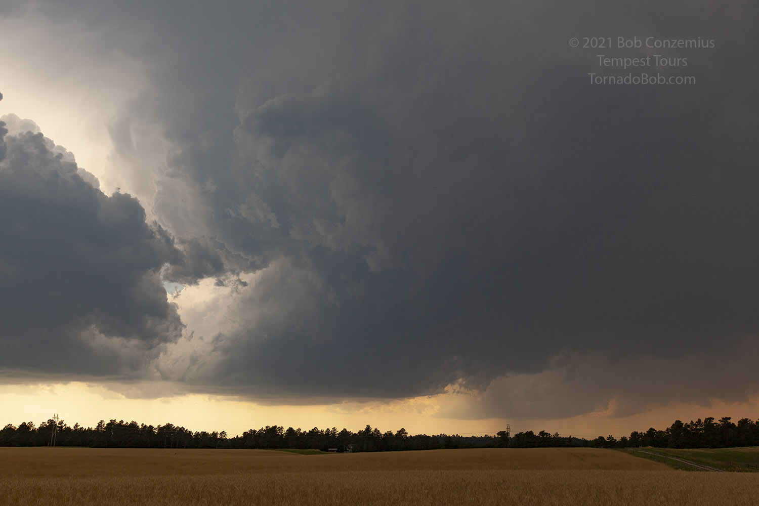
| The updraft base of the storm grew in size, and it also looked more linear. |
This stop was long enough for the storm to encroach upon our east jog of Highway 2 toward Hemingford. As we feared, hail began to explode sporadically upon the pavement in front of us, and I thought we would be in for a beating, but the density of falling hailstones was low enough that we really didn't get hit, and we made it to Hemingford and were able to turn south ahead of the storm again.
 |
| After turning the corner at Hemingford, we saw a more discrete, oval-shaped base to our west. We got far enough south to give ourselves time and stopped again for more photography and video. |
 |
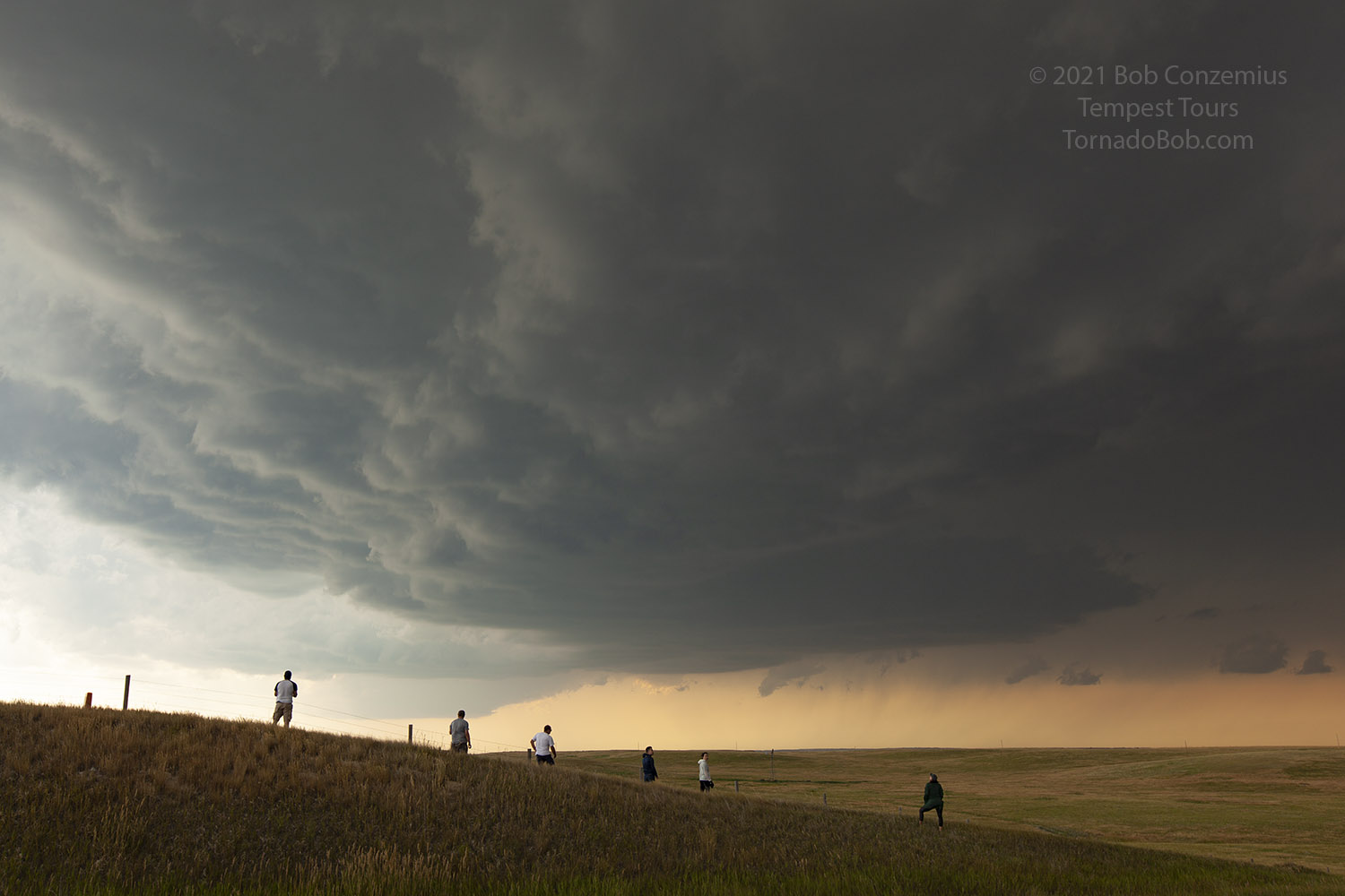
| A multi-tiered updraft of our supercell. |
 |
| The wheat field in front of us was a nice foreground for this dramatic wall cloud. |
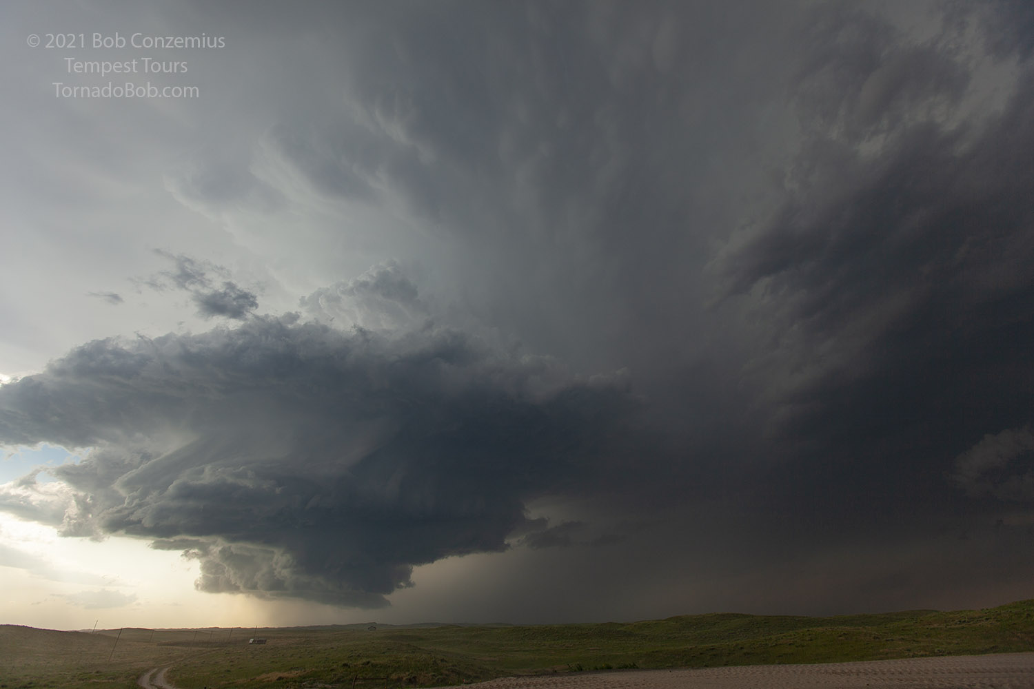
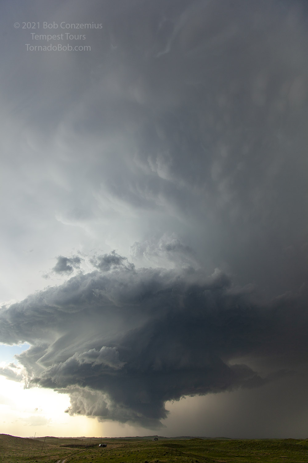
The storm had looked interesting for a bit, but then it appeared to weaken or become more linear. Around the same time, another strong storm popped up to the west. It was a bit far behind the outflow boundary of our first storm for my tastes. I didn't think it had access to very high CAPE air (gee, didn't this just happen yesterday?). Nevertheless, we didn't have a great road to continue with our first storm, so we drifted southwest out of Alliance, on U.S. 385, stopped at a safe spot, and waited for it to come at us. While we were getting into position, the National Weather Service issued a tornado warning for it. The storm was rotating, and it had a nice wall cloud underneath, but there really wasn't much (if any) rotation at low levels. Still, it was an interesting storm to watch, and the inflow into it was strong enough to kick up dust.
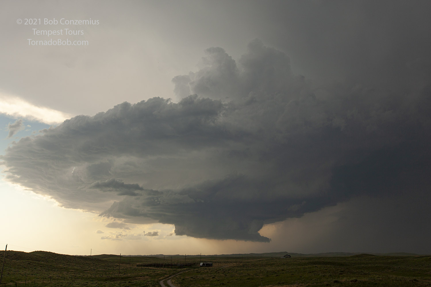 |
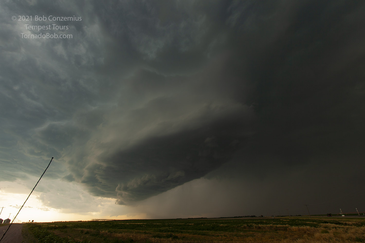
| A tornado-warned storm approaches U.S. 385 from the northwest. |
 |
| The updraft was certainly discrete and relatively compact. |
 |
| We sat here long enough to get some good timelapses. |
The updraft base came right to us, and we found ourselves under some sporadic hail once again. We waited until the updraft was right upon us, and then we got moving. It never had any tight rotation at cloud base, but it was really fun to watc, especially since this was the first storm chase tour for many of the guests on this tour. We had another guest who was on the previous tour, but the pattern was quite inactive for that tour, so he was just as happy as the others. Once the storm passed, there were no other roads nearby, so we had to continue on 385 to Bridgeport in order to have a chance at intercepting our storm again. By the time we got there, other storms had developed, and we had to navigate through those. These were not as photogenic, and we found ourselves in occasional heavy rain. We did a pit stop in Oshkosh and hung around that area to try some lightning photography at sunset, but there wasn't a whole lot to see. We found rooms in Sidney then stopped on the way there for some sunset photography. There was another strong cell on the northwestern horizon that looked potentially promising for a nighttime storm with some lightning photography, but it not amount to much for us. We were tired, and everyone decided to rest for the night.
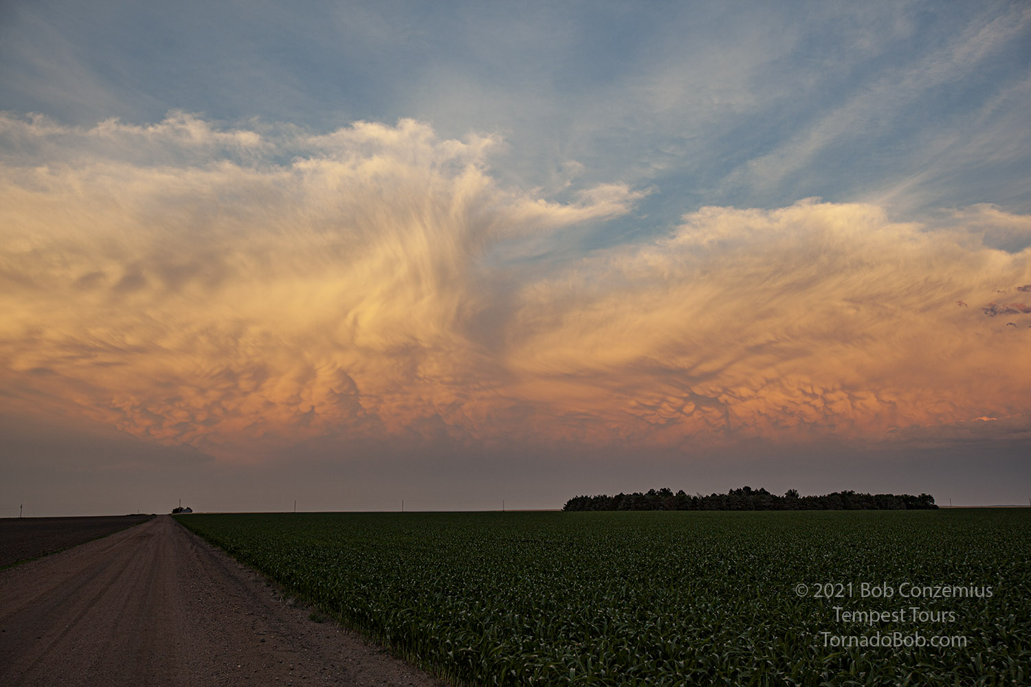 |
| The storms move away at sunset. |
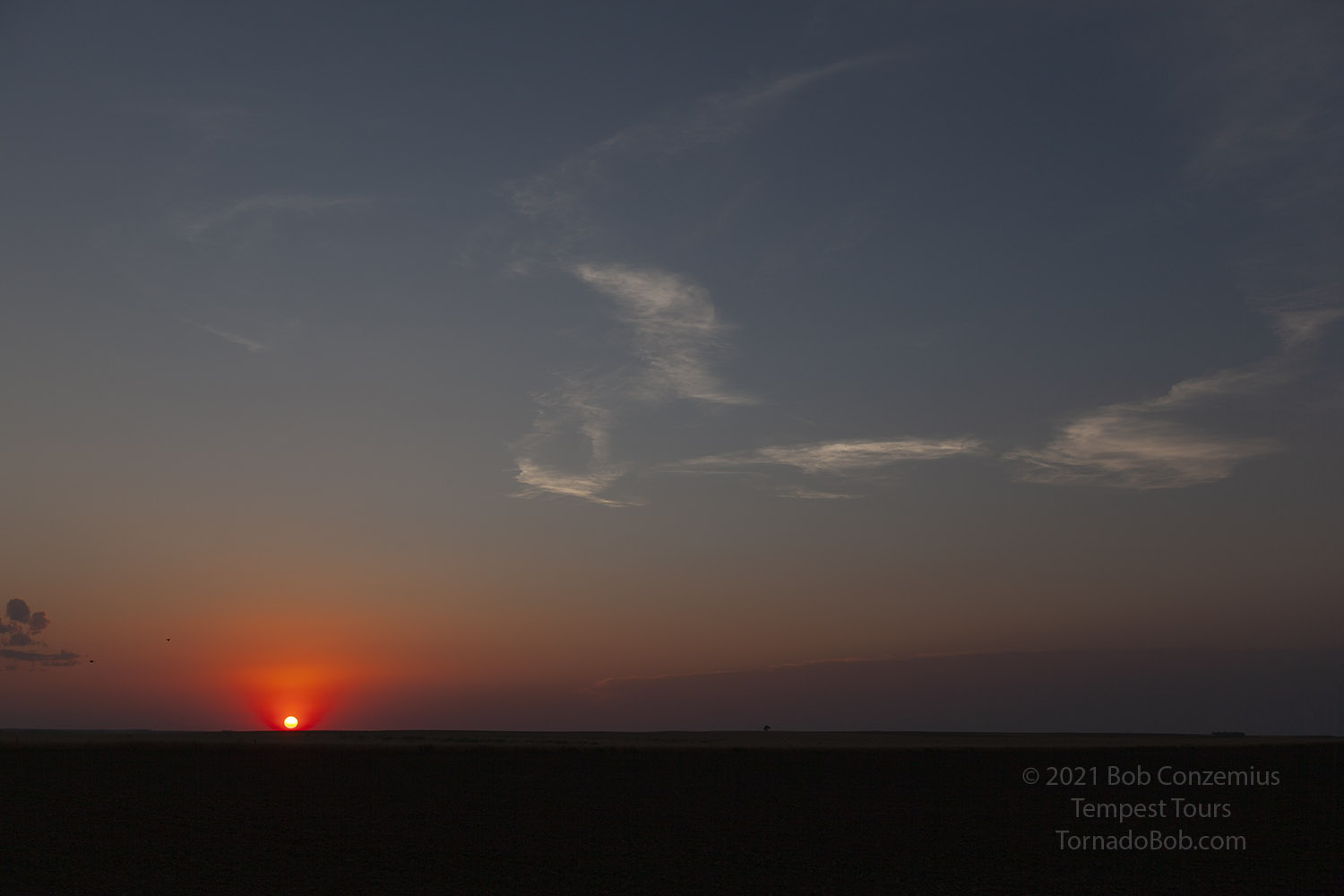 |
| Sunset south of Oshkosh, Nebraska. |
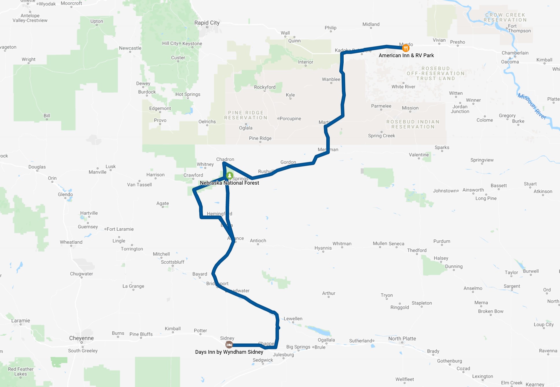 |
| Our route for the day. |
Back to Storm Chases | Home