May 21, 2020 Supercells
Southwestern Kansas
Read, also, Bill Reid's storm chase account.
After a double-header chase the day before, we had a somewhat longer drive to get into position for some supercellular storms in southwestern Kansas. I don't recall where we ate for breakfast-- I guess it was the hotel grab-n-go. Whatever the case, we were soon on Highway 6 and turned south on our favorite Colorado road, U.S. Highway 385. As I was driving safely, well within my own lane, a pheasant flew out of the ditch and right in front of the van. I saw the pheasant bounce off the front grill and off to the left, while some other object flew up off the grill and over the top of the van. It was our Chevy emblem. Scott, who was following behind, thought we had split the pheasant in two, but it was just the whole pheasant plus the emblem. Usually, hitting a bird is taken as a sign of good luck. In this case, it was, because the day would turn out to be a supercell bonanza!
We drove east on I-25 to Goodland then south to Tribune where we stopped for lunch at Karen's Kitchen and Antiques. We must have spent a little too much time staring at our food because a landspout tornado was reported just nine miles to our northeast while we were inside. There was a southwest-northeast line of towering cumulus in our area and maybe some very light rain showers coming from some of them but no active storms. Whatever the case may have been, we made sure to stay underneath this developing line to see any further funnels or tornadoes that developed. None occurred in our immediate area.
We drove south to Syracuse and then west to intercept a strong storm developing south of Holly, Colorado. This storm provided a show of gustnadoes along its southwestern flank and then developed a nice, low, persistent wall cloud, which we were able to time lapse for quite a few minutes because the storm was not moving very fast. This wall cloud became less organized, and soon, the core of the storm was very close with radar showing potential for some pretty large hail. We needed to get back to Holly ASAP so we could head east!
 |
|---|
| Bill takes a picture of the new wall cloud south of Holly, CO. |
 |
|---|
| The wall cloud looks a lot more interesting here. |
A tornado report appeared on our screen as we were encountering the outer edge of the core. The report might have been a delayed report of our gustnadoes, or it could have been something new, but whatever the case, we did not see any tornadoes. We also did not see tennis ball hail that fell in the area just after we had driven through.
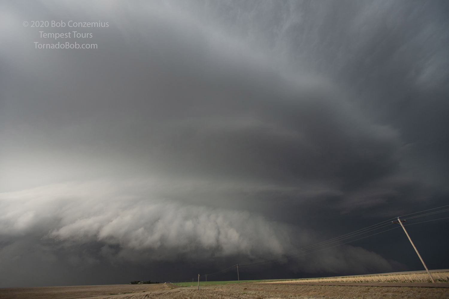
The storm, at this point, began to look a lot more outflow-dominant. There was no longer a pronounced wall cloud, but there were some occasionally interesting areas of shear along the inflow-outflow interface. We played with the leading edge of the storm as we went east.
 |
|---|
| The shelf cloud of our now mostly outflow-dominant storm. |
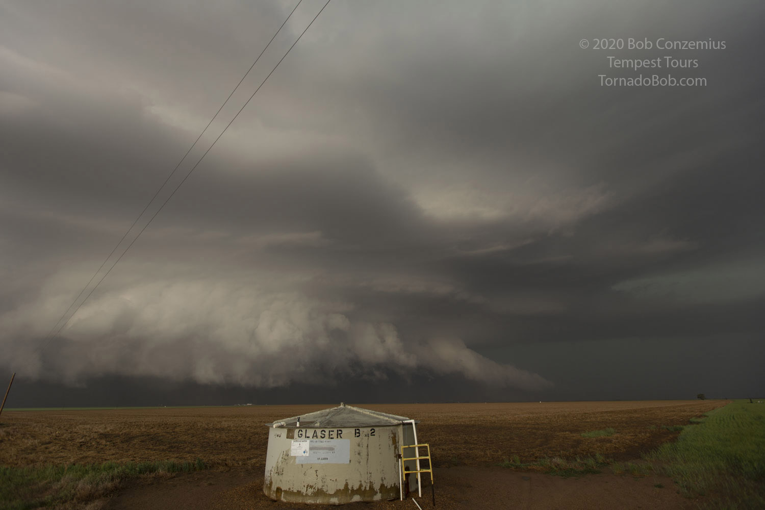
Bill saw a more discrete cell on radar farther southwest, so we dropped south at Lakin to intercept it. As we cleared the intervening cells around us, an exceptionally well sculpted HP supercell came into view. My jaw dropped open, but I could not grab my camera and take pictures because I was driving. We did find a place to pull over and spent a few minutes taking pictures. Silly me and my fear of lightning. I could have gotten some better pictures had I ventured outside the van, but a few close CGs kept me inside for the first stop with this storm.
 |
|---|
| A sculpted beast of an HP supercell! |
 |
|---|
| Looking northeast at the leading edge of the wall cloud. |
 |
|---|
| After driving a little farther east, I felt safer and ventured a little farther from the van to take this shot. |
As is often the case with HP storms, the wet RFD surged out ahead and threatened to engulf us. In fact, the outflow boundary from this wet RFD passed us, and the wind switched to the west, and the temperature dropped, so I thought any tornado potential was now over with. Instead, the wind suddenly switched back to a southeasterly direction and increased in speed. At the same time, a cloud of dust rose from the field along with a faint roaring sound. It appeared as if a tornado could be developing. The rain cleared enough to reveal a wall cloud and a wrapping RFD. A second surge of wind followed, and more dust rose from the field, but we could not see any definite tornado. A tornado warning had been in effect for a few minutes by this point.
The whole storm then seemed to gust out, so it was time again to find a new storm. Bill found one on radar, again to our southwest. We did have one problem, however, in that there was a severe storm with hail in-between us and the target storm. Luckily, the road took us southeast and just ahead of this core. We then had to clear the rain area of our target cell to get a view of the updraft base, but I was driving and looking south, not monitoring the view to the west.
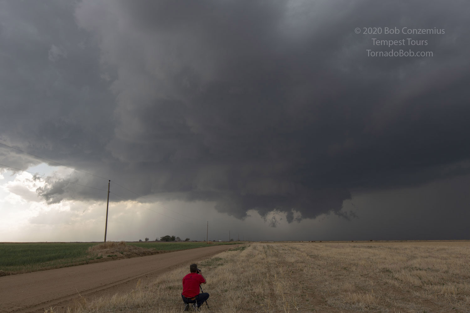
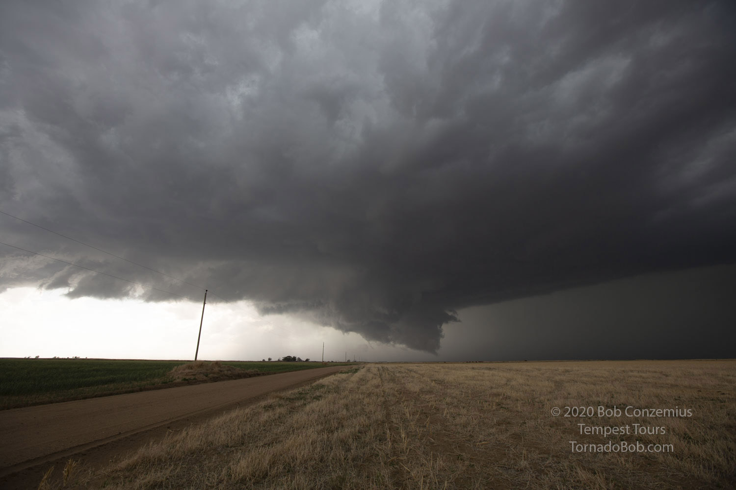
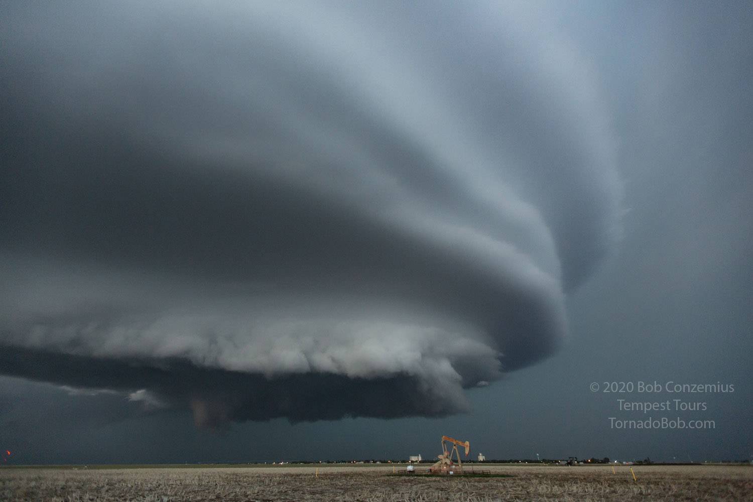
Then, Bill directed me to turn west on a local road south of Satanta. In front of us appeared one of the most photogenic, LP/Classic type supercells I had ever seen! As soon as we stopped, I grabbed all cameras I could and started shooting and filming. A few CGs threatened, but I didn't care a whole lot. The storm was spectacular! Since it was moving slowly yet spinning rapidly, we had ample time to enjoy it and jump around in excitement.
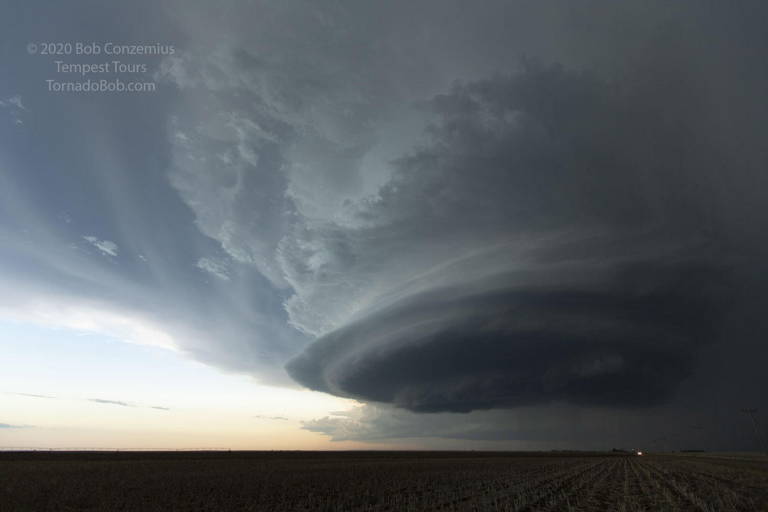 |
|---|
| A dramatic, wedding cake classic/LP supercell south of Satanta, KS. |
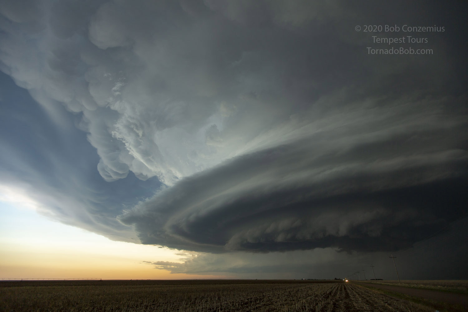 |
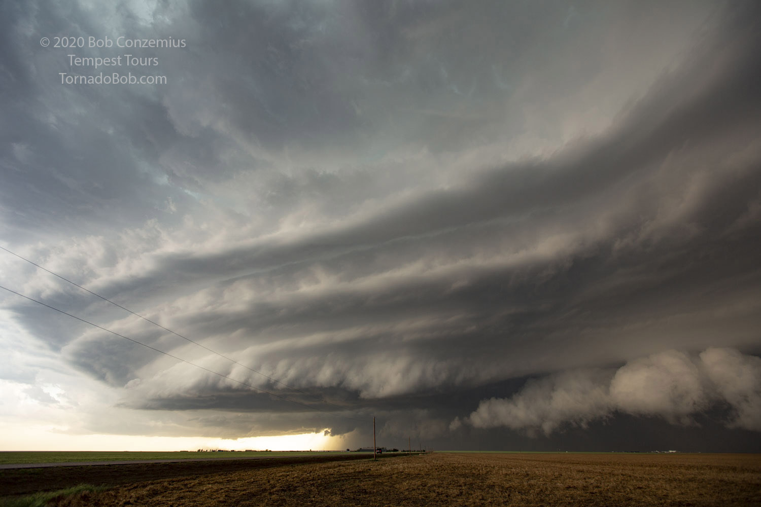
|---|
| Mammatus plus stacked plates! The storm has every aspect of interesting structure. |
 |
|---|
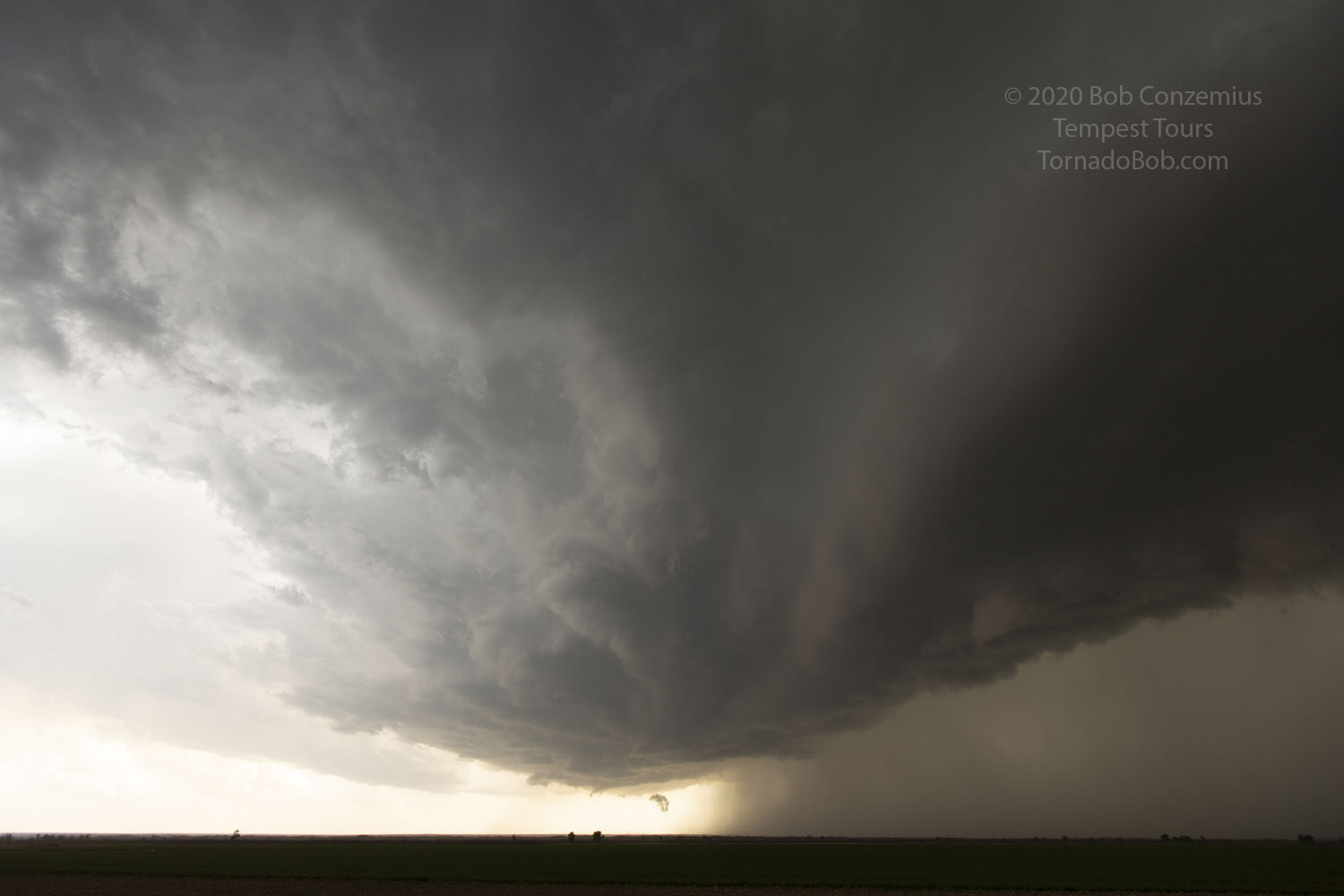
| As the cell crossed to our north, it produced rapidly rotating wall clouds. |
We stayed in this spot for what could have been an hour as the remaining daylight faded. The storm began producing more rotating wall clouds as it drew closer, but rotation never tightened up to tornado strength. A tornado warning was nonetheless issued, and we drove north through Satanta to see if we could spot anything. It was too dark by that time, so we decided to call it quits and head for Woodward, OK. This was our final chase day of the tour, and we needed to make it back to Oklahoma City the following day.
 |
|---|
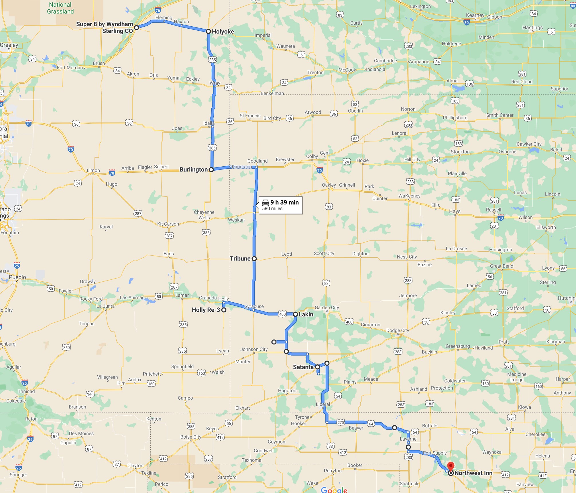
| We drove a total of 611 miles. |
Back to Storm Chases | Home