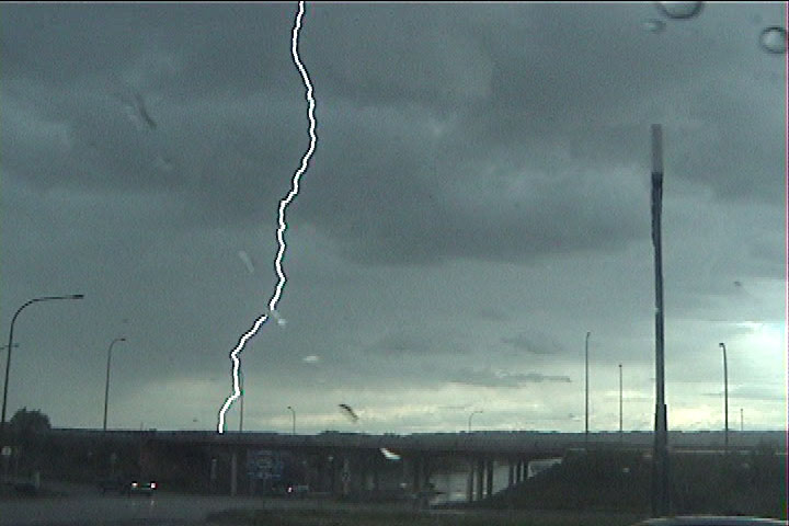
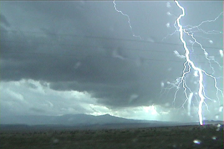
Lightning as viewed from the gas station. Storm number one of the day.
Brad Carter and I saw a tornado somewhere south and/or east of Kim, CO on a storm at 7:05 PM MDT today. The chase started at Trinidad, CO where we were treated to a nice CG barrage as we tried to top off the tank prior to chasing. Unfortunately, the very close CGs knocked the gas pumps out of commission, so we had to look around for another gas station.
Lightning as viewed from the gas station. Storm number one of the day.
After getting our gasoline at the other end of town, we proceeded eastward on U.S. 160, waiting for the right cell to come off the Raton Mesa. Our CG-barrage cell died ahead of us, so we looked back for the next cell to come off the mesa. Soon it did, and for a while, it had a nice looking updraft that occasionally had good upward motion and a lowering or two, but the cell soon weakened substantially. We met up with Tim Samaras and Carl Young at this point.
Storm number two coming off Raton Mesa.
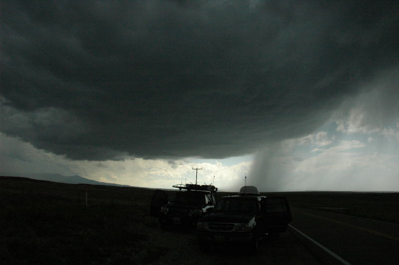
Updraft base of storm number two with Tim Samaras' and Brad Carter's vehicles in the foreground.
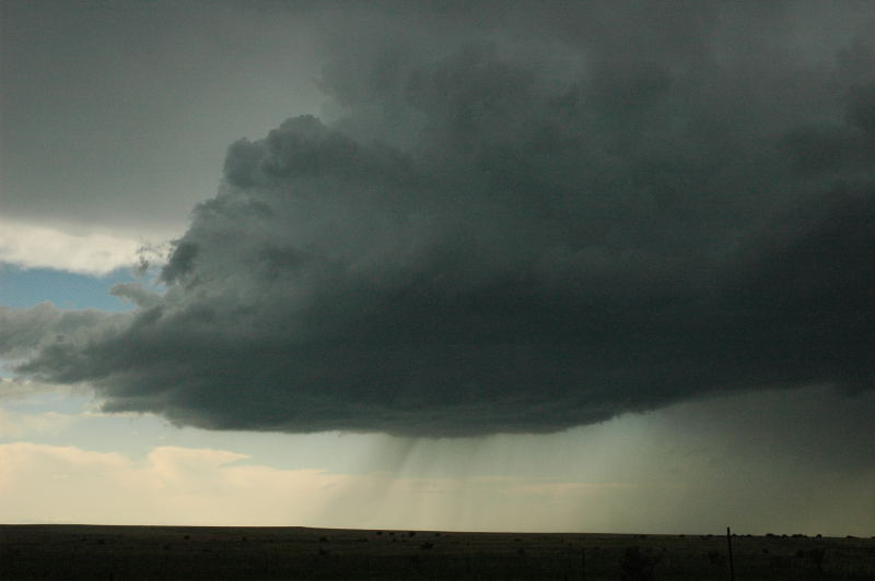
Storm number two starts to shrivel.
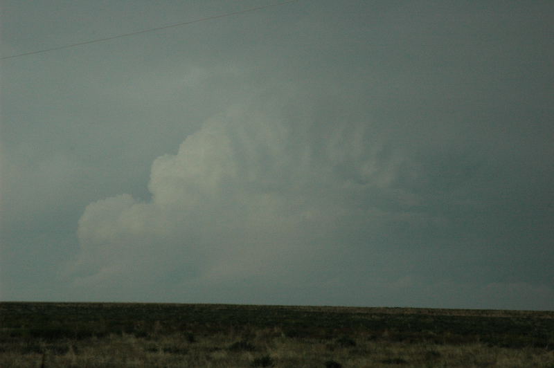
When our second storm shriveled, we were very torn between going south after the next storm coming off the mesa or blasting east to catch a severe-warned storm about 60 miles to our east in Las Animas County. We used the "thou shalt not get outflanked" commandment of storm chasing and opted for the southern storm (storm number three) because we were still ahead of it. We drove southward toward Branson, CO and observed a nice funnel, at the center of the base, that lasted about two minutes. However, as soon as it produced the funnel, it, too, began to shrink.
Storm number three with a small funnel right in the center of the base.
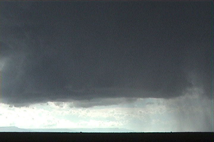
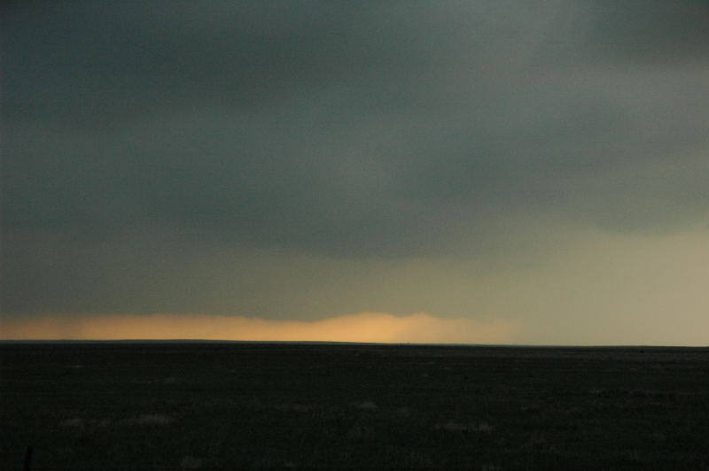
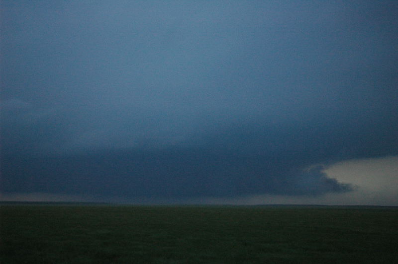
With the next cell coming off the mesa much farther to the southwest and less organized, and with the eastern storm increasing in intensity and becoming tornado-warned, we decided to take a shot at the eastern storm. At this point, other less-organized convection began to develop to our south while dying storm number three also rained itself out, and we found ourselves amidst all this in a rather featureless precipitation area but with a nice double rainbow in front of us.
One thing that was rather positive during this whole time is that the LCLs were lowering considerably, yet the boundary layer did not look too stable to be tapped by the surrounding storms. Additionally, new storms continued to develop around us where others died. On the synoptic scale, the shortwave trough was supposed to come into the region in the early evening, and the wind profiles and heat and moisture advection were predicted to improve substantially a couple hours before sunset.
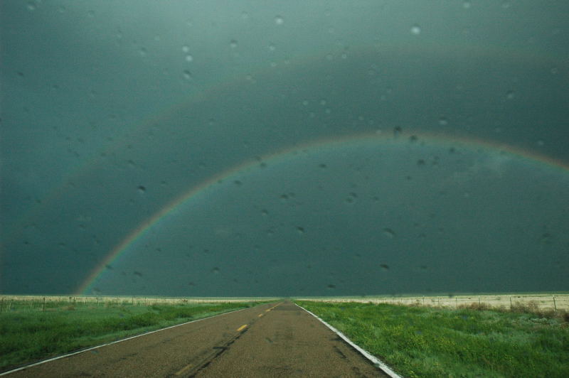
Featureless rain area with a nice rainbow to our east.
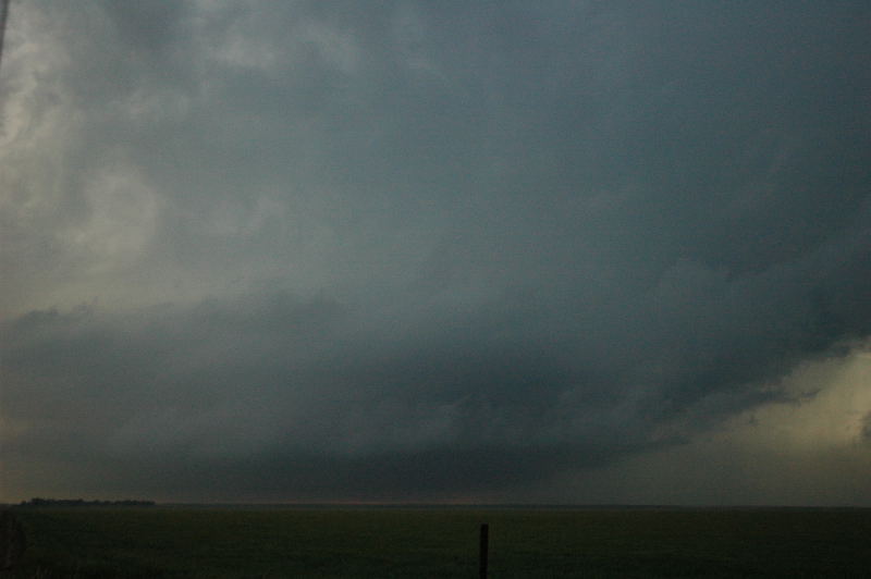
Meanwhile, Brad's WxWorks(TM) system showed a new supercellular storm developing between us and the tornado-warned eastern storm, so it became our new target. We soon saw this storm emerge out of the featureless murk. The corkscrewing updraft base appeared to rise straight out of the ground, causing me to became much more interested in the cell.
New storm developing between the eastern storm and us.
However, this storm soon began to weaken, too, both visually and on WxWorks, and we lost sight of it in stratocumulus overcast and light rain. Meanwhile, the weaker convection to our south intensified, and it got darker that way as well, with occasional CGs creeping up on us from that direction. However, it was not clear to us how strong that convection really was. I would like to say that I could have figured everything out without the WxWorks, but it was definitely rather helpful. It just provided us more detailed information that allowed us to more critically assess the strength and trends of the storms around us. Probably, a combination of visual signals, backed up by the WxWorks data, told us to drop south a bit. We did so, with caution, because our only south option was a gravel road, but it was our only way to get out of the pesky light rain and to afford ourselves a view of the updraft base of the strengthening storm to our southwest, which was the fourth storm we intercepted this day.
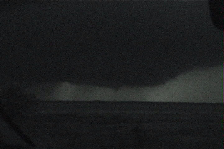
Much to our surprise, as soon as we cleared the rain and could see the base, we saw a distant tornado in progress.
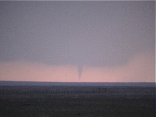
Tornado in Las Animas County, CO 7:05 PM MDT
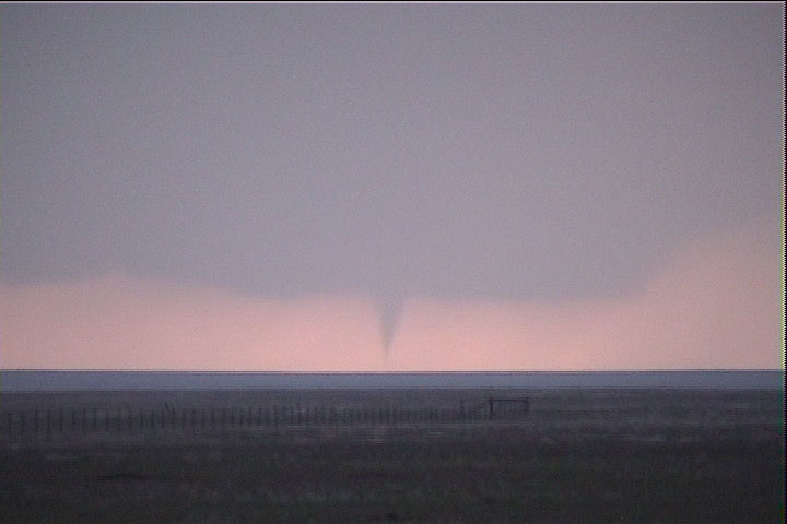
Tornado in Las Animas County, CO
We immediately called in our sighting to the National Weather Service Office in Pueblo, and the staff there were happy to receive our report. At the same time, the tornado, from our view, dissipated (I estimated on maps the next day that it was about 23 miles away from our location!), but the updraft base maintained an undulating appearance characteristic of tornadic storms, so we believed it would produce again.
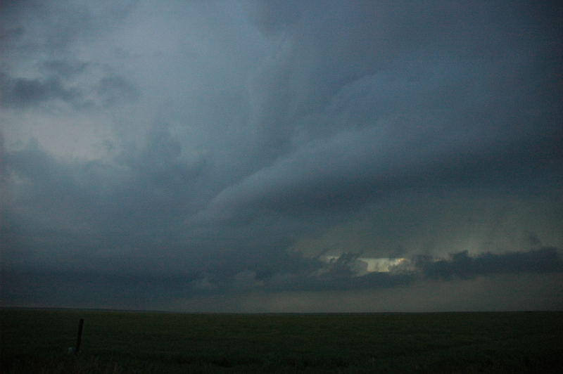
Storm number four maintains an undulating base after the tornado.
The storm did produce another weak tornado or two, perhaps, over the next hour and a half, but we could not easily see any because the contrast under the updraft base diminished substantially. Another storm was strengthening and approaching from the west-southwest, blocking the backlighting of the updraft base of our storm. The LCL continued to lower a bit, and the visual appearance of the storm was rather grungy in general, but a few interesting features stood out. The storm practically ground to a halt at this time, so we had to drive westward a few miles to even find the updraft again.
Updraft of storm number four.
A low-level inflow band or two flows into the storm.
Storm features a cow-catcher and a very low base.
Our parting view of the storm occurred as it was again trying to produce a tornado. If you look at the StormTrack forums, you'll see an account or two of this tornado. We never were able to determine ourselves that this tornado was there, but the other chasers' reports and images certainly appear trustworthy.
Storm Four tries to produce a tornado as darkness falls.
When we decided to leave, the storm had managed to block both our road options (north and west), so we had to do a bit of a core-punch, taking 1/2" to 3/4" hail, to start the long trip home. By this time, there were numerous other storms to dodge on our way back to the Denver area. We managed to stay clear, and we got back to Brad's house around 2:15 AM. I did not get home until 3:30!