The Setup
A low pressure area, dryline, and warm front were setting up over the central Plains. Conditions looked best for the development of supercells over far northern Kansas and southern Nebraska in the late afternoon and early evening. Today was the first day of Tour 4B, which I would be directing. We were scheduled to meet the guests for orientation at 10:00 AM. I was hoping to coordinate with Tour 4A a bit, but Bill decided the tour should head out a bit early, so he gathered for the orientation and headed out quickly. Meanwhile, not all my guests were present. I was missing two. I frantically began calling them, calling back to Tempest Tours headquarters, checking with the front desk to see if the guests had checked in (they had, and they had checked out earlier in the morning), interrupting Bill once to see if they accidentally had joined his tour. This had not happened to me before. These guests had gone AWOL and not informed anyone.
After about 30 minutes, I decided we had done everything we could do to find them, and it was time to leave. We got the van packed up, and we were on our way. I did the orientation in the van. We needed to get going because the target area (Nebraska/Kansas border) was a long drive away.
The Chase
We ate a fast food lunch at Braum's on the north side of Wichita and continued northward on I-135. Storms initiated a bit early just north of I-70, and it looked like we had some we could reach, so I headed east on I-70 past Junction City and exited Kansas 177 northbound. I had gotten ahead of Tour 4A due to efficient use of time, but this ended up being a disadvantage. The first echoes I targeted ended up not being the best ones. Tour 4A had not gone as far east on I-70, and when a more dominant cell developed farther west, they were in a better position to get north on it. Additionally, we had to navigate through Manhattan, and this slowed us down quite a bit.
We eventually got through, but I felt we were a bit behind the game. We were now playing catch-up behind a bunch of storms to our north, moving away from us. With time, these storms clustered together a bit, and they lost some of their discrete/supercellular characteristics. My head was buried in the computer looking at radar and navigation routes, lamenting our lagging position.
Then, a Facebook Messenger message from Matt Phelps came across: "Bob, are you going after that initiation?". I though, "What initiation?" Then, I turned my attention to the sky, which I should have done a bit earlier. There was a new cumulonimbus exploding to the east! I thought, "What the heck?" and instructed our driver to turn east.
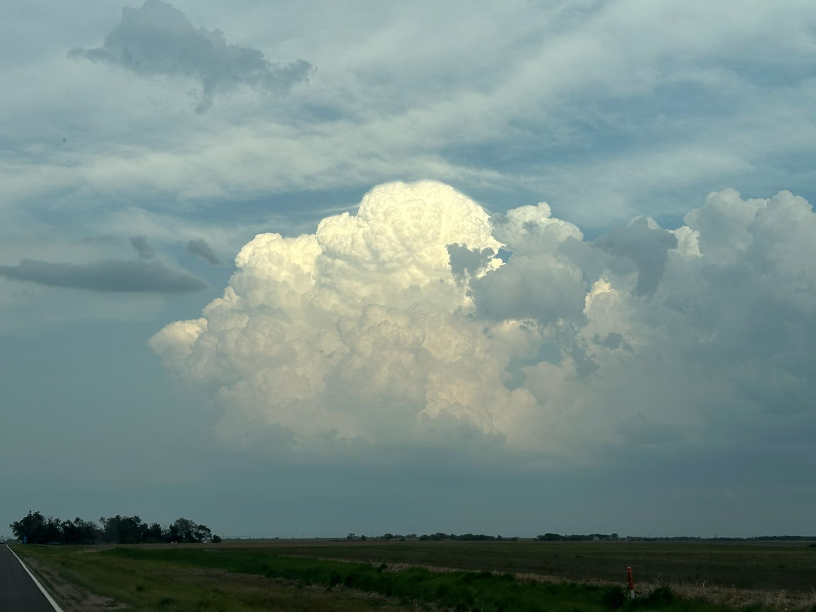
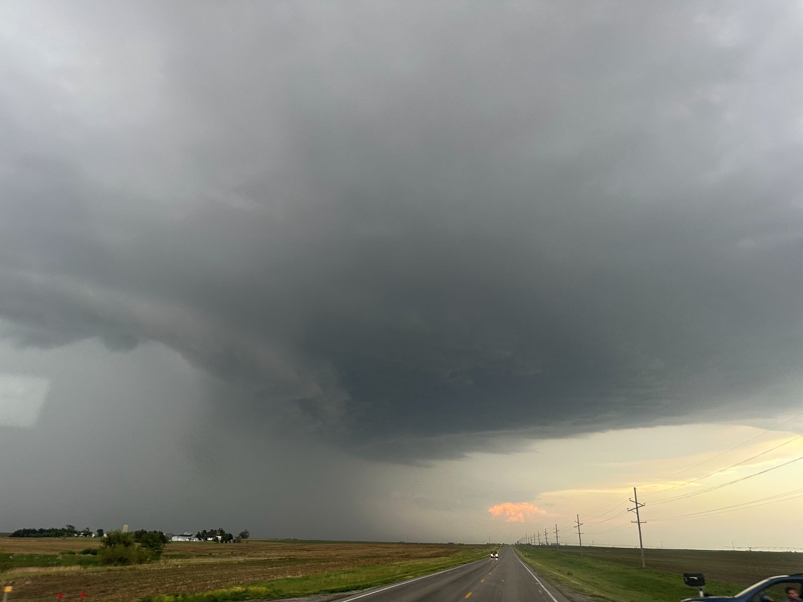
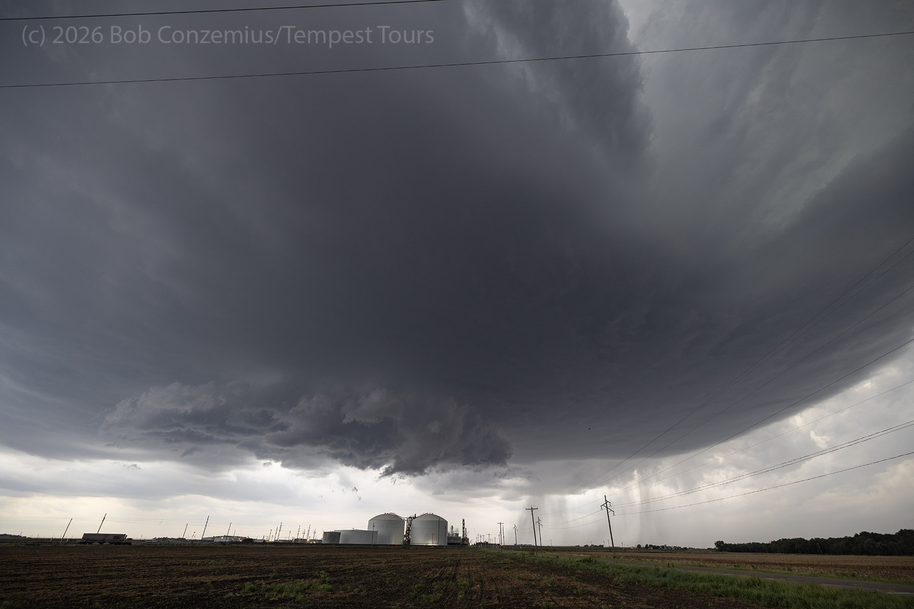
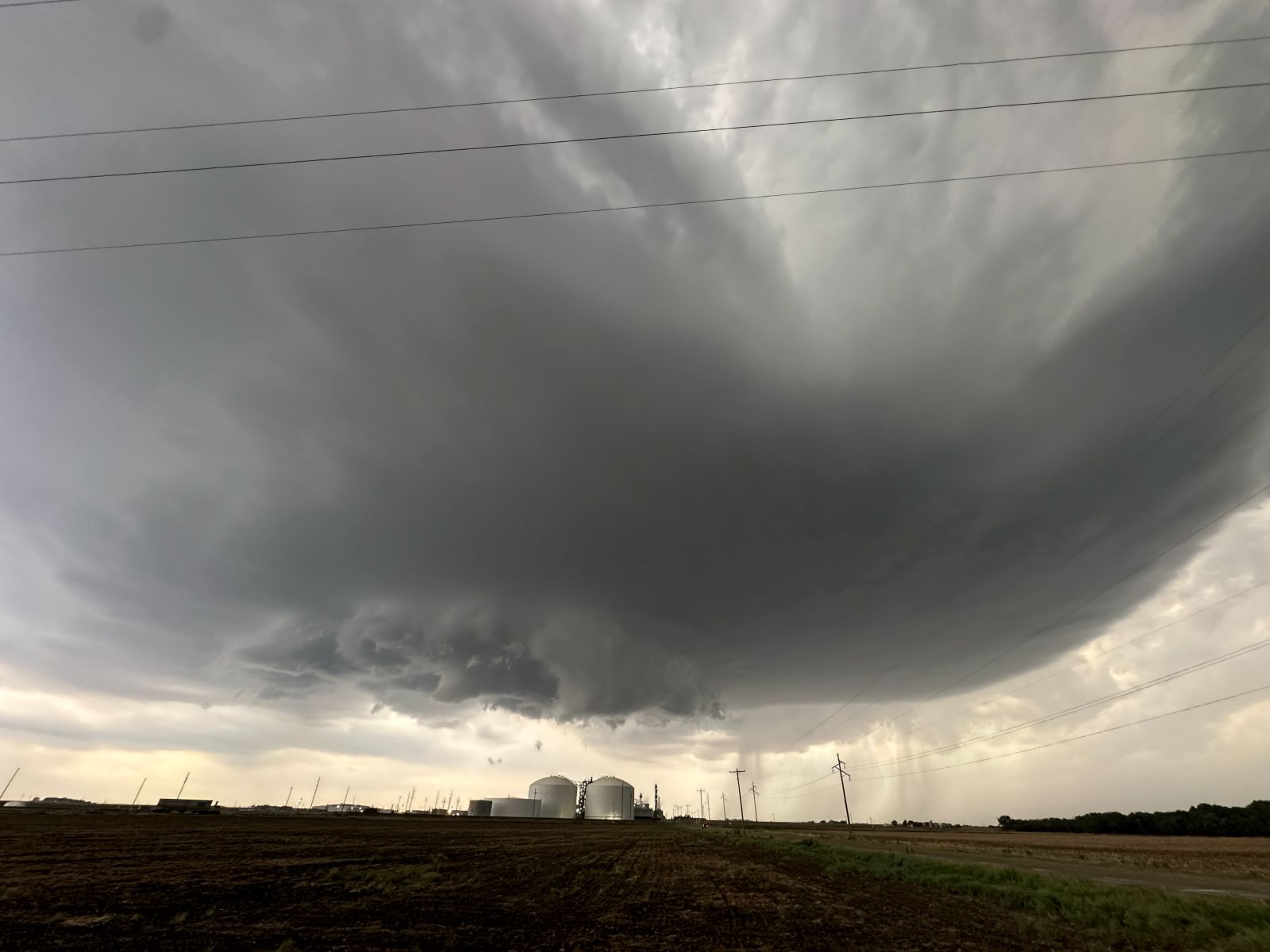
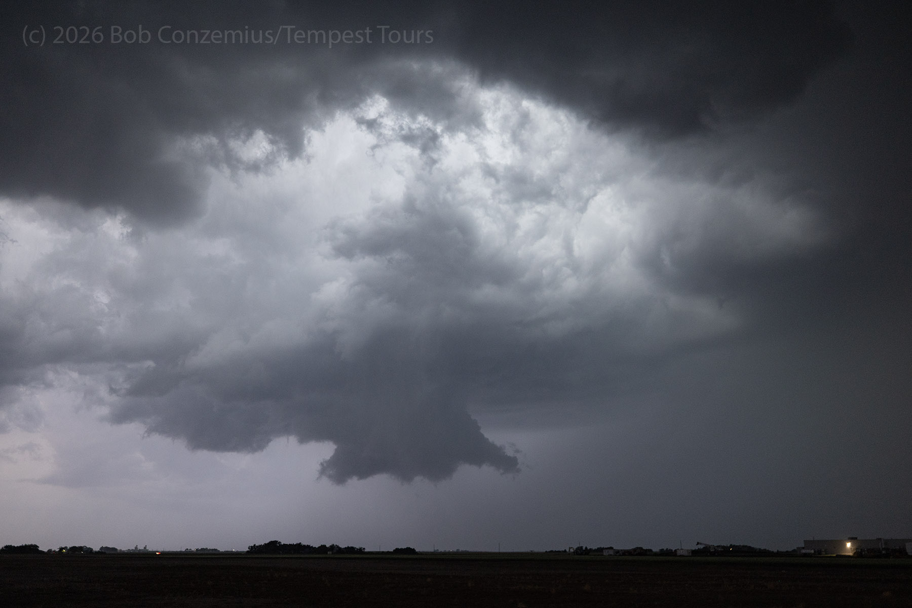
An Isolated Supercell
We pulled up on the west side of the new storm, east of the small town of Daykin. Since the storm did not yet have much of a precipitation core, we could easily see underneath the base and note anything that was happening there. Additionally, the core of the storm was right over our east road, so I wanted to wait until it drifted north of the road.
When the rain started filling in, and the storm got out of the way, we drove east again.
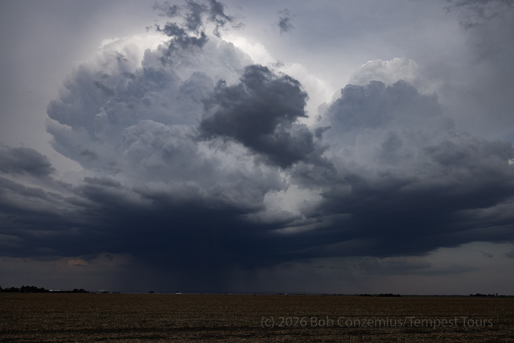
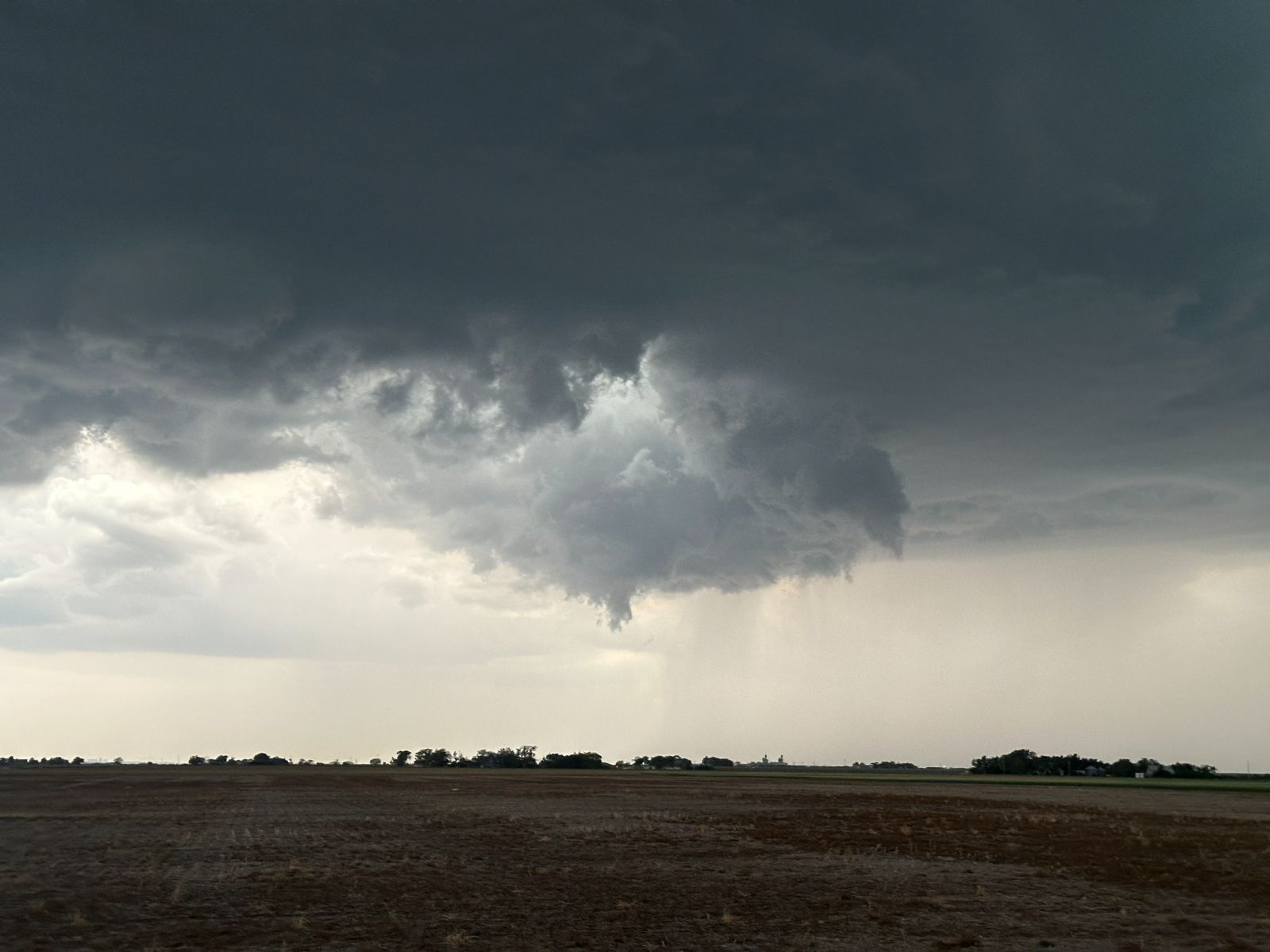
As we caught up to our storm to go around its southern flank, another storm developed to our south. I wondered whether it might become a more dominant storm. It didn't really matter, though. It was pretty close to sunset, and we would have to make this storm work for us.
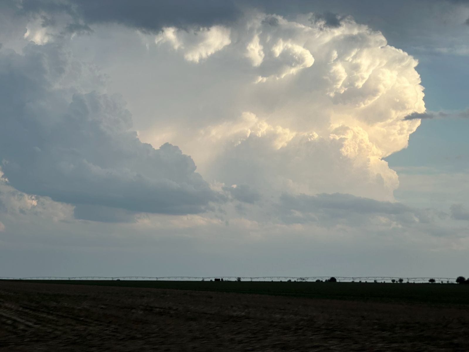
We continued east, past its southern flank. It had a wide, flat base with a bit of precipitation cutting into it. As we got east, it looked a bit more supercellular.
Beatrice
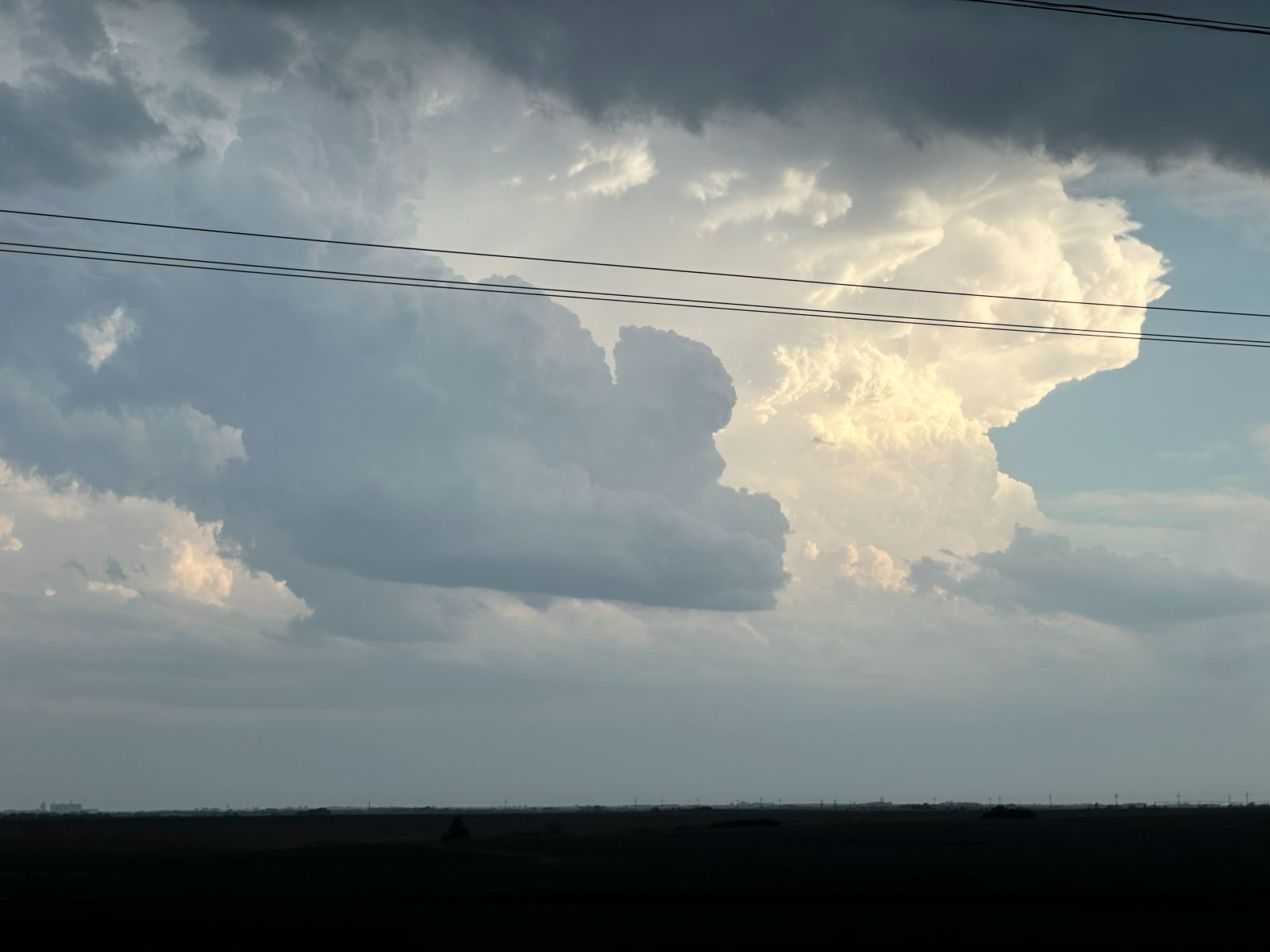
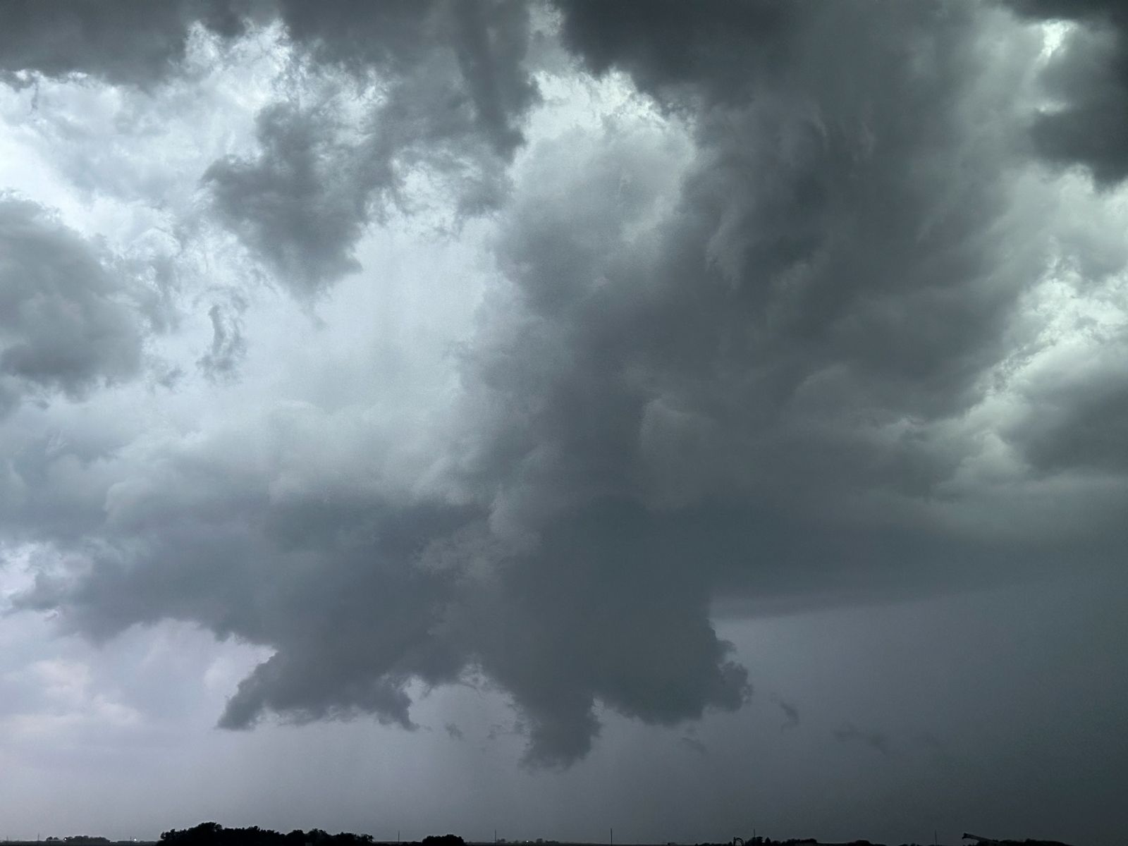
The storm took us near Beatrice. We would have to deal with city traffic and view the storm from a somewhat urban area. I did the best I could to find a spot with an open view to take a look at the storm. We pulled up east of a grain elevator and looked back at the storm. We were just barely east enough to see the barrel updraft above us. I wanted to be farther east, but the town was there. A wall cloud was developing, and it was rotating a bit!
We needed to get a bit more east. We pulled into Beatrice, and I found an open view next to a hospital. We pulled into the parking lot. I reported the rotating wall cloud via Radarscope/Spotternetwork. Maybe my excitement (perhaps over-excitement) is what motivated the weather service to issue a tornado warning on the storm. Either way, there was a couplet on radar. The NWS Office called me and asked how the wall cloud looked and whether a tornado appeared imminent. By this time, it wasn't rotating quite as much, so I couldn't really tell them much. Things had been looking increasingly interesting, but there wasn't as much cause for concern now. Over the next 20 minutes or so, the storm crept slowly east while our wall clouds went through various stages of evolution while the area underneath the updraft became increasingly occluded and broken apart by the RFD intrusion.
Chase Turns Bad
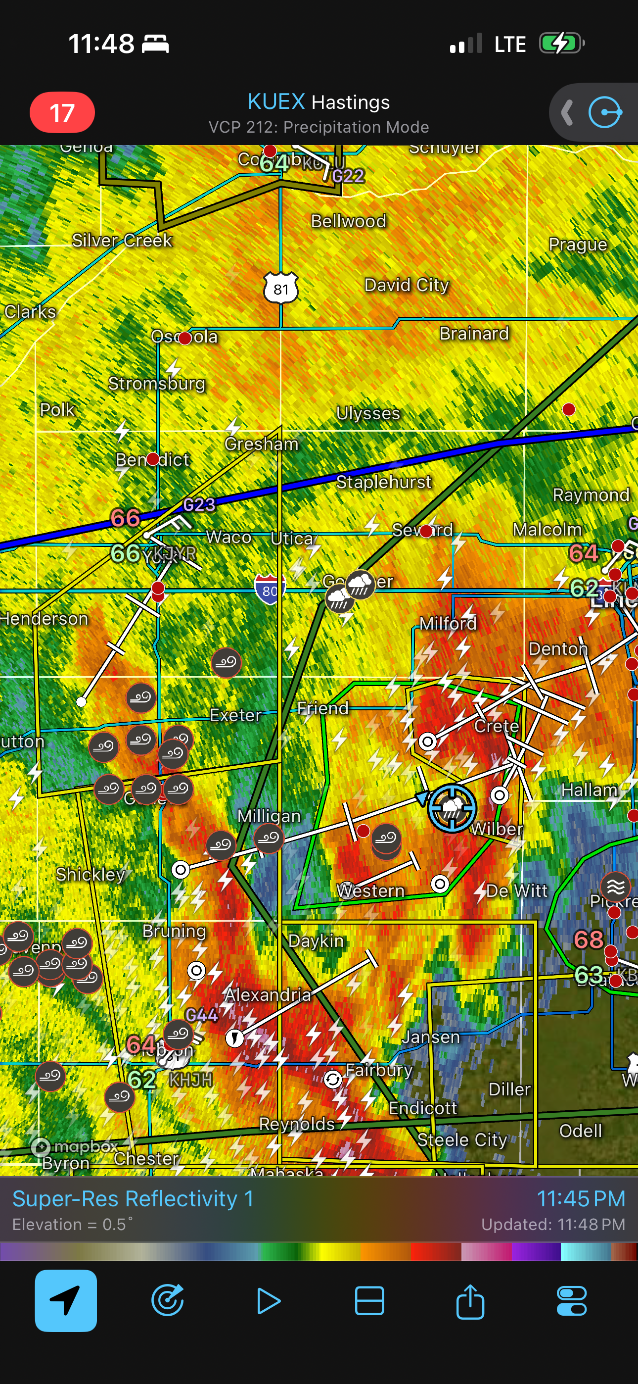
It was getting dark now. To make things safer, I try to avoid storms after sunset because driving through storm cores in the dark can be stressful, but staying dry becomes challenging in the evening when storms typically become more numerous and merge into larger convective systems. Since that was now happening for us, it was time to end the chase and head to our hotel in Lincoln. Switching to storm avoidance mode, I tried to find the best route between the increasingly numerous cores. We exited Beatrice to the west. There was a core encroaching on our westbound road, and we needed a north option fast, so we took Highway 103 north through De Witt, which was just in time as the large raindrops and small hail were just beginning to fall. I was biting my nails as we stayed barely in front of this core.
We were now ahead of one core, but another was intensifying to our west, and yet another was just to our east. There was enough room to stay between them if we stayed on 103. However, just north of Wilber, 103 was closed for construction. The alternate route looked like it would take us into the eastern core, so I decided to go west a couple miles and take another county road (1900) north. We ended up driving past 1900, so we turned north on 1800 instead. 1800 was a nicely improved gravel road, and we could easily go 40+ mph and stay ahead of the core. We had 10 miles to go on this gravel road before we hit pavement again at Highway 33, and by this time, we'd hopefully be far enough ahead of the core to have enough room to zig-zag up to Lincoln. Brittany was pushing our speed as high as safely possible on good gravel-- almost 50 mph.
Two miles into this committed route, an abrupt rise in the grade of the road, where it crossed an east-west section road, almost launched us into the air. As soon as we landed on the other side, the sound of dirt clods being flung against our wheel wells filled the van. The road surface had abruptly changed to muddy dirt, and our escape route had become a trap. At first, things seemed to be going okay as the van was still headed in a straight line, but when I noticed Brittany's exaggerated steering wheel motions, the gravity of our situation hit me. I asked her to stop and turn around. We needed to get off this road. Storm cores were now less of a concern than this road was.
She brought the van to a stop, and my stomach sank as I could see how much Brittany was turning the wheel to initiate any sort of direction change in the van. She put the transmission into reverse. The tires just spun. The van moved only sideways if at all. The only thing that controlled our van, if we moved now, was slow motion gravity, and it would only pull us away from the crown of the road and eventually into the ditch. It's like quicksand that only pulls you in deeper if you struggle to get out. We tried for a bit, including getting out and pushing, until we got to the edge of the ditch. Game over.
It was time to call for help. Our numerous attempts to call a tow truck were unfruitful. I called a couple, and they said they were unable to make it out, especially while the roads were wet. A couple guests Googled "towing companies" and found numbers to call, and they took our credit card numbers, but they were fraudulent, non-local, and had no intention of coming out to help. We then called the Sheriff dispatcher, since they would know the local businesses better, and asked them to call a tow truck for us. They tried, but no towing companies were available. Apparently, they knew better than we did not to attempt a rescue on a dirt/mud road in heavy rain.
I've been in situations like this before. If you wait an hour or two after the rain passes, the mud will dry out a bit, and traction will return.
Unfortunately, this was not an option, either. Our position was now under a full scale assault as multiple lines of severe thunderstorms, with heavy rain, developed to our west and south and converged on our position. Flash flood warnings were issued. Looking at radar, it appeared this would go on for hours. The road would get even muddier. By now, it was clear to all of us that our best option was to just leave the van and free it the next day.
One of the guests called the sheriff and asked for them to come pick us up. Deputy Escobar drove out to meet us. He would only be able to drive to the intersection where the road had changed to mud or else he, too, would become stuck. There was only one Sheriff's vehicle and six of us (we were now really glad that two guests this morning were no-shows!). There was no room for luggage, too. We grabbed the minimum essentials for the night, locked up the van, and ran the 1000 feet in the dark, heavy rain, and mud, to the deputy's vehicle. We all piled in, including sitting on each others' laps. Obviously, this configuration is unsafe for transport, so Deputy Escobar would drive us into Wilber, where we would meet another deputy, and half of us would continue in the other vehicle. In Wilber, the streets were flooded, and our deputy nearly killed the vehicle driving through deep, standing water. Glad we made it through that quickly. The deputies dropped us at the Fairfield Inn in Crete because they could not take us out of their jurisdiction. From there, I called an Uber, and we got to our hotel in Lincoln at 1:30 AM.
Wrap-up
A great chase day ended with a very stressful situation, but we made it back to our hotel.