The Setup
A warm front was draped across southeastern Kansas. Dewpoints were in the upper 60s south of the front, and temperatures were near 80. 0-6 km shear was 50 knots or greater, and low-level CAPE was greater than 100 J/kg.
The National Weather Service Forecast Office in Wichita, KS wrote a summary of the event on their web page.
The Chase
We left Purcell, OK just after 10:00 AM after our morning briefing. We stopped at Blackwell, OK at a Mexican restaurant for lunch. After lunch, we toured the Twister Museum in Wakita, OK and then headed back east because the winds at Wakita were westerly.
On our way back east, we had towering cumulus developing along a remnant boundary (last night's cold front). We drove back to Blackwell, and we targeted a stronger updraft near Arkansas City, KS. This initial updraft sputtered somewhat, so we made a pit stop in Arkansas City then began the chase as a storm east of our original target intensified quickly.
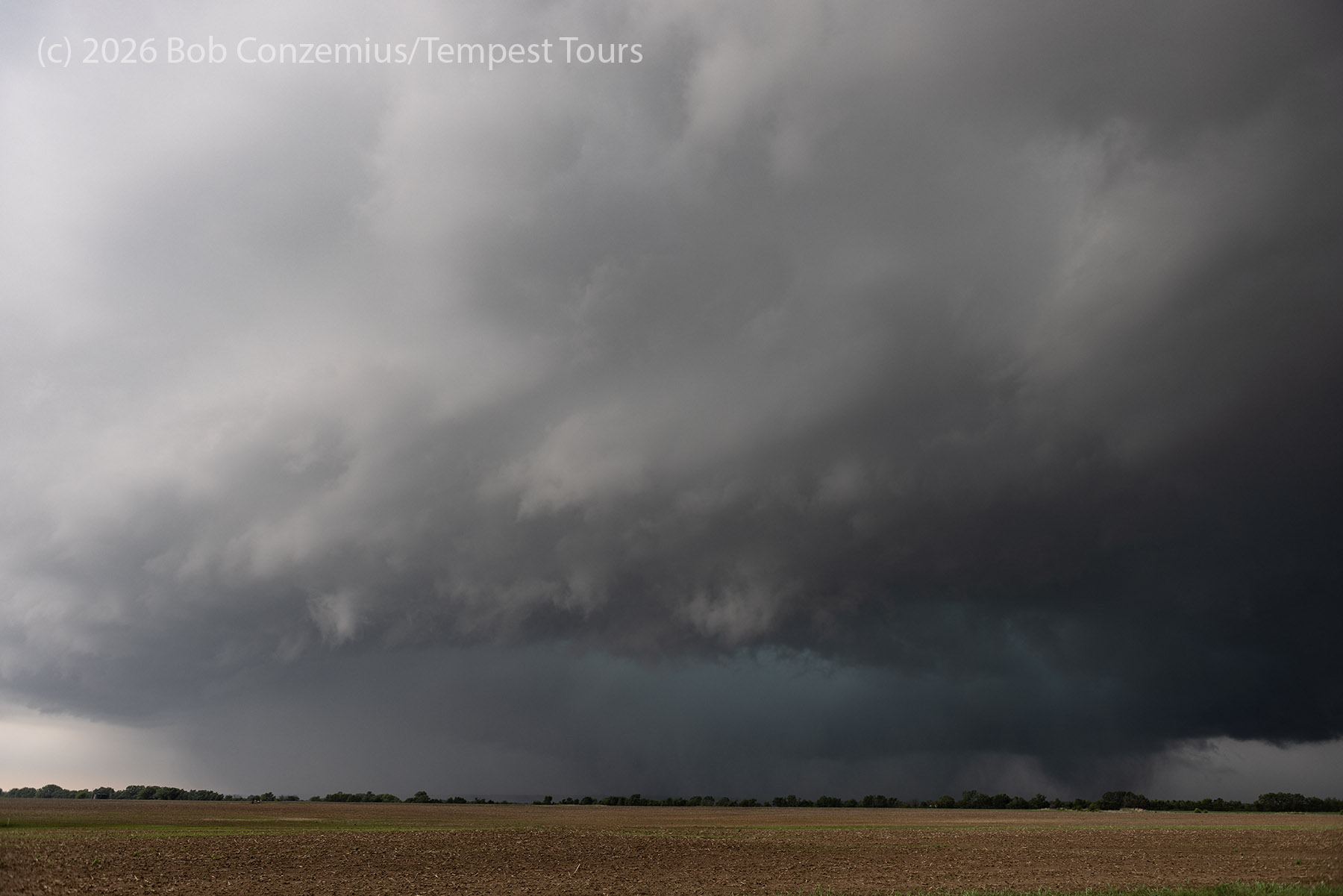
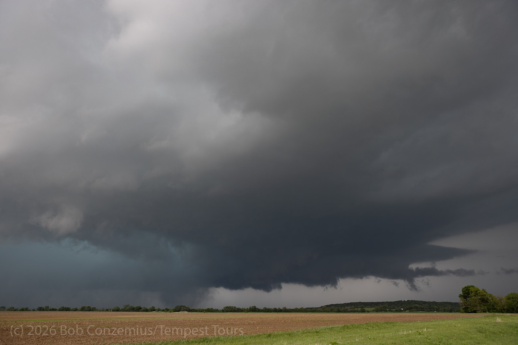
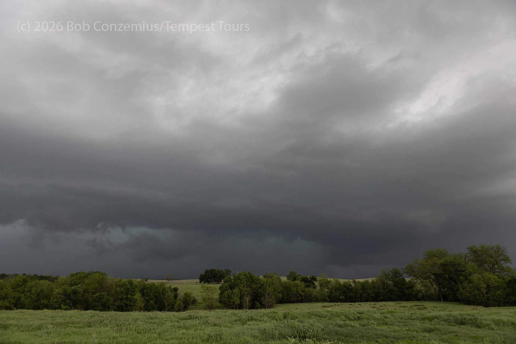
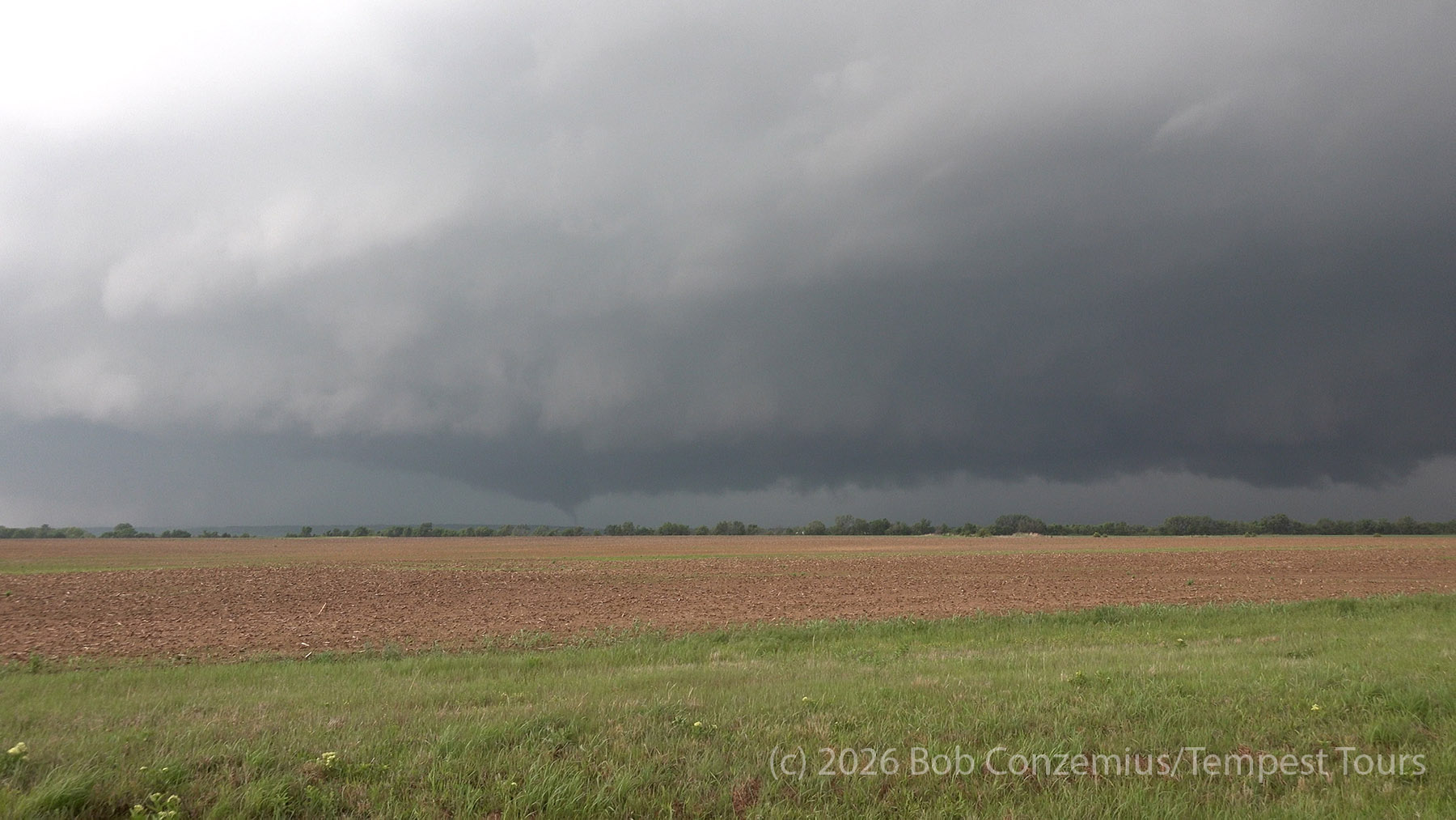
The Tornado
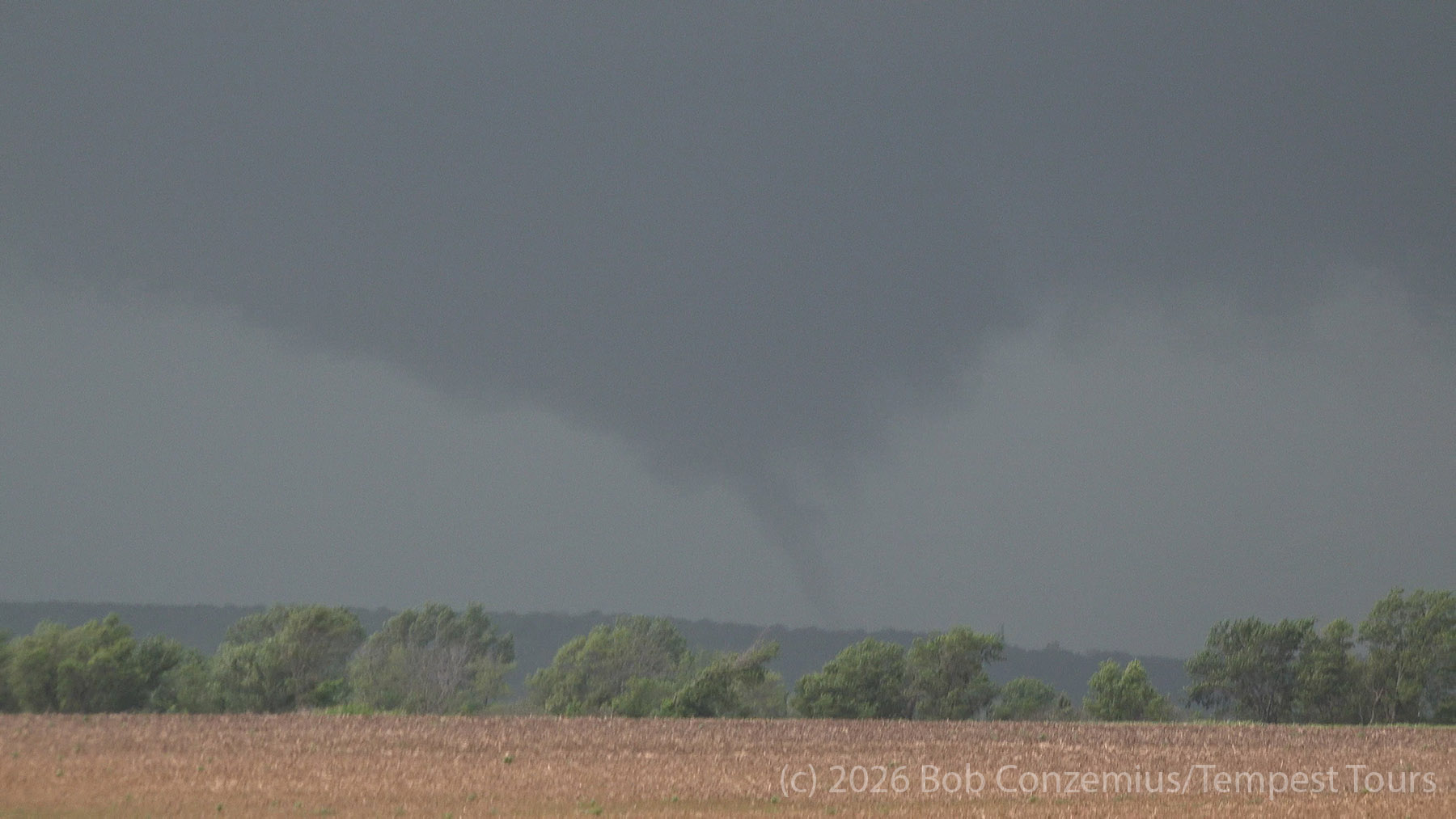
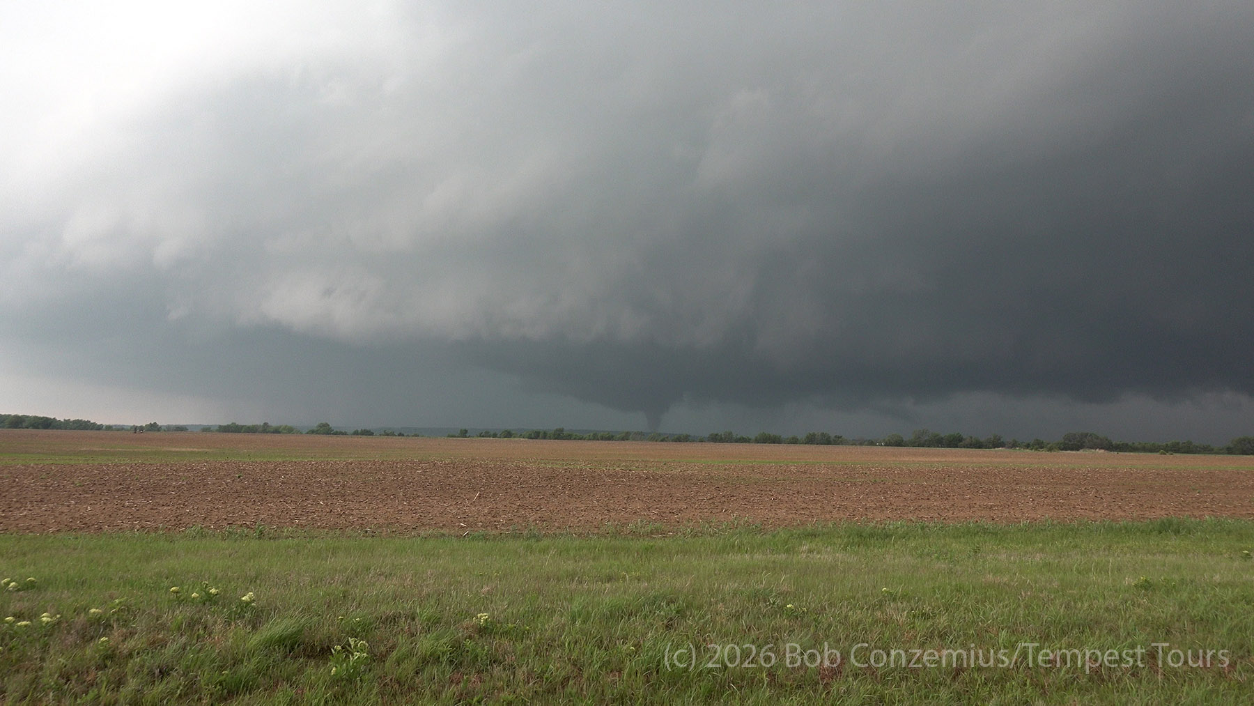
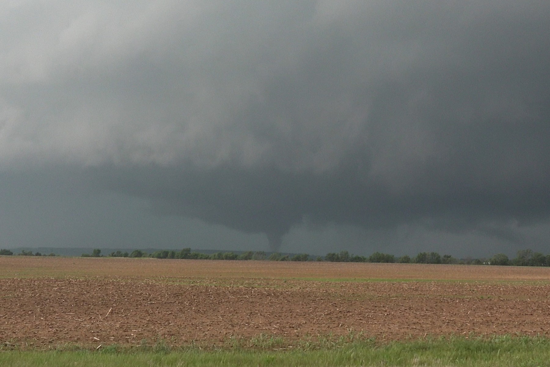
We observed a tornado west of Sycamore, KS. This tornado was rated EF-1.
Wrap-up
Reflect on the day — what worked, what didn't, what surprised you. Add any post-storm thoughts, storm reports, or context from the SPC storm data.